
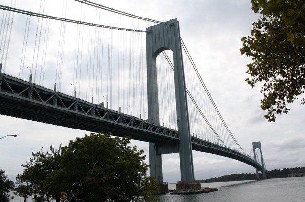
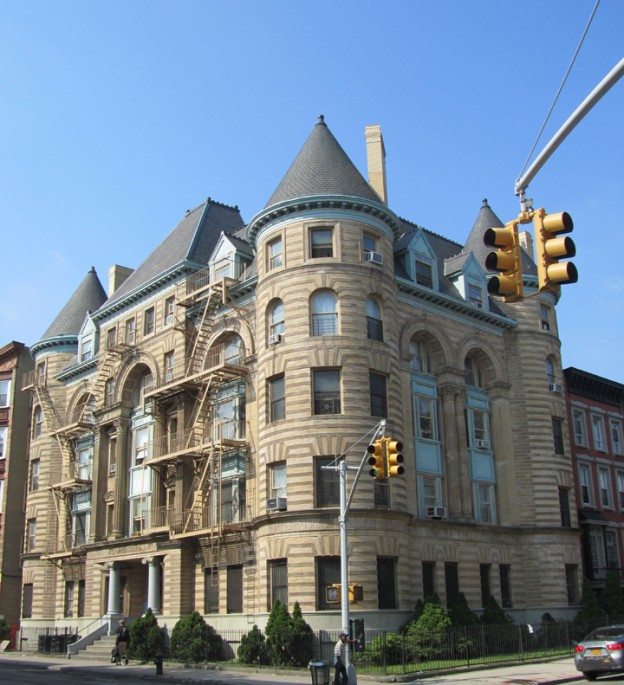
HDC will work with the Addisleigh Park Civic Organization to provide resources to adjust their zoning in order to protect the historic character of their neighborhood, as well as promoting the neighborhood as a cultural and historic destination.
HDC will work with the Addisleigh Park Civic Organization to provide resources to adjust their zoning in order to protect the historic character of their neighborhood, as well as promoting the neighborhood as a cultural and historic destination.
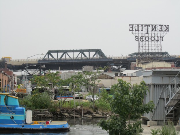
Belmont was originally part of the Town of West Farms (incorporated 1846), which, with the Towns of Kingsbridge and Morrisania, was annexed by New York City in 1874. From 1901 to 1973 Belmont was served by the Third Avenue Elevated, which had stops at 180th Street, 183rd Street and Fordham Road.
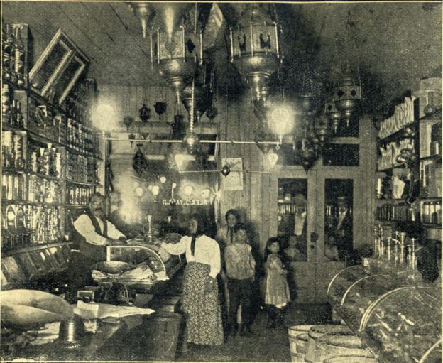
Today, the easiest way to get to Belmont from Manhattan is by Metro-North to Fordham. A short walk east along Fordham Road, with Fordham University’s beautiful campus on one’s left, takes one to Arthur Avenue, the main commercial artery of Belmont, renowned as The Bronx’s “Little Italy,” though the neighborhood also contains sizable representations of Albanians and Mexicans. Notable residents have included the esteemed novelist Don DeLillo (b. 1936), who was born and grew up near Arthur Avenue (and who attended Fordham University) and was the recipient of the National Book Award in 1985 for his novel White Noise. DeLillo’s novel Underworld (1997) is partly set in the neighborhood.
Perhaps the most famous of Belmont’s native sons is Dion Francis DiMucci (b. 1939), who grew up at 749 East 183rd Street, at Prospect Avenue. A member of the Rock and Roll Hall of Fame, Dion (he has always been known by the single name) was one of the most popular recording artists in the world in the late 1950s and 1960s, and has been counted a principal influence by Paul Simon, Bruce Springsteen and Lou Reed. Dion got his musical start by singing a cappella on Belmont street corners. With three other neighborhood boys, he formed Dion and the Belmonts in 1957. Belmont is also notable as the setting of the Academy Award-winning film Marty (1955). Locals like to point out that actor Joe Pesci was “discovered” by Robert DeNiro while tending bar at Amici’s, an Arthur Avenue restaurant. Another important cultural touchstone for the neighborhood is the off-Broadway play, film, and Broadway musical A Bronx Tale by Chazz Palminteri.
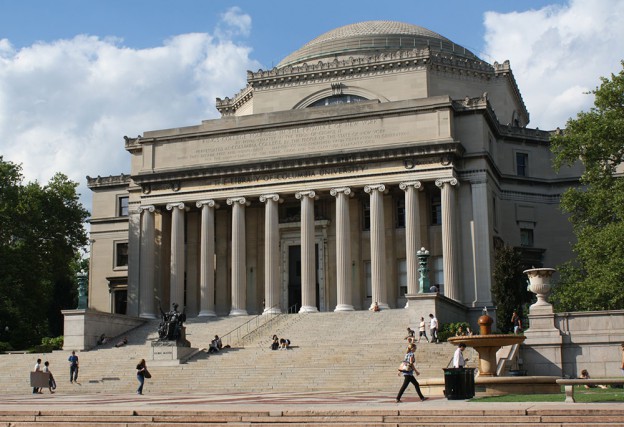
Fordham University, on the northern border of Belmont, originated as St. John’s College in 1841. The campus was built on the Rose Hill manor farm of Robert Watts. Renamed as Fordham University in 1907, it was the first Roman Catholic college in the northeastern United States. Among Fordham’s countless notable alumni are Congress Member Geraldine Ferraro, Governor Andrew Cuomo, CIA director William Casey, Attorney General John Mitchell, football coach Vince Lombardi, baseball announcer Vin Scully, novelist Don DeLillo, and actor Denzel Washington.
Belmont was once part of the landholdings of the Lorillard family. The Lorillard tobacco firm was founded in 1760 and moved to this part of The Bronx in 1792. In 1870, the family moved their manufacturing operations from The Bronx to Jersey City, and in 1888, the city acquired the eastern section of the Lorillard lands for incorporation into Bronx Park. The western section—today’s Belmont—was subdivided for development. Many Italian immigrants were attracted to the area by jobs in the construction of the New York Botanical Garden (opened 1891), the Bronx Zoo (opened 1899) and the Jerome Park Reservoir (opened 1906). There is a persistent myth that Arthur Avenue was named by one of the Lorillards in honor of President Chester A. Arthur. However, the name “Arthur Street” appears on the New York City Department of Public Parks topographical map of the Bronx in 1873. That is eight years before Arthur became president, making it unlikely that the avenue was named for him.
To learn more about the area, visit www.BronxLittleItaly.com.
Originally called District Street, Atlantic Avenue in Brooklyn is one of the borough’s most dynamic commercial thoroughfares. There, within a cohesive mid-19th century streetscape, one can shop for one-of- a-kind home treasures, stock up on Middle Eastern food delicacies, and meet friends for dinner and drinks. Underfoot is the world’s first subterranean train tunnel, which was rediscovered in 1980.
To learn more about Atlantic Avenue click here
The beginnings of the community now known as Audubon Park date back to 1841, when John James Audubon purchased fourteen acres and built a large mansion along the Hudson River shortly after publishing his famous work, Birds of America. Audubon named his farm, a pastoral landscape of woods, wildlife and rocky outcroppings, “Minnie’s Land” in honor of his wife. After bringing back plant and animal specimens from his 1843 expedition to the American West, Audubon lived on this secluded estate until his death in 1851. Facing financial hardship, Audubon’s family sold the land in small portions through the 1850s and 1860s. As early as 1854, the name Audubon Park was used for an enclave of ten large homes located on the former estate. Into the 1890s, Audubon Park retained a distinct identity from that of the rest of Washington Heights, remaining relatively secluded even as improvements in the street system and the introduction of cable cars and the Ninth Avenue elevated railroad brought residential development to its borders. In 1892, the city extended its fire limits up to West 165th Street, prohibiting new wood frame construction. The first masonry structures to appear within Audubon Park were a row of 12 three-story rowhouses constructed in 1896-98 on West 158th Street.
When the Interborough Rapid Transit subway line along Broadway arrived at West 157th Street in 1904, Audubon Park was ripe for explosive growth. In 1905, the first apartment buildings in the area were built just outside Audubon Park’s boundaries at 609 West 158th Street and 3750 Broadway. However, most development occurred after the Grinnell family, which had controlled most of the former Audubon estate since the 1880s, sold its holdings to a syndicate of developers in 1908. Within a year, nine apartment buildings replaced most of the area’s winding roads and wood frame villas. From 1905 to 1932, 19 apartment houses were constructed in what is now the Audubon Park Historic District. Elegantly designed in a variety of styles and equipped with modern amenities, these buildings were marketed for upper middle-class tenants. Anchoring this neighborhood was Audubon Terrace, a unique complex of educational and cultural institutions whose construction began in 1904 and included the Church of Our Lady of Esperanza and the Hispanic Society of America. The influence of Audubon Terrace on the surrounding neighborhood is reflected in the names of some of its apartment buildings, including the Cortez, Goya, Hispania and Velazquez.
Audubon Park has served as the site of significant preservation battles throughout its history. Efforts to create a park out of the remaining undeveloped portions of the Audubon estate and to save the John James Audubon house as a museum were scuttled by the construction of a viaduct carrying Riverside Drive from 151st Street to 161st Street in 1928. With the imminent development of new apartment buildings, a local community group successfully moved the house, but it was eventually demolished despite these efforts. Fortunately, success stories can be found in the designation of the Audubon Terrace and Audubon Park Historic Districts in 1979 and 2009, respectively. Today, a group of residents working with the Riverside Oval Association is advocating for the protection of the aforementioned 12 rowhouses on West 158th Street, constructed in 1896-98.
Initially developed as a suburban enclave for Brooklyn’s business elite in the decades following the Civil War, Bay Ridge transformed into one of the borough’s most culturally diverse neighborhoods with the arrival of the IRT subway in 1916 and it remains so today. Visitors to this neighborhood will find vibrant commercial districts, cohesive rowhouse blocks, wood frame farmhouses, Victorian mansions, beautiful churches, pre-war apartment buildings, and quaint cul-de- sacs.
To learn more about Bay Ridge click here
Dating back to 1831, the Bayley Seton Campus was Staten Island’s first public health facility, originally known as Seaman’s Retreat. The original Seaman’s Retreat building is a designated NYC landmark that is seriously threatened by demolition by neglect. The site also contains the first U.S. Public Health Service Hospital, a Mayan Revival style building built in 1931, and smaller contributing doctors residences. Working with John P. Kilcullen of the Preservation League of Staten Island, HDC will help advocate for landmarking, stabilization, and preservation of the hospital complex.
Since 1984, the Bayside Historical Society (BHS) has been located at The Castle in Fort Totten Park. Built in 1887, the building was originally used by the U.S. Army Corps of Engineers as their Officers’ Mess Hall and Club. The Gothic Revival-style Castle is a NYC designated landmark and is also listed on the National Register of Historic Places.
HDC is partnering with the Bayside Historical Society to build on their work since the 2016 designation of the Ahles House and continue surveying, researching, and compiling a list of significant sites for consideration for preservation and designation.
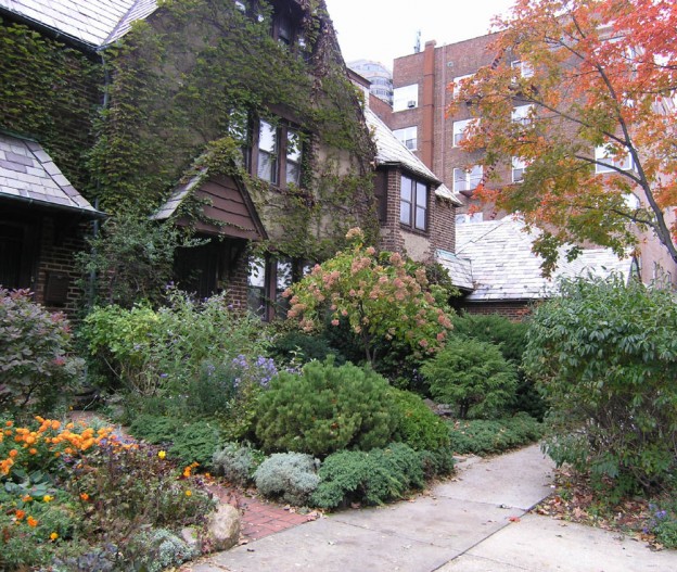
In the 1850s, the neighborhood now known as Bedford Park was part of the property owned by financier and noted sportsman Leonard Jerome, Winston Churchill’s grandfather. He leased a section of it for use as a race track and, to ensure accessibility and promote development, lobbied for a paved boulevard and began selling off his other Bronx properties. By the 1870s, streets were laid out and blocks were subdivided into house lots, but construction didn’t take off until the early 1880s. Early developments were primarily free-standing wood-frame homes, soon followed by religious architecture and infrastructure. Some of the oldest surviving examples of these buildings include houses at Bainbridge Avenue & E 201st Street, the Bedford Park Congregational Church, the Convent of Mount St. Ursula and the former Beford Park Railroad Station .
By the early-20th century, transportation improvements such as the extension of elevated lines to nearby Fordham Road, and construction of the Mosholu Parkway, had expanded the boundaries of the neighborhood and increased the population drastically. This fueled residential development and also prompted the construction of new facilities for city services, like the NY Fire Department and the NYPD . Several prestigious educational institutions were also created, with buildings located in an area referred to as the Educational Mile. These include DeWitt Clinton and the Bronx High School of Science, along with Lehman College.
However, the most significant project in the neighborhood’s development was the construction of the Jerome Park Reservoir, transforming the former racetrack at Jerome Park into a fresh-water reservoir for the New Croton Aqueduct. Completed in 1906, it became a valuable asset for the rapidly growing City of New York and provided residents with recreational open space. The project also shaped demographics, as the Italian and Irish immigrants who worked on it relocated to the area and built neighborhood staples like the St. Philip Neri Roman Catholic Church.
Bedford Park continued to grow throughout the 20th century, especially after WWI. During this time, it began to shift from a quiet suburb into a more densely populated urban area. Within 20 years of the completion of the Grand Concourse, apartment buildings featuring the then fashionable architectural styles lined the boulevard and the surrounding areas, replacing single-family houses. This type of development would continue throughout the 1950s, but the neighborhood never lost its bucolic character and ethnic diversity.
Today, Bedford Park is facing significant development pressures, with many of the early free-standing houses already lost to out-of-scale development. Community groups and organizations are working to raise awareness on the area’s history and significance, in order to protect its character and the neighborhood from.
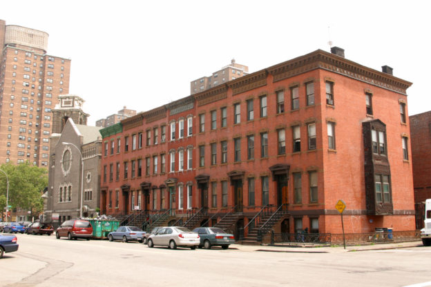
The majority of the buildings were constructed on speculation to house New York’s growing middle class, generally between 1870 and 1920. Rowhouses are set back from the street and possess their original stoops and railings. The architectural style of buildings followed the trends popular during the area’s development, including Italianate, Neo-Grec, Romanesque Revival, Queen Anne, and, at the turn of the 20th century, Neo-Renaissance and Neo-Georgian appeared. The materials of the buildings also give an idea of their age; older buildings were constructed of brick and brownstone, while light-colored brick, terra-cotta and limestone became increasingly popular toward the turn of the 20th century.
Stuyvesant Heights in Bedford-Stuyvesant was designated a New York City historic district in 1975, and a large extension was designated in 2013; the Bedford Historic District was designated in 2015. The low-scale buildings on the tree-lined streets share architects, styles and details, together making Bedford-Stuyvesant a distinctive piece of New York City.
To learn more about Bedford-Stuyvesant click here
HDC will help the Bushwick Historic Preservation Association advance their proposed list of landmark designations and preservation priorities, including the Northeast Bushwick Historic District.
While Park Slope has received the protection of landmark designation in certain areas, the historic heart of the neighborhood remains at risk of new development and drastic alterations. A special committee of the Park Slope Civic Council is working to expand the Park Slope Historic District and to ensure the preservation of the Center Slope, an area with spectacular brownstones and ties to the American Revolutionary War. From community outreach to survey endeavors, this group is aiming to work towards completing the quilt of landmark protections for the Park Slope neighborhood.
In 1750, British naval officer Thomas Clarke bought a Dutch farm to create his
retirement estate, named “Chelsea” after the Royal Hospital Chelsea in London. His
property extended from approximately Eighth Avenue to the Hudson—its shore ran
roughly along today’s Tenth Avenue—between 20th and 28th Streets. The estate
was subdivided in 1813 between two grandsons; Clement Clarke Moore received the
southern half below 24th Street while his cousin, Thomas B. Clarke, inherited the
northern section.
In the 1830’s, as the street grid ordained by the city in 1811 extended up the island
and through his property, Moore began dividing his land into building lots for sale
under restrictive covenants which limited construction to single-family residences and
institutional buildings such as churches. By the 1860’s, the area was mostly built out with
a notable concentration of Greek Revival and Anglo-Italianate style row houses, many
now preserved within the Chelsea Historic District.
Thomas B. Clarke’s property north of 24th Street was developed around the same time,
but with a more varied mixture of row houses, tenements, and industry. By the late
19th century, the area had an unsavory reputation. During the urban renewal era of the
mid-20th century, much of it was officially declared a slum and rebuilt with tower-inthe-
park housing, although clusters of row houses and several significant institutional
buildings remain.
By the 1850’s, infill of the Hudson pushed the waterfront to Eleventh Avenue and
within decades to its current location west of Twelfth Avenue. Industry was bolstered
by the mid-19-century with the opening of the Hudson River Railroad, and soon the
neighborhood supported a range of smaller manufacturers interspersed with sizable
operations including iron works and lumberyards. Storage and warehousing became
important uses around the turn of the century with the creation of the Gansevoort
and Chelsea Piers. By 1920, most of the area’s factories had been replaced by modern
facilities. The heart of this industrial district is preserved within the West Chelsea Historic
District. Clement Clarke Moore’s rowhouse blocks to the east were largely converted to
apartments for a working class employed by these businesses. As they became inactive,
an influx of gay residents opened a new chapter of Chelsea history. The neighborhood
remains proudly gay friendly today.
The current character of the western part of Chelsea is built on adaptive reuse of
industrial relics. Art dealers drawn to the lofty spaces of former warehouses and factories
began arriving in the 1990’s and built the blocks west of Tenth Avenue into the world’s
largest gallery district. After decades of abandonment, the elevated Hudson River
Railroad was transformed into the High Line, a public park and tourist attraction. Its
innovative design and impact on real estate values spurred a boom in new buildings by
celebrated architects along its length.
Although Thomas Clarke’s 1750 Chelsea estate extended only east to Eighth Avenue
and south to 20th Street, the present-day neighborhood encompasses a larger area.
Its eastern edge along Sixth Avenue lies within the Ladies’ Mile Historic District, named
for the elite shopping district, which saw its first department store open in the 1860’s.
Today, Chelsea contains a variety of historic architecture, including some of the city’s
most intact nineteenth-century residential blocks, significant commercial buildings, and
industrial complexes near the Hudson River.
Chinatown and Little Italy, Manhattan
Two adjoining and overlapping iconic communities that represent the country’s immigrant history in the national consciousness, Chinatown and Little Italy are seeing the loss of legacy businesses and insensitive alterations to historic storefronts and tenement facades. The Two Bridges Neighborhood Council is working to raise public awareness of the area’s history and architecture, to promote the neighborhoods as historic resources, to educate property owners on appropriate and sensitive building renovations and to gain protections for area landmarks such as the Lefkowitz building, recently proposed as the site of a new jail facility.
*Photo credit – Flickr Larry Gassan
While just nine blocks apart from one another, Clay Avenue and the Grand Concourse appear to be worlds apart in terms of architecture and urban form. However, both the small-scale street of two-family houses and the wide thoroughfare lined with Art Deco apartment buildings help to tell the story of the development of this section of The Bronx. Both are located in what was historically the village of Morrisania, named for the English brothers Colonel Lewis Morris and Captain Richard Morris who purchased the land in 1670.
In 1900, Ernest Wenigmann began amassing property on Clay Avenue with the intention of constructing 28 houses. Wenigmann commissioned architect Warren C. Dickerson, who had a reputation for designing many fine rowhouses across the borough. For the Clay Avenue development, Dickerson employed elements of the Renaissance Revival and Romanesque Revival styles, and while the houses are all different in their ornamentation, they are linked by the use of beige or red brick, as well as their similar massing and repetitive trends found on either side of the street. The houses were designed in pairs, with each house meant to house two families, but Dickerson subtly designed the houses so that each would give the appearance of a single-family dwelling. Thus, the aspirational middle-class homeowner could fit their family into one apartment while renting out the adjacent unit for additional income, all the while residing in what appeared to be a single-family home. The 28 houses on Clay Avenue were all constructed between 1901 and 1902, when Ernest Wenigmann began selling the properties. Within three years, the street was almost entirely occupied, illustrating the success of Wenigmann’s venture and Dickerson’s designs. Clay Avenue remains a beloved architectural ensemble and tight-knit community.
In 1909, seven years after Wenigmann completed construction of the houses on Clay Avenue, the Grand Concourse was opened to traffic and became a crucial link between Manhattan and the still rural sections of The Bronx. The completion of the Jerome Avenue subway in 1918 and the introduction of real estate tax exemptions precipitated a wave of development that swept the Grand Concourse from 1922 to 1931. This period saw the construction of over half of the district’s buildings, primarily five- and six-story apartment houses situated on large lots and enlivened by decorative elements that evoked faraway places. The 1933 opening of the IND subway along the Grand Concourse sparked a second building boom from 1935 to 1945 that produced many now iconic Art Deco and Moderne style buildings. These structures feature terra cotta, mosaic tile, cast stone and beige brick in their designs. Although these buildings were executed in a range of architectural styles, many of them are representative of the garden apartment typology. This housing form, which developed in the late 1910s and 1920s, was principally characterized by medium-rise structures arranged around large courtyards.
The neighborhoods surrounding Clay Avenue and the Grand Concourse shared in the precipitous population loss and economic decline that plagued much of The Bronx in the post-World War II era. Nevertheless, the community emerged from the turmoil to become the stable, dynamic and diverse area that it is today. The significance and integrity of this neighborhood’s built fabric prompted the Landmarks Preservation Commission to designate two historic districts here: Clay Avenue (1994) and the Grand Concourse (2011).
The area of Queens comprising Corona-East Elmhurst was called “Mespat” by the Native Americans and “Middleburgh” by the English colonists. It became part of the Town of Newtown, when it was incorporated in 1683 as one of the three original municipalities (along with Jamaica and Flushing) comprising what is now Queens. It remained largely rural until transportation improvements led to suburban development. In 1854 the Flushing Railroad began service through what is now 44th and 45th Avenues (now part of the Port Washington Branch of the Long Island Rail Road). Anticipating commuter service, a group of real estate speculators formed the West Flushing Land Company and purchased an extensive tract that they subdivided into house lots, naming the new neighborhood West Flushing. Just north (above what is now 37th Avenue) stood the National Race Course, also established in 1854. A massive complex and tourist attraction, it was soon renamed Fashion Race Course and notably hosted the first-ever ticketed baseball game, a best of three series between New York and Brooklyn.
In spite of this enthusiasm, actual building activity remained slow through the 1850s and was curtailed during the Civil War. By 1868, however, Benjamin W. Hitchcock, who also developed much of Woodside, acquired more than a thousand building lots in West Flushing, and most were sold by the early 1870s. Another local developer, Thomas Waite Howard, felt the name West Flushing was too easily confused with Flushing and petitioned the U.S. Postal Service for a more poetic moniker: Corona, the crown (or crown jewel) of Queens. Transit lines continued to expand, including the 1876 introduction of horse car lines to Brooklyn, providing connections to ferries to Manhattan, and trolleys running along Corona Avenue began in the 1890s. In 1898 Queens County was subsumed into Greater New York, and Corona, previously part of Newtown, became its own neighborhood with 2,500 residents. In 1904 the Bankers’ Land and Mortgage Corporation launched a new residential development in north Corona called East Elmhurst, comprising 2,000 building lots along the western edge of Flushing and Bowery Bays. Growth accelerated with the opening of the Queensborough Bridge in 1908 and the East River tunnels to Pennsylvania Station in 1911. Perhaps most significantly, the subway system arrived in 1917 with the opening of the Alburtis Avenue (now 103rd Street-Corona Plaza) station. In the 1930s the neighborhood’s eastern boundary, the dumping ground that was once Flushing Creek, was transformed into “The World of Tomorrow” as the site of the 1939 World’s Fair; it later reprised that role for the 1964 World’s Fair and eventually became Flushing Meadows-Corona Park.
From the beginning, Corona-East Elmhurst was a diverse neighborhood. Several of its oldest institutions attest to the 19th century German influence, while many 20th century sites are associated with its Italian-American and Jewish communities. The northern section of this tour boasts a remarkable collection of culturally significant African-American sites. The first recorded residents of African descent arrived in the 17th century and settled along what is now Corona Avenue, a section of which (at 90th Street in Elmhurst) is named for the Rev. James Pennington (1807-1870), an enslaved fugitive from Maryland who became an influential Evangelical Abolitionist on the world stage. In the 1920s, Corona saw an influx of African-Americans, many following the Great Migration from the South, and Afro-Caribbean immigrants from the West Indies. After World War II, the area attracted prominentAfrican-American cultural figures and civil rights activists, many of whom are celebrated on this tour.
The Crown Heights North Association (CHNA) is dedicated to the preservation of the historic buildings of the Crown Heights North community in Brooklyn. Its focus is the revitalization, economic advancement, housing stabilization, and cultural enhancement of the area’s residents. The group is particularly concerned with new construction taking place on Franklin Avenue. Working with HDC, CHNA plans to educate residents on the landmarking process, as well as highlighting buildings within the proposed Phase 4 of the Crown Heights North Historic District, including St. Marks Avenue, Dean, Bergen and Pacific Streets and the enclaves of St. Francis and St. Charles Places, between Bedford and Franklin Avenues.
From farmland before the 1850’s, Crown Heights grew into one of Brooklyn’s most architecturally distinguished neighborhoods within less than 50 years and was recognized with historic-district designation in 2007. Originally part of Bedford-Stuyvesant and known as Bedford, it adopted the name “Crown Heights” in the mid-20th century. Today it is strongly Caribbean- and African-American with a growing white population.
To learn more about Crown Heights North click here
Located along the hilly terminal moraine between the prosperous communities of Bedford and Flatbush, Crown Heights South was considered a rocky no-man’s land of scrub farmland for most of the 19th century. During that time, it was home to subsistence farmers whose homes dotted the landscape, as well as poor Irish and black families who settled in shantytowns called “Crow Hill” and “Pigtown” by a derisive press. In 1846, this was where the city of Brooklyn placed the Kings County Penitentiary, as far from downtown Brooklyn as was feasible.
By 1874, Frederick Law Olmsted and Calvert Vaux had completed Eastern Parkway as a Parisian-style boulevard to extend the picturesque character of Prospect Park into the expanding residential neighborhoods of Brooklyn. The parkway, which followed the moraine through the neighborhood that was now called Crown Heights, was designed to be lined with fine homes and mansions, though this housing never developed as Olmsted and Vaux envisioned. The thoroughfare did bring attention to the neighborhood, though, and formed the border between Crown Heights North and Crown Heights South in later years. While the northern side of Crown Heights was fully built up by 1900, it wasn’t until after the new century began that large-scale residential development began in southern Crown Heights. The north-south corridors of Nostrand, Bedford, Rogers and Franklin Avenues were already important transportation corridors, leading to the paving of Union, President, Carroll and other cross streets.
Several major changes led to the development of Crown Heights South after the turn of the 20th century. These included the 1907 demolition of the infamous Kings County Penitentiary, which was replaced by a Jesuit Prep school and college; the 1913 construction of Ebbets Field, home to the Brooklyn Dodgers baseball team; the development of Brooklyn’s famous Automobile Row, with its showrooms and service centers, which flourished on Bedford Avenue between 1905 and 1945; and the presence of the nearby Brooklyn Museum, which opened in 1897. Encouraged by these developments, as well as the new subways constructed under Eastern Parkway, developers built up entire blocks at a time with new housing. With the exception of certain blocks of single-family mansions, much of what was built was designed for multiple families, as the age of the single-family rowhouse had nearly passed. Crown Heights South displays a fine array of architectural styles of the early 20th century, designed by such prominent Brooklyn architects as Montrose W. Morris, Axel Hedman, J. L. Brush, Arthur Koch and Slee & Bryson in the Revival styles popular at the time: Renaissance, Colonial, Flemish, Tudor and more.
Today, the neighborhood retains its vibrant mix of residential architecture, including attached rowhouses, detached mansions and grand apartment buildings, as well as some fine religious buildings and grand institutions. One of its most well-known structures is the Bedford Armory, the city’s first mounted cavalry-unit armory that occupies an entire city block. The armory’s future is a source of controversy, with developers seeking to construct housing on the site and community members vying to preserve the building. Unfortunately, none of Crown Heights South’s architectural gems have been designated as landmarks by the New York City Landmarks Preservation Commission. Local advocates, including the Crown Heights South Association, formed in 2016, are working to survey and advocate for the neighborhood to ensure that any future changes are sensitive to its rich past.
New York City is known for many things: Art Deco skyscrapers, picturesque parks, the world’s greatest theater district, venerable museums and educational institutions, not to mention bagels and pizza! But above all of these, New York is most important as home to some of the world’s most fascinating and significant people and as the site of impactful and significant happenings throughout history. The city’s cultural influence is, perhaps, its greatest contribution to the world, and its built environment stands as a grand scavenger hunt of clues waiting to be uncovered. Lucky for us, the city’s Landmarks Law, passed in 1965, provides the legal framework for protecting the physical reminders of the city’s cultural wealth. In fact, one of the stated purposes of the Landmarks Law is to “safeguard the city’s historic, aesthetic and cultural heritage.”
In the first 50 years that landmarks were designated by the City, much emphasis was placed on the historic and aesthetic. In recent years, though, more consideration has been made for the importance of sites associated with people or historical events, rather than just for their architectural or historical value. In 2015, the NYC Landmarks Preservation Commission (LPC) designated the Stonewall Inn as an Individual Landmark solely for its association with the Stonewall Uprising of 1969. In 2018, the Commission designated the Central Harlem—West 130th-132nd Streets Historic District, describing it as “not only representative of Central Harlem’s residential architecture, but the rich social, cultural, and political life of its African American population in the 20th century.” Also, in recent years, Greenwich Village’s Caffe Cino and Julius’ Bar were listed on the National Register of Historic Places as significant and influential sites connected to the Lesbian Gay Bisexual Transgender (LGBTQ) community, The New York Times profiled a historian giving tours of Muslim sites of significance in Harlem, and the City is commemorating some of our most storied and accomplished female citizens with the installation of statues in all five boroughs. Indeed, grassroots preservation activism around the city is also swelling around sites of cultural significance: Tin Pan Alley and Little Syria in Manhattan, Walt Whitman’s house in Brooklyn, Arthur Avenue in The Bronx and a recently-rediscovered African burial ground in Queens, to name a few.
In response to this movement of interest in cultural landmarks, the Historic Districts Council undertook an initiative to highlight such places as one of its Six to Celebrate in 2018. The culmination of that effort was a conference in October 2018 entitled “Beyond Bricks and Mortar: Rethinking Sites of Cultural History.” The conference convened preservationists, historians, artists, planners, place-makers and more to work together to clarify what cultural significance is and how it can work, how to document and create compelling narratives around cultural sites, and how to identify the specific challenges of cultural sites from a preservationist perspective.
This brochure provides just a sample of some of the city’s cultural landmarks, organized thematically and representing all five boroughs. The list includes some sites that are legally protected — in some cases by more than one government body — and some that are unfortunately in danger of being lost. Preserving culturally significant sites that may not possess overtly aesthetic value often requires a particularly active and engaged form of advocacy to achieve protection from the wrecking ball. But, as long as there are interesting people making their mark on New York City and crucial events taking place here, that effort will never be in vain, since those stories are the lifeblood of this vibrant place.
Dorrance Brooks Square, Manhattan
A residential enclave, this neighborhood east of St. Nicholas Park features remarkably intact and finely detailed residential rowhouse architecture, built for upper-middle-class professionals in the late 19th century. The community is named for the adjoining park dedicated in 1925 that honors African-American infantryman Dorrance Brooks, who displayed ”signal bravery” in World War I. The square became a rallying point for civil rights protests. Closely associated with the Harlem Renaissance, the area was home to jazz musician Lionel Hampton. The Dorrance Brooks Property Owners and Residents Association is seeking official recognition of and protection for its historic character and buildings.
The Downtown Brooklyn Landmarks Coalition, which is made up of the Park Slope Civic Council, the Brooklyn Heights Association, Cobble Hill Association, Prospects Heights Neighborhood Development Corporation, Friends of Terracotta, DUMBO Neighborhood Association, and the Boerum Hill Association was created in 2023 in response to the rapid development occurring in Downtown Brooklyn. The coalition aims to identify buildings worthy of designation to preserve the historic and cultural significance of the neighborhood before it is lost.
HDC will assist the Downtown Brooklyn Landmarks Coalition with strategies and publicity to advance their landmarking campaign for significant buildings and sites in Downtown Brooklyn.
East Flatbush is not only rich in historic character but in nature as well! Sitting within its boundaries is the award-winning “Greenest Block in Brooklyn”, East 25th Street, a block that teems with greenery and community enthusiasm. From churches to Neo-Renaissance rowhouses, the 300 East 25th Street Block Association is working to celebrate and preserve the structures in their unique community and to oppose the threats of demolition and overdevelopment. This group is seeking official recognition and protection of the area by being designated a historic district.
UPDATE:
The East 25th Street Historic District was designated on November 17, 2020
East Harlem encompasses a large section of northeastern Manhattan bounded by 96th Street, 142nd Street, Fifth Avenue and the Harlem River. Also known as El Barrio, the area is famous as one of the largest predominantly Latino neighborhoods in the city.
Echoing development patterns across the city, the neighborhood was largely built in response to the availability of transportation. In the 1830s, tracks were laid along Park Avenue for horse-drawn streetcars and later, the tracks became the New York and Harlem Railroad line, with train stops in East Harlem Development was relatively slow until the construction of the Second and Third Avenue elevated rail lines to 125th Street in 1879-80, followed by a second wave of development with the arrival of the subway in 1919. Rowhouses, tenements and flats buildings housed the area’s largely working class population, while Third Avenue became the area’s first commercial thoroughfare.
To learn more about East Harlem click here
East Harlem abarca una larga parte del noroeste de Manhattan, delimitado por 96th Street, 142nd Street, la Quinta Avenida y el Río Harlem. También conocida como El Barrio, esta área es famosa por ser uno de los barrios con más latinos en la ciudad.
Repitiendo los patrones de urbanización de la ciudad, el barrio fue mayormente construido en respuesta a la disponibilidad de transporte. En la década de 1830, se construyeron rieles a lo largo de Park Avenue para tranvías impulsados por caballos. Los rieles se convirtieron en la vía férrea de Nueva York y Harlem, con paradas en East Harlem (vea sitio #5a). Varios hoteles fueron construidos para aprovechar las elevaciones de altura que ofrecían vistas de la creciente ciudad hacia el sur y se construyeron haciendas residenciales en la zona costera. La urbanización aumentó con la construcción de las vías férreas elevadas de la Segunda y Tercera Avenida hasta 125th Street entre 1879 y 1880, y con la llegada del subterráneo en 1919. Casas en hilera, conventillos y edificios de apartamentos albergaron a gran población de clase trabajadora, y la Tercera Avenida se convirtió en su primera avenida comercial.
East New York is a dynamic and largely unrecognized jewel in New York City. In the mid-17th century, Dutch farming families began migrating here from the town of Flatbush, referring to the land as the “new lots,” and it was soon identified as a subsidiary of Flatbush. In 1852, residents deemed themselves independent and began to refer to the community officially as New Lots. Present-day East New York is part of what was once the town of New Lots. In 1886, New Lots was annexed to help form the city of Brooklyn, and in 1898, was annexed again when Brooklyn and the other boroughs were consolidated to become the City of Greater New York.
In 1835, developers began buying farms in New Lots and laying out streets and lots. The area was prime for development due to the presence of the Jamaica Turnpike and the Long Island Railroad tracks along Atlantic Avenue. It was also a well-known destination for its two horse racing tracks, Union Course and Centerville Race Track (both demolished). The area’s most influential developer was a Connecticut merchant named John Pitkin, who purchased 135 acres and named his neighborhood East New York. The renaming was not only to set it apart for real estate purposes, but Pitkin envisioned a world-class and impressively-designed community filled with factories, shops and housing to rival New York City – an illustrious goal. Although Pitkin experienced significant losses during the financial panic of 1837, sales picked up in the mid-19th century and East New York became a thriving community even before neighborhoods much closer to Manhattan had even begun to be developed. Transportation improvements in the 1880s, including the opening of the Brooklyn Bridge and the introduction of steam cars and the elevated railroad on Atlantic Avenue, led to a building boom in East New York. Immigrants, including Germans, Italians, Russians and Eastern Europeans, migrated from crowded Manhattan neighborhoods to settle in the East New York countryside, in hopes of building a community where they would be free to communicate in their native languages, congregate and worship, patronize businesses catering to their cultural tastes and provide their children with opportunities to become skilled and educated citizens.
By the 1930s, East New York was widely regarded as a stable, working class community, boasting of great housing stock, schools and low crime. After World War II, however, the neighborhood unfortunately experienced a slow decline that it is still recovering from today. After the war, the city lost a great number of manufacturing jobs at the same time as large numbers of Puerto Ricans and African Americans were arriving in the city seeking employment. East New York was hit particularly hard in the 1970s by the FHA Mortgage Scandal and the unscrupulous and racially-charged real estate practice of “blockbusting,” which resulted in home foreclosure and abandonment. Unemployment, drug abuse and crime became commonplace in East New York, and its notorious reputation unfortunately lingers today. In recent years, East New York has begun to experience a rebirth. Vacant lots have been transformed into community gardens; well-maintained homes have helped to revitalize blocks; desolate sections under the elevated train tracks now exhibit vibrant murals; and diverse groups are working to enhance the neighborhood. One of these is Preserving East New York, a grassroots preservation group that formed to protect the neighborhood’s historic resources and illuminate its 300-year narrative of refuge, expansion, battle and rebirth. The group is advocating for landmark designation of some of the area’s historic buildings, an effort mainly spurred by the city’s announcement in 2015 that East New York would be rezoned for increased density as part of Mayor Bill de Blasio’s Housing New York plan.
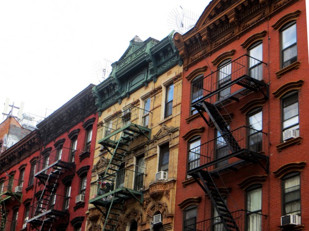
Historically, the Lower East Side extended from East 14th Street south to Fulton and Franklin Streets, and from the East River west to Broadway and Pearl Street. Today, the regarded boundaries of the East Village and Lower East Side extend roughly from East 14th Street to the Bowery to the East River, with Houston Street as their north-south divider.
The area’s architecture reflects its early development, with extant examples of early 19th century rowhouses, religious structures, theaters, schools, libraries, banks and settlement houses and the tenement. The East Village contains three New York City historic districts: St. Mark’s Historic District and Extension, East Village / Lower East Side Historic District and East 10th Street Historic District. The latter two were designated in 2012 after a robust advocacy and outreach effort by community groups and preservationists. At the time of this publication, there are no locally designated historic districts in the Lower East Side.
To learn more about East Village/Lower East Side click here
The first European settlement in Elmhurst was founded in 1642 at the head of the Maspeth Creek. The town was destroyed due to increasing conflicts between Native Americans and the Dutch, and was replaced in 1652 by a new village located on safer ground inland, at what is now Queens Boulevard and Broadway. The English called the place Middelburgh, since Dutch authorities required a Dutch name, but referred to it as Newtown among themselves, to distinguish it from the old town at Maspeth.
The 18th century was a period of prosperity for Newtown Village, population slowly increased and the local economy became more diversified. The proximity to New York allowed for crops to be sold in the open market or traded for manufactured goods, and also provided access to luxury goods and services. The road system was largely created during this time, connecting the outlying hamlets with the churches and town offices at Newtown, giving them access to the mills, the meadows and the shore. During the Revolution, the British Army occupied Newtown. Officers were billeted in the houses and buildings were repurposed for field hospitals, armories and headquarters. After the war, the town recovered gradually, mostly thanks to new practices and technologies in agriculture that boosted the economy. Social change was spurred by the abolition of slavery in New York State in 1827 and a group of newly freed African Americans established the first African Mehtodist Episcopla (A.ME.) Church and cemetery in the town.
In the years before the Civil War, and during the first decade after, Newtown remained largely a one-street town. Although there was some commercial growth, and a new building was erected for the Newtown High school (site 6), attempts to expand the limits of the old village were unsuccessful. This began to change in 1869, when large estates were auctioned. In 1893, the Meyer brothers, led by Cord Meyer Jr., bought over 100 acres of the Samuel Lord estate to develop an ambitious plan for a new suburb northwest of the old Newtown Village. This development was planned to offer amenities rarely present in a rural district, and certainly nowhere else in Queens at the time: paved streets, a water system and private sewers. The project proved to be extremely successful, and the neighborhood became known for its fashionable housing developments and infrastructure. Cord Meyer, Jr. also lobbied to have the name of the village changed to Elmhurst, to avoid any association with the polluted Newtown Creek. The name is said to have been inspired by large, mature American elms that existed along Broadway, particularly in front of St. James Church. Despite initial resistance from the townspeople to discard the historic name of the village, in 1896 the Post Office officially changed to Elmhurst.
The opening of the subway in 1936 spurred local development which resulted in the destruction of much of the old village’s building stock, most notably the Moore Homestead. After the Second World War, Elmhurst became a place for architectural innovation. Influenced largely by the New York World’s Fair of 1964, buildings like the Pan American Hotel, the Queens Place Mall and the former Jamaica Savings Bank branch (site 15) changed the neighborhood’s landscape. In the 1980s, immigrants from many different countries changed Elmhurst from an almost exclusively white community to the most ethnically diverse neighborhood in the city.
In the early 20th century, a thriving network of vacation communities was constructed along the oceanfront in Brooklyn and Queens to accommodate the city’s working class in their summertime recreational pursuits. One of these was Rockaway, Queens, which was once home to over 7,000 modest bungalows in dozens of distinct seasonal communities. Sadly, fewer than 400 exist today, the rest having been demolished to make way for new development beginning in the mid 20th century. Rockaway’s largest cluster of existing bungalows (93 in total), located in Far Rockaway on Beach 24th, 25th and 26th Streets south of Seagirt Avenue, was once part of a Russian and German Jewish immigrant community called Wavecrest.
To learn more Far Rockaway Beachside Bungalows click here
One of the first Queens residential developments was Forest Hills, a 600-acre parcel of farmland previously known as the Hopedale section of Whitepot. Purchased by the Cord Meyer Development Company in 1906, the parcel was renamed in honor of its proximity to Forest Park and its elevation above the surrounding area.
For this new development, George C. Meyer stipulated the layout of a suburban community, with lots designated for houses, schools and churches, as well as utilities and plantings. Aesthetically, the area would be united by its architecture. Meyer hired architects Robert Tappan and William Patterson to design single-family houses that would complement one another. Cord Meyer began the development of these lots in 1906, mostly north of Queens Boulevard. Forest Hills Gardens was established in 1909, and the community was completed in 1912-13. Arbor Close and Forest Close, small townhouse complexes with shared gardens, were constructed in 1925 and 1927, respectively.
To learn more about Forest Close & Forest Hills click here
HDC will help the Fort Washington Historic District Task Force advocate for community preservation efforts, including a Fort Washington Historic District that includes a stylistically diverse and well preserved stock of the early twentieth-century apartment complexes, which are a character-defining feature of the neighborhood, as well as sites significant to the area’s Jewish heritage.
HDC will support the Garifuna Coalition USA, Inc., an organization representing a culturally differentiated Afro-indigenous community who began migrating to New York City in the 1930s, in their efforts to be more effective in their strategy to identify the historic resources in their community and promote the community’s significance.
The New York Fashion Workforce Development Coalition (NYFWDC) is a multi-stakeholder working group bringing together individuals from the fashion industry, community, academia, non-profit sectors, and government to find solutions to strengthen and grow New York’s fashion future via social justice, women’s economic advancement and empowerment.
HDC is supporting the NYFWDC in their efforts to promote the Garment District’s cultural, historical, and architectural significance and advocate for the continued presence of fashion manufacturing within the district as part of larger plans for the area.
The Brooklyn community of Gowanus, centered around the Gowanus Canal, is largely made up of historic architecture directly related to the water route. Located between Park Slope and Carroll Gardens, it is considered part of Brooklyn’s industrial waterfront. The canal itself is 2.5 miles long, 100 feet wide, and stretches from Gowanus Bay in New York Harbor to Douglass Street. Unlike other industrial areas of the city, Gowanus was never densely built up, and much open space remains today. The structures that surround the canal are generally six stories or fewer, lending a low-scale, 19th-century character. This area continues to be mixed-use manufacturing with peripheral residential enclaves.
Historically one of New York’s most contaminated waterways, the Gowanus Canal area was designated as a Superfund Site in 2010. To protect the historic character of the neighborhood the local community is currently working to place the Gowanus Canal Corridor on the National Register of Historic Places so that its urban industrial character is preserved.
To learn more about Gowanus click here
Spurred by a period of economic growth and an influx of European immigrants during the 1850s, more than a dozen shipbuilding firms turned the neighborhood into a major shipbuilding center. While shipbuilding declined after the Civil War, Greenpoint’s other industrial enterprises, which included porcelain making, glass making, and oil refining, continued to thrive. Greenpoint’s residential development was closely aligned with its industrial growth, as workers’ housing was built inland from the waterfront. Large, elaborate rowhouses were constructed for owners and managers, while modest rowhouses, tenements, and apartment buildings were built for laborers. The neighborhood also boasts many fine churches and institutional buildings, such as the Greenpoint Savings Bank and the Mechanics and Traders Bank.
To learn more Greenpoint click here
This single-block street in the north shore neighborhood of Stapleton encapsulates Staten Island’s 19th century residential character, projecting a strong sense of place. It features a rare grouping of intact wood frame and masonry houses, many boasting whimsical architectural features. At this time, there are just three historic districts on the whole island.
To learn more about Harrison Street click here
municipal cemetery in the United States. It was part of the property purchased by the English physician Thomas Pell from Native Americans in 1654. On May 16, 1868, the Department of Charities and Correction (later the Department of Correction or “DOC,” which split off from the Department of Public Charities in 1895), purchased Hart Island from the family of Edward Hunter to become a new municipal burial facility called City Cemetery. Public burials began in April 1869. Since then, well over a million people have been buried in communal graves with weekly interments still managed by the DOC. The burials expanded across the entire island starting in 1985. Over its 150-year municipal history, it has also been home to a number of health and penal institutions. The island is historically significant as a cultural site tied to a Civil War-era burial system still in use today.
During the Civil War, in April 1864, the federal government leased Hart Island as a training camp for the 31st regiment of the United States Colored Troops. For four months in 1865, Hart Island was host to a prisoner-of-war camp for 3,413 captured Confederate soldiers. Hart Island was also leased to the federal government for training and defense purposes during World War II and the Cold War. Following the Civil War, personnel from the U.S. Sanitary Commission were stationed at Bellevue Hospital and helped to establish a morgue for examining and identifying the dead. In 1866, the City Council passed new sanitary codes prohibiting new burial grounds from opening in New York City. The Potter’s Field then in use on Wards Island (established in the 1840s) closed, and City Cemetery on Hart Island (then part of Westchester County) opened in 1869.
In 1872, a highly efficient grid system of burials began on Hart Island that is largely unchanged today. Trenches were laid out in three layers of 50 graves. In 1931, this system changed to sections of two across and three deep with 50 bodies per section. Each pine box is listed as a grave and recorded in ledger books. Consequently, the City’s mortuary service, still operated by the Office of the Chief Medical Examiner at Bellevue Hospital, can readily disinter a body for further examination or return it to families claiming the deceased at a later date. In 1931, the City also began recycling graves, which is legal after a body has decomposed to skeletal remains. Due to these practices, City Cemetery is large enough to accommodate New York City’s burial needs indefinitely, making it an important municipal resource.
In 2013, the New York City Council passed legislation requiring the DOC to post its database of burials online and to list its visitation policy. In 2013, a group of eight women working with a charity, The Hart Island Project (HIP), petitioned the City to visit the graves of their infants buried on Hart Island. In 2015, the New York Civil Liberties Union filed a class action lawsuit establishing rights for families to visit graves on Hart Island. Families are now able to visit once a month by appointment. HIP was founded in 1991 to provide public access to information about burials and, in 2014, launched The Traveling Cloud Museum, an online database with an interactive map for locating burial sites and collecting stories of the recently buried. These resources are intended to reconnect Hart Island with communities across the globe.
Hell’s Kitchen, Manhattan
The built environment of Hell’s Kitchen reflects many important aspects of immigrant life at the turn of the century, incorporating the housing, institutions and industrial buildings that provided the livelihoods of newly-arrived New Yorkers for generations. Manhattan Community Board 4 and the office of Council Speaker Corey Johnson have made it a priority to gain landmark protections for portions of the neighborhood in order to preserve its near-pristine historic streetscapes of rowhouses, tenement buildings, religious structures and commercial architecture.
When the western Bronx was annexed by New York City in 1874, it was only a matter of time until this rural area would experience widespread urban expansion and a surge in population. John Mullaly (1835–1915), regarded as the “father of the Bronx Park system,” was a newspaper reporter and editor who looked upon this future growth with concern for the well-being of city residents and for the intelligent development of the city itself. Mullaly’s effort culminated in the 1884 New Parks Act and the City’s 1888-90 purchase of 4000 acres for Claremont, Crotona, Van Cortlandt, Bronx, St. Mary’s, and Pelham Bay Parks, as well as the Mosholu, Bronx, Pelham, and Crotona Parkways that connect the parks to one another. In 1932, 18 years after his death, Mullaly Park in the south Bronx was dedicated in his honor.
To read more click here
Cuando la parte oeste del Bronx se anexó a la ciudad de Nueva York en 1874, fue solo cuestión de tiempo hasta que esta área rural experimentase una urbanización expansiva y una explosión de población. John Murray (1835-1915), considerado como el “padre del sistema de parques de El Bronx,” fue un reportero y editor de periódicos que pensó que este futuro crecimiento sería una amenaza para el bienestar de los residentes y el desarrollo inteligente de la ciudad.
Los esfuerzos de Murray culminaron en 1884 con la Ley de Nuevos Parques, y la compra por parte de la ciudad en 1888-90 de tierras para los parques Claremont, Crotona, Van Cortland, Bronx, St Mary’s, y Pelham Bay, así como también con la creación de las carreteras Moshulu, Bronx, Pelham, y Crotona, las cuales conectan los parques entre sí. En 1931, 18 años después de que Mullay muriera, se le dedicó en su honor el Mullay Park en el sur del Bronx.
Filled with green space, picturesque churches and remarkable historic streetscapes, The Bronx has long been one of New York City’s hidden treasures. In the face of the massive development pressure sweeping across the city, the Historic Districts Council has gathered residents and activists from across The Bronx to create a coalition focused on promoting and preserving historic buildings and neighborhoods throughout the borough. Together, we will be able to better mobilize against inappropriate development and work to protect what makes The Bronx unique.
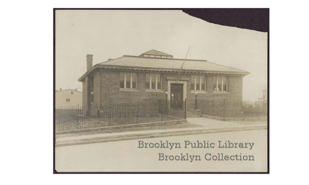
The New York Public Library (NYPL) was formed in 1895 with the consolidation of three private corporations: the Astor Library (founded by John Jacob Astor in 1849), the Lenox Library (founded by James Lenox in 1870) and The Tilden Trust (a fund established in 1886 by Samuel J. Tilden). The NYFCL also joined this consolidation in 1901 in order to benefit from Carnegie’s gift of $5.2 million for 67 library branches to be built between 1901 and 1929 (56 are still standing). Carnegie’s only stipulation was that the city acquire the sites and establish building maintenance plans. To design the buildings, the NYPL organized a committee of architects: Charles F. McKim, Walter Cook and John M. Carrère. In order to stylistically link the branches and save money, the committee decided on a uniform scale, interior layout, character and materials palette for the buildings.
To read more about New York City’s Historic Public Libraries click here
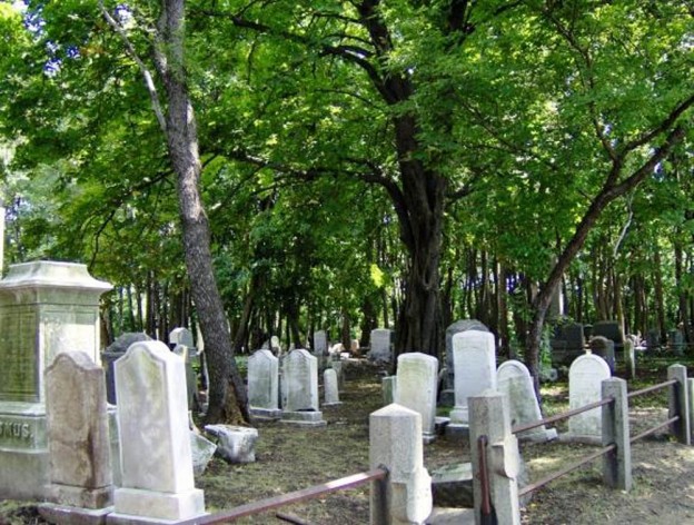
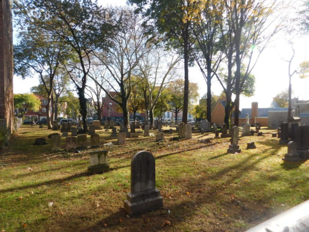
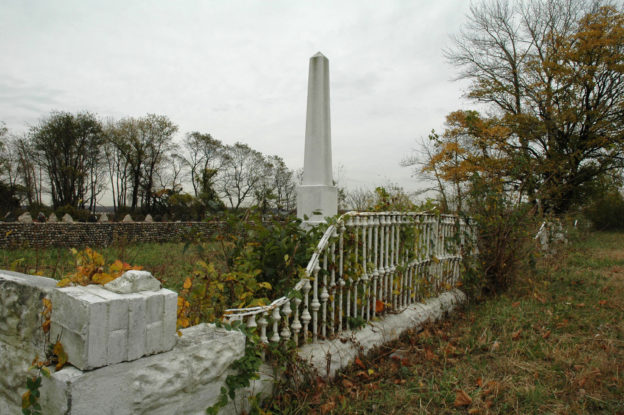
A relative lack of development pressure allowed Staten Island’s small burial grounds to remain. From the 17th century well into the 19th century, family farms occupied much of Staten Island, especially in the south. Within the confines of these farms, “Homestead Graves” or family burial grounds were established. These were some of the first community cemeteries on Staten Island, and many of today’s cemeteries are still named after the families whose homestead burial grounds were sold for public use. Many of the 13 accessible and five inaccessible cemeteries covered in this brochure became abandoned, vandalized or used as dumping grounds in the 20th century.
To learn more about the Historic Staten Island Cemeteries click here
Hunts Point, the Bronx
Much more than massive wholesale markets, this south Bronx neighborhood possesses historic and cultural richness that Dondi Mckellar of Bronx Community Board 2 is working to celebrate and preserve. The 1912 Feldco Building was a center for generations of popular music styles from jazz to salsa to hip-hop, and the area is home to a burial ground for enslaved Africans, vibrant local businesses, architectural gems, and a rich musical and artistic heritage. The group is working to ensure that both long-time residents and newcomers are aware of the neighborhood’s cultural wealth, and that new development is respectful of the area’s architecture and scale.
Inwood is located at the top of Manhattan Island, at the point where the Hudson and Harlem Rivers meet a the Spuyten Duyvil. The area is historically, architecturally and environmentally unique as almost half of the land is public park space that preserves the natural terrain and geological features of the island, as opposed to the designed landscapes of many parks in New York City. In 1906, the extension of the IRT transit lines to Dyckman Street resulted in the rapid development of six- and seven-story apartment houses on land purchased from farms and private estates. Today, Inwood remains characterized by early-20th- century apartment residences built in relation to the preserved landscape of its public parks to the west and south. An industrial area, serving the transportation, sanitation and utility infrastructure of New York City, occupies a large portion of its eastern edge.
To learn more about Inwood click here
Inwood está situado en la parte superior de la isla de Manhattan, en la confluencia del Río Hudson y el Río Harlem, en el barrio Spuyten Duyvil. Esta zona es única en arquitectura, historia y medio ambiente. Casi la mitad del terreno es un parque público que preserva el suelo natural y las características geológicas de la isla, al contrario de los paisajes diseñados en muchos parques en la Ciudad de Nueva York. En 1906, la prolongación de las líneas IRT del subterráneo hacia Dyckman Street, en donde las primeras estaciones de transporte masivo abrieron, resultó en la rápida construcción de casas de apartamentos de seis y siete pisos en terrenos comprados a granjeros y dueños de haciendas privadas. Los inmigrantes de clase trabajadora y de distintos orígenes culturales, buscando mejores condiciones de vida que aquellos edificios estrechos en downtown Manhattan, se mudaron a Inwood para residir en apartamentos nuevos, espaciosos y más asequibles ubicados en construcciones neoclásicas, con estilo italianizante y arquitectura neo-tudor. En la actualidad, Inwood se caracteriza por sus apartamentos residenciales de comienzos del siglo XX, los cuales fueron construidos en concordancia con el paisaje preservado de los parques públicos en el sur y oeste del barrio. Un área industrial, que ofrece infraestructura para las necesidades de transporte, aseo y servicios públicos de la ciudad de Nueva York, ocupa una gran parte del borde oriental.
Jackson Heights is an early-20th-century neighborhood in central Queens, composed of low-rise garden apartments and houses as well as institutional and commercial buildings. It was the first and remains the largest garden-apartment community in the United States— the product of both the early 20th-century model tenement and the Garden City movements.
Jackson Heights was designated as a New York City Historic District in 1993, and an extension of those boundaries, which would meet those of the 1998 National Register Historic District, is currently being sought. This would include buildings that, due to the restrictions placed upon them by the Queensboro Corporation, possess the same quality design, materials and scale of the earliest buildings creating historic Jackson Heights.
To learn more about Jackson Heights click here
Jackson Heights es un vecindario fundado en el comienzo del siglo XX, en el centro de Queens, compuesto de edificios bajos con jardines y casas, junto con edificios institucionales y comerciales. Fue la primera comunidad de apartamentos con jardín, y todavía es la más grande en los Estados Unidos, producto de la corriente de viviendas ejemplares y del movimiento urbanístico Garden City (ciudad jardín) de principios del siglo XX. Hacia finales del siglo XIX, las malas condiciones de vida en los barrios pobres de la ciudad dieron origen a esfuerzos reformatorios para mejorar la vivienda urbana. Como resultado, la luz, la ventilación y el espacio verde abierto se volvieron piezas claves en el diseño de urbanizaciones nuevas. Esto es particularmente evidente en Jackson Heights.
HDC will work with the Kew Gardens Improvement Association and the Kew Gardens Preservation Alliance to help support their campaign to preserve the historic core of the neighborhood, which includes the historic bridge at Lefferts Boulevard, the surrounding historic pre-war buildings, and several blocks of historic houses.
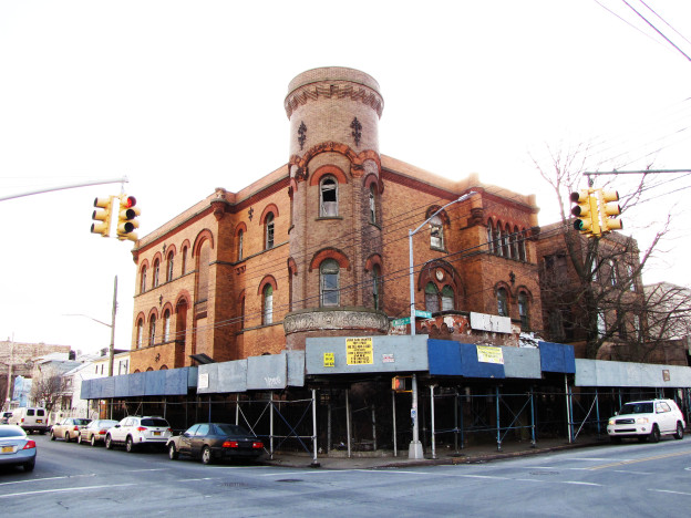
Kingsbridge, the Bronx
This northwestern Bronx community is home to architectural gems from multiple eras and in various styles, from the imposing Kingsbridge Armory to 19th century farmhouses to stunning 1930’s Art-Deco apartment buildings. The Northwest Bronx Community & Clergy Coalition has been working since 1974 with residents and small businesses in the Bronx to prevent displacement, foster equitable economic development, protect housing and maintain strong and stable communities. The NWBCCC is now seeking to identify historic resources in order to better protect and stabilize community character and foster pride in the area’s architecture and history.
With recent landmark designations of Philip Johnson’s AT&T Building (1978), the Citicorp Center (1973-1978), the interior of the UN Plaza’s Ambassador Grill and Lounge (1969-83) and six sites with ties to the LGBTQ community of the 1960’s and 1970’s, the time to assess preserving our recent past has firmly arrived. The Historic Districts Council will work in partnership with Docomomo US and Queens Modern to highlight architecturally and culturally significant buildings of the last 50 years that are unprotected and unrecognized. Beginning with the 1970’s, the decade of HDC’s formation, the partnership seeks to raise public awareness of a time of great change and adversity characterized by a remarkable variety of architectural forms, technical advances and urbanistic ideas. This is the city we’re sending into the future; let’s start talking about the ALL the parts we should keep.
In November 2014, the New York City Landmarks Preservation Commission (LPC) announced a plan to clear 95 properties that had been on its calendar for five years or more, but not yet designated as landmarks. The wholesale removal of these properties without considering each one’s merits would have represented a severe blow to the properties and to the city’s landmarks process in general, sending a message that would jeopardize any future effort to designate them.
The Historic Districts Council acted strongly in opposition to this action, and advocated for a more considered, fair and transparent approach. As part of this effort, HDC worked with Manhattan Borough President Gale Brewer and a coalition of other preservation organizations to submit an alternative plan for the LPC’s consideration. The plan eventually formed the basis for the LPC’s initiative, entitled “Backlog95,” calling for a series of public discussions to evaluate the properties in geographical groupings.
To learn more about the Landmarks Under Consideration click here
Based in the Flatbush neighborhood of Brooklyn, I AM CARIBBEING is dedicated to showcasing Caribbean culture, particularly along the corridors of Flatbush, Church, Nostrand, and Utica Avenues, aka “Little Caribbean.” I AM CARIBBEING is led by Kennya Cummings and Shelley Worrell, two community activists dedicated to highlighting the most culturally iconic places of the area. I AM CARIBBEING is a leading force in this thriving community, where West Indians live, work, and play. HDC will work with I AM CARIBBEING to promote their work commemorating the history of the Caribbean diaspora in New York City.
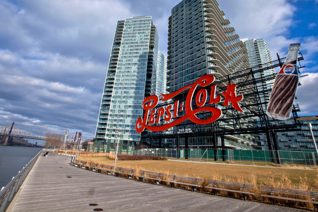
The westernmost portion of Queens remained predominantly rural and undeveloped until around 1870, when Long Island City was incorporated from the nascent industrial communities of Astoria, Blissville, Hunters Point and Ravenswood. The start of this area’s growth began when the Long Island Rail Road moved its main terminus from Downtown Brooklyn to the East River waterfront in Hunters Point in 1861. In the last quarter of the 19th century, its waterfront became home to oil refineries, lumber yards, factories and chemical plants, while the city’s population tripled from 15,609 in 1875 to 48,272 in 1900. After Queens was consolidated into Greater New York City in 1898, Long Island City’s connections to Manhattan were strengthened with additional transportation options. Banks and manufacturing firms soon gravitated towards Long Island City , which became famous for the large electric signs that dotted the rooftops of its buildings, advertising products like Swingline Staplers, Chiclets and Pepsi Cola to travelers passing through.
To read more about Long Island City click here
Much of the Lower West Side was once underwater, with the Hudson River shoreline running approximately where Greenwich Street is now located. During the colonial period, the settlement at Manhattan’s southern tip was guarded by Fort Amsterdam (renamed Fort George by the British), and later reinforced by the Whitehall Battery. Partially destroyed during the American Revolution, the fort was demolished and the Battery rebuilt as an elegant promenade. The adjacent blocks remained the city’s most elegant residential neighborhood, as evidenced by several surviving Federal-style row houses in the neighborhood. In the lead-up to the War of 1812, the U.S. Government built a new fortification—the West Battery, later renamed Castle Clinton—on an artificial island 300 feet offshore.
By the mid-19th century, fashionable New Yorkers had moved northward and lower Manhattan was given over to commercial activity and tenement housing. Landfill extended the island’s western shoreline, enveloping Castle Clinton, by then repurposed as an immigration station. Horsecar tracks plowed through the neighborhood’s north- south thoroughfares and in 1867 the first elevated train in the country began operating along Greenwich Street. Single-family row houses were split up into multiple units, and purpose-built tenements were erected to cater to the neighborhood’s increasingly diverse immigrant population.
One of the Lower West Side’s most notable immigrant communities was “Little Syria”, which existed along lower Washington Street and the surrounding blocks from the 1880s through the 1920s. The “Great Migration” of Syrians to the U.S. was sparked, in part, by the opening of the Suez Canal in 1869 and the subsequent devastation of the local silk industry. Though government officials often referred to them as “Turks” due to their citizenship within the Ottoman Empire, the community generally identified as Syrian. The majority came from the Mount Lebanon area, and many embraced their Lebanese heritage in the 1920s with the rise of that country’s national independence movement. Most of Little Syria was Christian; approximately half were Syrian Melkite and Lebanese Maronite Catholics.
Manhattan’s Syrian Quarter was central to the lives of other Syrian communities throughout the U.S., both economically and culturally. Its merchants imported—and its factories produced—wares including Oriental rugs, cigarettes and mirrors. Printers modified their machinery to reproduce Arabic characters, and more than 50 Arabic newspapers and periodicals were produced at its height.
The Lower West Side’s Syrian community began to decline in numbers and visibility during the 1920s, the same period in which the neighborhood was experiencing profound changes to its built environment. The Immigration Act of 1924 halted new arrivals to sustain the neighborhood, and residents either moved or Syrian quarters or assimilated into the general population. Rising property values also played a part as the commercial development of the Financial District increased during the Roaring Twenties. By the 1930s much of the neighborhood’s low-scale row houses and tenements had been replaced by Art Deco skyscrapers. Today the neighborhood has largely vanished, although several significant sites remain nestled among the office towers of Lower Manhattan.
Unlike other parts of Midtown, one can still experience the full flavor of this neighborhood’s evolution from a residential enclave into an entertainment district anchored by Madison Square Garden, and later to one of the nation’s most important mercantile centers before WWI. At this time, only a small portion of this area west and north of Madison Square is protected as a historic district.
To read more about the Madison Square North click here
HDC will partner with LANDMARK WEST! to explore Manhattan Avenue (West 100 to 104th Streets) on the Upper West Side. HDC will help LW! research the area’s social and architectural history, engage with NYCHA residents about their historic campuses, and advocate for increased protection at the local and national levels.
Morningside Heights posee la mayor concentración de edificios institucionales construidos en un periodo de tiempo relativamente corto a comienzos del siglo XX, tanto en la ciudad como en cualquier otra parte de Estados Unidos. Es el hogar de sitios monumentales de oración, educación superior y sanación, los cuales acentúan el fondo de casas en hilera y construcciones de apartamentos que culminan en un elegante paisaje urbano elegante y agradable a la vista. Topográficamente, Morningside Heights está situado en un altiplano históricamente conocido como Harlem Heights, mientras que geográficamente está rodeado de West 110th Street al sur, West 125th Street al norte, Morningside Park al este y Riverside Park al oeste, dos parques diseñados por Frederick Law Olmsted.
Morningside Heights is graced with the highest concentration of institutional complexes built in a relatively short period at the turn of the 20th century, both in the city and anywhere in the United States. It is home to monumental places of worship, higher learning and healing, which accentuate its backdrop of rowhouses and apartment buildings, culminating in streetscapes that are both elegant and eye-filling. Topographically, it is situated on a plateau historically known as Harlem Heights, while geographically it is bounded by West 110th Street to the south, West 125th Street to the north, and two Frederick Law Olmsted–designed parks to the east (Morningside Park) and to the west (Riverside Park).
Morningside Heights was calendared by the Landmarks Preservation Commission in September 2016 and had a public hearing on December 6, 2016.
To learn more about Morningside Heights click here

HDC will support Friends of Mosholu Parkland work to create a Master Plan for Mosholu Parkway to improve the quality of life for the local communities, including Bedford Park and Norwood. We will also assist in their preservation efforts for sites including The Bronx Victory Memorial and Frank Frisch Field.
El Bronx fue nombrado en honor a Jonas Bronck, un inmigrante europeo nórdico, quien llegó a la colonia de Nueva Holanda en 1639. Bronck y su esposa Teuntje Joriaens crearon una granja en lo que ahora se conoce como Mott Haven, en la intersección del Río Harlem y Bronx Kill, con vistas a la isla Randall. En 1670, gran parte del área fue adquirida por la familia Morris, quienes construyeron una casa de campo llamada Morissania. La familia mantuvo su propiedad, y el área estuvo escasamente poblada hasta inicios del siglo XIX. La llegada del ferrocarril de Nueva York y Harlem, anunciada en 1840, convenció a la familia Morris de aceptar proyectos suburbanos en su hacienda.
Jordan L. Mott, homónimo del barrio Mott Haven, compró unas grandes extensiones de tierra de la familia Morris en 1841 y 1848. Con la intención de crear una “zona céntrica del Condado de Westchester” (de la cual Mott Haven todavía era parte) Morris dispuso calles y lotes para construcciones, y empezó a promocionar este lugar como Mott Haven. De acuerdo con sus planes, la parte sur tendría uso industrial, con su propia carpintería metálica, y comunicado con un canal de 3000 pies, construido específicamente para este fin. La parte norte fue reservada específicamente para edificios residenciales prolijos, protegidos por cláusulas que restringían elementos “dañinos para la salud o nocivos u ofensivos para el barrio”. Otros constructores pronto siguieron los pasos de Mott en el sur de El Bronx, comprando grandes extensiones de tierra de la familia Morris, y diseñando sus propios suburbios, como Wilton (subdividido en 1857) y Nueva York del Norte (1860), ambos parte de Mott Haven en la actualidad. La familia Morris también formó parte del auge de las construcciones, y fueron quienes planearon el barrio industrial Port Morris.
El desarrollo de estas extensiones de tierra fue sostenido, aunque no tan rápido como a los promotores les habría gustado. Mott Haven propiamente dicho, el cual se extendía entre la Tercera Avenida y el Río Harlem, era el más poblado, con una concentración de casas modestas con armazón de madera, mayormente construidas para los trabajadores locales de las fábricas. Para la década del 1860, el área incluso se jactaba de algunas casas en hilera hechas de ladrillo, algunas de las cuales aún subsisten. Gran parte del área, sin embargo, permaneció en manos de inversionistas esperando que se incrementara el valor de la zona. El pánico de 1873 retrasó este proceso por varios años, aunque en 1874, el sur de El Bronx se anexó a la ciudad de Nueva York, asegurando su eventual desarrollo como un barrio urbano. La llegada del transporte público (apertura de la estación de la calle 138 de la Compañía Suburbana de Tránsito en 1887, posteriormente parte del tren elevado de la Tercera Avenida de la Interborough Rapid Transit) le dio un último empuje al crecimiento de la zona. En una década o dos, la mayoría de las calles de Mott Haven estaban construidas con una amplia variedad de edificios, desde cómodas casas en hilera para una sola familia, hasta edificios con múltiples apartamentos y edificios residenciales. La industria también floreció. La empresa de herrería de Jordan Mott, en la actualidad controlada por sus descendientes, continuó expandiéndose. Otras manufacturas llegaron al barrio, incluyendo un número notable de productores de pianos. De hecho, a inicios del siglo XX, El Bronx tenía 63 fábricas de pianos, 43 de ellas en Mott Haven, las cuales producían más de 100.000 instrumentos al año.
El origen industrial de Mott Haven provocó que el barrio fuese particularmente afectado por la desindustrialización de la ciudad de Nueva York a mediados del siglo XX. A pesar de que el sur de El Bronx se convirtió en un símbolo de decadencia urbana y desinversión en la década de 1970, también permaneció siendo un barrio vibrante de inmigrantes con nuevas instituciones, como el Teatro de Puerto Rico (sitio 11b en la guía), que se mudaron a varios de los edificios históricos que subsistieron. La rica historia y distinción arquitectónica de Mott Haven ha sido reconocida por la Comisión de Preservación de Emblemas de la Ciudad de Nueva York, a través de la designación de tres distritos históricos (incluyendo el primero en El Bronx) y varios emblemas individuales.
The Bronx is named after Jonas Bronck, a Nordic European settler who arrived in the colony of New Netherlands in 1639. Bronck and his Dutch wife, Teuntje Joriaens, established their farmstead in what is now Mott Haven at the confluence of the Harlem River and Bronx Kill overlooking Randall’s Island. In 1670 much of the area was acquired by the Morris family, who established a large manor called Morissania. The family retained ownership—and the area remained sparsely populated—through the early 19th century. It was the arrival of the New York and Harlem Railroad line, announced in 1840, that finally persuaded the Morrises to embrace suburban development on their estate.
Jordan L. Mott, the neighborhood’s namesake, purchased sizable tracts from the Morris family in 1841 and 1848. Hoping to create a “downtown of Westchester County” (of which this area was then still a part), he laid out streets and building lots and began marketing the new hamlet called Mott Haven. According to Mott’s plan, the southern portion was devoted to industrial uses, including his own iron works, all served by a purpose-built, 3,000-foot canal. The northern section was reserved for tidy residential buildings, protected by restrictive covenants from anything “pernicious to health or noxious or offensive to the neighborhood.” Other developers soon followed Mott to the South Bronx, purchasing large tracts from the Morris family and laying out their own suburbs such as Wilton (subdivided 1857) and North New York (1860)—now both part of the neighborhood of Mott Haven. The Morris family itself entered the development fray, planning the industrial neighborhood of Port Morris.
Development of these tracts was steady, if not as rapid as their promoters may have wanted. Mott Haven proper—which consisted of the area between Third Avenue and the Harlem River—was the most populous, containing a concentration of modest, mostly wood-framed, houses built for local factory workers. By the 1860s the area even boasted a few brick rowhouses, some of which still survive. Much of the area, however, remained in the hands of real estate investors waiting for the area to gain in value. The Panic of 1873 delayed this by several years, although around the same time, in 1874, the South Bronx was annexed into New York City, likely ensuring its eventual development as an urban neighborhood. The arrival of mass transit (the 1887 opening of the Suburban Rapid Transit Company’s 138th Street Station, later part of the IRT Third Avenue Elevated) provided the ultimate spark for the area’s growth. Within a decade or two, most of Mott Haven’s streets were completely built up with a diverse range of buildings, from comfortable single-family rowhouses, to larger multi-family tenements and apartment buildings. Industry also blossomed. Mott’s iron works, now controlled by his descendants, continued to expand. Other manufacturers moved into the area including a remarkable number of piano manufacturers. In fact, by the early 20th century the Bronx had (by one count) 63 piano factories—43 of them in Mott Haven—producing more than 100,000 instruments a year.
Mott Haven’s dense industrial base meant the neighborhood was particularly hard hit by the deindustrialization of New York City in the mid 20th century. Though the South Bronx became a symbol of urban decay and disinvestment by the 1970s, it also remained a vibrant immigrant neighborhood with new institutions, such as the Teatro de Puerto Rico (site 11b), moving into the many surviving historic buildings. The rich history and architectural distinction of Mott Haven has been recognized by the New York City Landmarks Preservation Commission through the designation of three historic districts (including the first in the Bronx) and several individual landmarks.
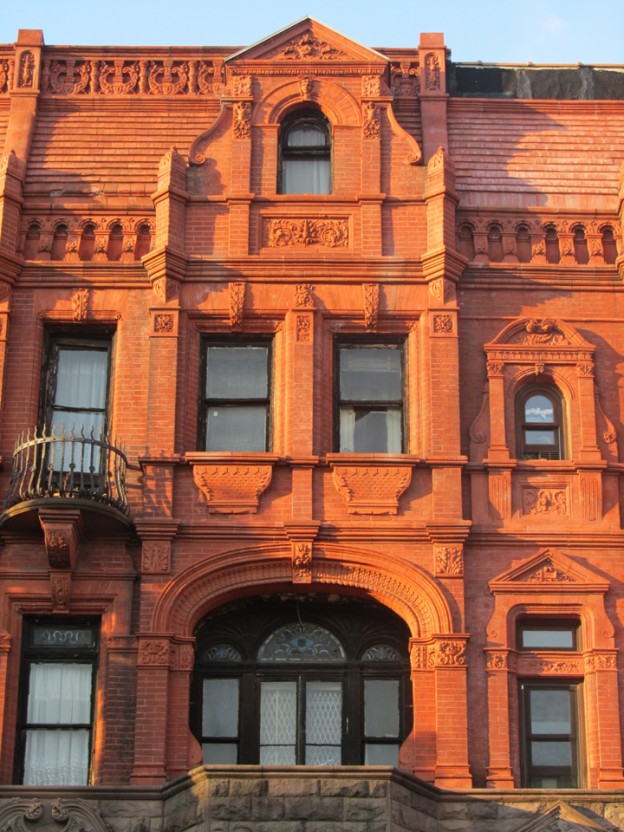
The Mount Morris Park neighborhood is a residential area in central Harlem, bounded by 125th and 117th Streets from north to south, by Adam Clayton Powell Jr. Boulevard to the west, and by Marcus Garvey Memorial Park to the east. The park, known as Mount Morris Park until 1973, has always been the centerpiece of the neighborhood. Besides the park, the area is characterized by attractive low-scale rowhouses, townhouses and institutional buildings, including many churches. Stylistically, most of the architecture found in Mount Morris Park is Romanesque Revival, French Neo-Grec and Queen Anne, as well as Classical and Renaissance. There is also much transition among styles in the architecture here, which results in a charming, eclectic mix, and the neighborhood retains a strong turn-of-the-20th-century architectural character today.
To learn more about Mount Morris Park click here
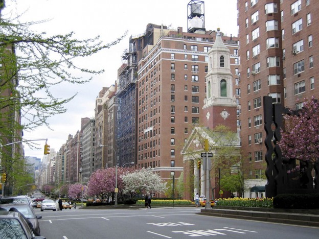
Park Avenue, today a coveted address, was once neglected. In 1831, the New York and Harlem Railroad was granted use of what was then known as Fourth Avenue for its train tracks. Starting 1837, steam engines heading to and from Grand Central spewed sparks and noise through vents. Per new legislation the trains were moved below ground and eventually electrified. As a result the street was paved over and the vents were turned into beautifully landscaped malls. Perhaps the most important contributor to Park Avenue’s special character is its apartment buildings, whose largely uniform heights form continuous street walls. The buildings were designed by respected architects in popular styles, including: Gothic Revival, Renaissance Revival and Art Deco. Among the notable architects were: George and Edward Blum, Rosario Candela, J. E. R. Carpenter, George F. Pelham and Emery Roth. Today much of Park Avenue is a designated historic area.
To learn more about Park Avenue click here
Parkchester is an extraordinary complex of more than 50 buildings, located on 129 acres of land, three-quarters of which is left to open space. This pioneering housing development influenced mid-twentieth-century thinking on the planning and design of large apartment complexes and is considered a model of good high-density housing. Parkchester features an extraordinary collection of terra cotta details and public sculptures designed by leading artists. In 1978, the Landmarks Preservation Commission conducted a Bronx survey that recommended the designation of Parkchester as a historic district. More than 40 years later, that designation has yet to happen. HDC will continue working with HDC Board Director Susan Tunick and Sharon Pandolfo of The Parkchester Project. The Parkchester Project aims to save the historic character of Parkchester and advocate for its landmark designation.
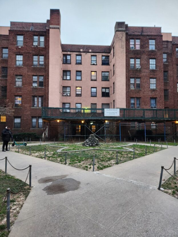
The Bronx Park East Community Association is located in the Allerton section of the Bronx and works to highlight and bring awareness to the historic treasures of the neighborhood, including The Coops, a pioneering example of 1920s non-profit workers’ cooperative housing built by the United Workers Association.
HDC will work with the Bronx Park East Community Association to highlight and bring awareness to the neighborhood’s architectural and cultural history, including The Coops.
The Empire State Development Corporation’s Pennsylvania Station Project seeks to remove multiple blocks of important historic buildings around Penn Station. Working with Andrew Cronson and David Holowka of Save Chelsea, HDC will highlight and advocate for the landmarking of these threatened buildings. In addition, Save Chelsea aims to expand outreach efforts to residents of the neighborhood and elected officials to call attention to the need to preserve the area’s historic fabric.
The Port Morris section of The Bronx was once part of Morrisania, which was established as a seaport in 1842 by Gouverneur Morris, Jr., son of United States founding father Gouverneur Morris. In the 1850s, the area’s waterfront developed as an industrial center with tenants such as stone works and furniture and piano factories. Around the turn of the 20th century, Port Morris was part of a network of industrial waterfront districts in the southern Bronx, northern Queens and northern Manhattan. As there were not yet bridges connecting these parts of the city, ferries were the primary means of crossing the waterways.
One of the ferry depots along this network was at East 134th Street in The Bronx, for which a pair of large ferry bridges or “gantries” was constructed in 1948. The ferry bridges were discontinued in the 1960s and have been left to deteriorate. Inland of the industrial waterfront, developers constructed apartment buildings and commercial blocks to serve factory employees. Today the neighborhood has retained this layout.
To learn more about Port Morris and the 134th Street Ferry Bridges click here
Port Morris y los puentes transbordadores de la calle 134
La sección Port Morris de El Bronx fue alguna vez parte de Morrisania, que fue establecido como un puerto marítimo en 1842 por Gouverneur Morris Jr., hijo del padre fundador de Estados Unidos, Gouverneur Morris. En la década de 1850, la ribera de esta área se desarrolló como un centro industrial con arrendatarios que incluían fábrica de muebles, de pianos y de labrado de piedras. Al final del siglo XIX, Port Morris era la capital de fabricación de pianos en Estados Unidos. Estos emprendimientos aprovecharon el bajo costo de la tierra en esta área, y el acceso que ofrecía a distintos mercados y a materia prima a través del ferrocarril. En la zona continental de la ribera industrial, los constructores erigieron edificios de apartamentos y manzanas comerciales para satisfacer las necesidades de los empleados de las fábricas. Hoy en día, el barrio mantiene su trazado. La autopista Bruckner constituye el límite entre la ribera y las zonas continentales, lo cual ofrece a los peatones un claro sentido del carácter de esta delimitación.
En 1906, se construyeron los depósitos de ferrocarriles de Nueva York, New Haven y Hartford en Bronx Kills. Con las mejoras en el transporte, Port Morris consolidó su estatus de centro industrial. En 1916, la ciudad de Nueva York aprobó la primera ley de zonificación, la cual, además de otros aspectos, reguló el uso de la tierra por primera vez. Port Morris, Mott Haven y West Farms fueron zonificados casi exclusivamente para ser áreas industriales, mientras que el resto de El Bronx fue zonificado como residencial para ser un suburbio de Manhattan. Port Morris experimentó un decaimiento de prosperidad Val comienzo de la década de 1940. Los incendios provocados destruyeron muchos edificios de la zona en la década de 1970, pero para finales del siglo XX, la industria empezó a reavivarse. En 2006, la ciudad designó esta área como una Zona Industrial de Negocios, con incentivos para los negocios que los estimulaba a quedarse en esta zona.
A comienzos del siglo XX, Port Morris era parte de una red de distritos industriales en el sur de El Bronx, el norte de Queens y el norte de Manhattan, todos localizados en la ribera. Debido a que todavía no había puentes que conectaran estas zonas de la ciudad, los transbordadores eran el principal medio de transporte para atravesar el río. Las empresas que conformaban esta red le pertenecían en su mayoría a inmigrantes alemanes, los cuales incluían a George Ehret, el millonario que fundó Hell Gate Brewery, una de las cerveceras más grandes del país en ese tiempo, situada en la calle 92nd y 2nd Avenue en Manhattan. El servicio de transbordador de Ehret transportaba pasajeros y productos entre las fábricas de El Bronx, el mercado en Harlem, la cervecería en la calle 92nd, el barrio residencial mayormente alemán de Yorkville en Manhattan, el barrio industrial mayormente alemán de College Point en el norte de Queens, y el enclave recreacional alemán de North Beach, también en el norte de Queens.
Una de las terminales del transbordador a lo largo de esta red se encontraba en la calle East 134th en El Bronx, para lo cual se construyó un par de puentes transbordadores o gantries (grúas) en 1948. Los puentes transbordadores fueron descontinuados en la década de 1960 y dejados a la merced del deterioro. Sus siluetas rústicas adornan la ribera y se han convertido en objeto de vigorosas campañas de preservación lideradas por Friends of Brook Park, un grupo local de educación y defensa que aboga por convertir este lugar en un parque muy necesario. Los puentes transbordadores son la parada final de este tour autoguiado en Port Morris.
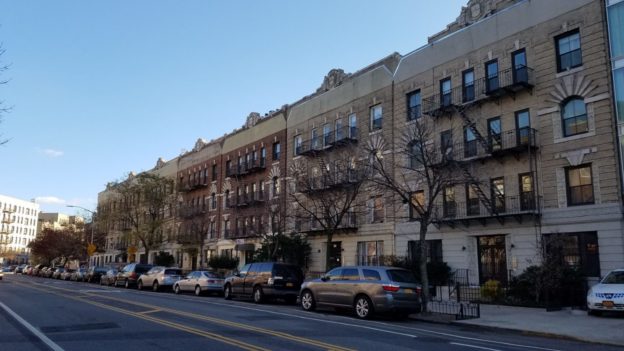
The Prospect Heights neighborhood is located immediately north of Prospect Park, bounded by Atlantic Avenue to the north, Eastern Parkway to the south, Flatbush Av- enue to the west, and Washington Avenue to the east. The area was home to the Le-nape Indians at the time of European contact. During the 18th century, the land came into possession of a number of different owners, several of whom were slave owners. It was still predominately farm and wood lands until the middle of the nineteenth century. The two most important factors in the growth of Prospect Heights were transportation improvements –which included new links between Prospect Heights and the ferries along Brooklyn’s waterfront- and the development of Prospect Park.
The original design of Prospect Park, like the original design of Central Park, was the work of the civil engineer Egbert Ludovicus Viele. In his 1861 plan, the park extended as far south as 9th Street, and as far north as Prospect Place. It included all the land between the present Prospect Park West and Washington Avenue, bisected by Flatbush Avenue. The city acquired all the land to execute Viele’s plan, but the Civil War put the execution on hold.
In 1865, consultant Calvert Vaux proposed that additional land be purchased to the south (to 15th Street) and east (to Ocean Avenue), and that everything east of Flatbush Avenue be jettisoned. The City of Brooklyn agreed, and figured they would just sell off the extra land. Construction began on Prospect Park in 1866 and the park opened to the public in 1871, although it was not yet complete. During the 1880’s, the city sold off the land between Sterling Place and Prospect Place, which was developed with row houses that are now the Prospect Heights Historic District. In 1898, when the City of Brooklyn became the Borough of Brooklyn, Park Slope was largely urbanized. P.S. 9 and its Annex (both designated NYC Landmarks) stood at Sterling Place and Vanderbilt Avenue, the Brooklyn Museum had recently opened (only about a quarter as large as it is today), the Soldiers’ and Sailors’ Memorial Arch was in place, and Frederick MacMonnies’s bronze quadriga had just been placed atop it.
Prospect Heights north of Sterling Place (Butler Street) was an established area, but not the “East Side Park Lands.” The land between Eastern Parkway and St. John’s Place was mired in litigation over title to the land, and remained undeveloped until well after the turn of the century. There were buildings along Plaza Street to the west of the oval plaza, but no buildings on Plaza Street to the east. By 1908, the Museum had more than doubled in size, but the East Side Park Lands remained empty. Meanwhile, Bedford-Stuyvesant was intensively developed.
This development delay led into the apartment house era. The 1920 opening of the IRT Subway extension under Eastern Parkway spurred the construction of six-story elevator apartment houses. This typology was an attractive choice for developers, as the NYC Building Code only required the first two floors of six-story buildings to be fireproof, as opposed to all floors of seven-story buildings. In 1915-16, the Martinique building, at 163- 169 Eastern Parkway, was the first building to rise on the land. Many followed, making the East Side a rare example, especially in Brooklyn, of a central area developed with apartment houses from the start.
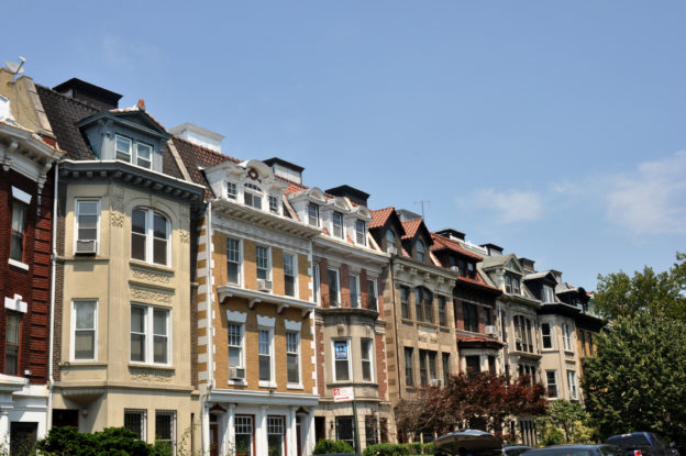
This neighborhood was once part of the Town of Flatbush, one of the original six towns established by Dutch and British Colonists in what is now Kings County. Flatbush remained an independent municipality until it was annexed in 1894 by the City of Brooklyn, which then became part of Greater New York in 1898. Up until this point, much of Flatbush was used for agricultural purposes. One of the largest landowners was the Lefferts family, which settled in Brooklyn in 1661. Various branches of the family maintained expansive farmsteads throughout Kings County, as well as in Queens, Long Island and New Jersey. The estate comprising much of Prospect Lefferts Gardens eventually passed to John Lefferts. An early proponent of development, he helped found the Flatbush Plank Road Company in 1855 to improve access to the area.
As was often the case in New York City, transportation was the primary catalyst for urban development in the neighborhood. Continuing his father’s efforts, John’s son James Lefferts invested in the Brooklyn, Flatbush & Coney Island Railway Company, established in 1878. Initially serving pleasure seekers traveling between the Flatbush Long Island Railroad terminal and the beach, this became a true commuter line in 1896 when it was extended northward to downtown Brooklyn and eventually crossed the Brooklyn Bridge to Manhattan in 1901. John Lefferts began to subdivide the estate in 1887 when he announced the sale of 516 lots east of Rogers Avenue. A promotional pamphlet proclaimed that, “the absurdity of devoting lands so desirable, central, and valuable to raising corn and potatoes has finally induced the owner to part with [the] lots.” The local press pronounced it “the most brilliant auction sale ever made in Flatbush,” which likely encouraged James Lefferts to put an additional 600 lots—most of the remaining farmstead—up for sale in 1893. Perhaps because these lots surrounded Lefferts’ own homestead, he added restrictive covenants prohibiting standard “noxious” uses (primarily industrial) and further stipulating that all buildings would be single-family houses. The lots covered by these covenants consisted of the area between Flatbush Avenue and Rogers Avenue from Lincoln Road to Fenimore Street, and was and is referred to as Lefferts Manor. In 1919 the Lefferts Manor Association was established to enforce the restrictions and preserve the area’s single-family residential character. Though the covenants limited use to single-family houses, the Association and the press were quick to point out that this did not overly restrict the neighborhood’s architectural variety. As one article noted, “the rule has not brought about any monotonous style of architecture. Some of the residences are of imposing size, in stone, stucco or wood. Others are dignified brick buildings in a row.” Outside Lefferts Manor, development was somewhat less constrained. Many blocks were built up with two-family row houses—some closely resembling their single-family counterparts and others more clearly embracing their duplex character. Some contain six-story elevator apartment buildings designed in a variety of styles. Flatbush Avenue in particular has a wealth of small-scale commercial buildings with fine architectural details.
By the 1960s the Association began to rely on zoning regulations to enforce the residential character of the neighborhood, and in the 1970s a portion of the neighborhood was designated as a New York City historic district to preserve its architectural character. The Prospect Lefferts Gardens Neighborhood Association was founded in the late 1960s to foster racial integration in the area and to promote the vitality of the greater neighborhood (both inside and outside Lefferts Manor), a goal shared by the many civic organizations that continue to advocate for the preservation of Prospect Lefferts Gardens.

HDC will work with Red Hook Business Alliance (RHBA) to raise awareness of Red Hook’s many unique visible and invisible histories. We will support historic preservation efforts and capacity building, as well as help in the creation of wayfinding and interpretive signage, multimedia assets, events, and exhibitions that create meaningful experiences for both residents and visitors.
Named after the construction company that initially developed the neighborhood, Rego Park is an enclave of art deco architecture that dates back to 1925. As the neighborhood houses a great number of historic buildings, Michael Perlman of the Rego-Forest Preservation Council is working to preserve the area’s rich history through conducting research and interviews, as well as mapping out potential historic districts. As the area is considerably underserved by preservation protections, this group is campaigning to gain landmark designations for a number of sites.
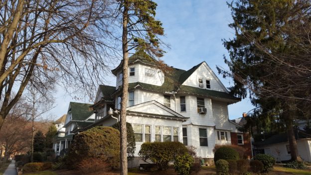
Like much of Queens, Richmond Hill remained farmland well into the 19th century. Its transformation into a prosperous residential suburb began in 1868 when businessmen Albon Platt Man and Edward Richmond selected this particular location for a new neighborhood. According to local legend, Man first became aware of the bucolic location during a drive to his country estate on Long Island, although it is more likely that Man was actually attracted not by the picturesque landscape but by the area’s lucrative potential, based primarily on the opening of the South Side Railroad that same year, offering commuter service to Brooklyn and Manhattan.
The original plan for Richmond Hill consisted of two sections. The southern section, encompassing most of present-day Richmond Hill, was laid out with a regular grid of streets (the northern section, comprising what is now Kew Gardens, wasn’t developed until later and didn’t follow Man and Richmond’s plans). Expecting a flood of buyers, Man and Richmond quickly set about getting their lots ready for sale. They paved roads and planted thousands of shade trees. By 1870, twenty houses were under construction and in 1872 Man held the first auction of building lots. Local advertisements called the neighborhood a “Suburban Chef D’Ouevre” (masterpiece) and the “most magnificent suburban enterprise on Long Island.” Though slowed by the Panic of 1873 and the subsequent economic depression, Man’s confidence in the neighborhood eventually paid off. By the 1890s, Richmond Hill was starting to fill in with large residences and the area was developing its own identity. One of its earliest residents—and most famous to this day—was Jacob Riis: journalist, photographer, social reformer and author of How the Other Half Lives. The home at 84-41 120th Street, where he lived with his family from 1888 to 1913, was designated a National Historic Landmark in 1968, but because such a designation does not confer legal protection, the house was demolished in 1973.
The short-lived Village of Richmond Hill formed in 1895 (also encompassing the neighboring communities of Morris Park and Clarenceville), before being subsumed into Greater New York City in 1898. At that time, there were so many houses under construction that the press claimed, “Richmond Hill seems more like a Western boom town than a staid Eastern community.” The distinct look of Richmond Hill’s houses was guided by a series of restrictive covenants that prohibited certain uses, including the broad category of “nuisances” and the sale of alcohol, and made design recommendations, namely that all houses should occupy large lots and be set back 20 feet from the street. Most of the residences were developed speculatively, constructed not for a specific client but for the general market. Many were designed, built and sold by a small group of architect-builders who lived in the neighborhood. The most prolific, and by far the best remembered, was Henry E. Haugaard; with his brothers, he operated a lumber mill, designed numerous houses in the neighborhood and maintained a sales office on Jamaica Avenue. Advertisements from the period often called these houses “Queen Anne,” although in reality a wide variety of architectural styles were used, including Colonial Revival, Shingle and Tudor Revival.
Richmond Hill remained an exclusive railroad suburb until the mid-1910s, when the subway finally arrived in the area (the Liberty Avenue elevated opened in 1915 and the Jamaica Avenue elevated arrived in 1917). The neighborhood is now a diverse and vibrant community of native New Yorkers and immigrants alike, though its housing stock remains little changed from its turn-of-the-century building boom.
The Rose Hill/Kip’s Bay Coalition is a small group of individuals interested in historic preservation.
HDC will work with the Rose Hill/Kip’s Bay Coalition on research and advocacy, helping to identify significant properties in the neighborhood, including both individual sites and possible historic districts.
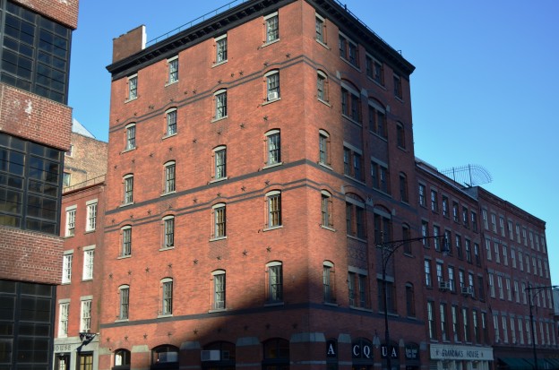
Located in lower Manhattan along the East River waterfront, the South Street Seaport provides a pivotal connection to New York City’s early days as a center of maritime industry. Indeed, the city’s settlement and growth were inextricably linked to its success, and this history remains embodied in the area’s low-scale, early 19th century commercial buildings, as well as its historic piers and streets, complete with historic Belgian blocks.
The second half of the 20th century brought much change to the Seaport, with efforts at urban renewal and its transformation into a tourist-friendly “festival marketplace” . In 1972, the National Register of Historic Places accepted the nomination of the South Street Seaport Historic District, which was expanded in 1977. That same year, the New York City Landmarks Preservation Commission (LPC) designated the South Street Seaport Historic District, and in 1989 designated the South Street Seaport Historic District Extension. The buildings in these historic districts date from a period of roughly 200 years, from the late 18th to the 20thcenturies, and serve to tell a rich and complex story to today’s visitors.
To learn more about the South Street Seaport click here
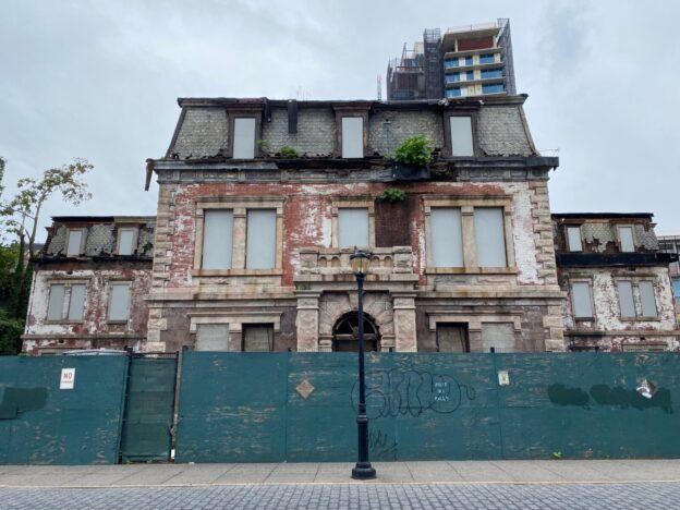
HDC will help the Preservation League of Staten and The National Lighthouse Museum advocate for the preservation and full adaptive reactivation of the former Third District US Lighthouse Depot site, a historic waterfront complex of numerous buildings including the lamp shops, barracks, oil vaults, and administration buildings which are at risk of demolition by neglect.
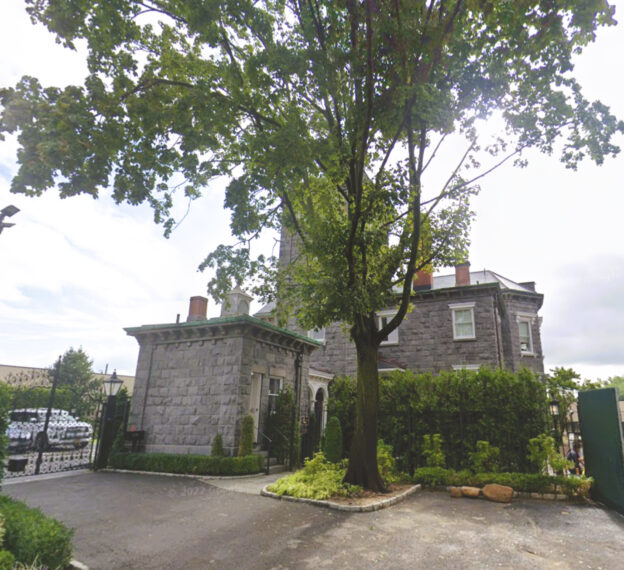
HDC will help the Greater Astoria Historical Society create new ideas, new messages, and new strategies for community preservation. In addition, HDC will provide strategic resources to revive a previously proposed historic district for Steinway Village.
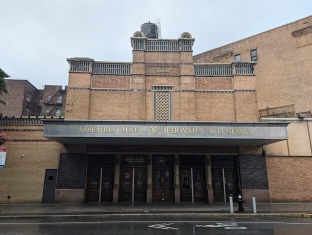
HDC will help the Sunnyside Shines BID elevate Sunnyside and Woodside as a destination for historical, architectural, and cultural enrichment. HDC will conduct a community survey of important historic resources, work on landmarking efforts for significant sites, and develop programming on the area’s history, especially focused on the neighborhood’s role in early affordable housing in NYC.
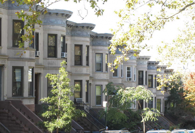
Originally part of Bay Ridge, the area got its own name with the creation of Sunset Park in 1891. Today, the neighborhood extends from Prospect Expressway to 65th Street and Eighth Avenue to the waterfront. Sunset Park’s first major development began after the Civil War, when manufacturing enterprises were established on its waterfront. Beginning in the 1880s, the inland area developed as a residential.
Sunset Park’s standout building type is the masonry rowhouse. Mostly built between 1885 and 1912, these stunning blocks are accented by commercial thoroughfares and institutional and religious buildings mostly completed by the early 1930s. The neighborhood’s most pronounced architectural styles are neo-Grec, Romanesque Revival and Renaissance Revival, all popular at the end of the 19th century. In 1988, an area encompassing 3,237 buildings was listed on the National Register of Historic Places.Despite this designation, Sunset Park currently remains unprotected by local landmark status, aside from a few individual landmarks.
To learn more about Sunset Park click here
Originalmente parte de Bay Ridge, el área debe su nombre a la creación del parque Sunset Park en 1891. Hoy en día, el vecindario se extiende desde Prospect Expressway hasta la calle 65 y desde la Octava Avenida a la ribera. La primera urbanización de Sunset Park empezó después de la Guerra Civil, cuando se establecieron empresas de manufactura en su ribera. A partir del año 1880, el área del interior se desarrolló como un vecindario residencial para familias de clase media y de clase trabajadora, e incluía muchos que trabajaban en la ribera. Un incentivo importante para su crecimiento fue el establecimiento en 1889 de un servicio de ferry desde y hacia Manhattan en la Segunda Avenida y la calle 39. Las primeras olas de inmigrantes a Sunset Park fueron irlandeses, alemanes y escandinavos, pero a finales del siglo XIX también llegaron inmigrantes de Italia, Grecia y Polonia. Para alojarlos, se construyeron grandes franjas de casas en hilera. Poblaciones puertorriqueñas y de otros países latinoamericanos empezaron a instalarse aquí en la década de 1940, y grandes números de inmigrantes asiáticos llegaron en la década de 1980 y establecieron el primer “barrio chino” de Brooklyn y el tercero de la ciudad de Nueva York.
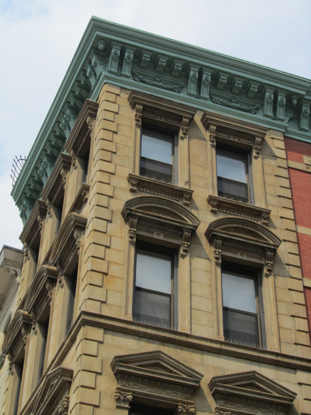
The Bowery is one of New York’s most storied streets with a rich and varied past that reflects the hurly-burly history of New York City itself. As Manhattan’s oldest thoroughfare, the Bowery began as a Native American trail and originally extended the length of the island north to south. New York’s early Dutch settlers widened the trail for their own use to connect New Amsterdam at the tip of Manhattan with their farms, or bouweriesfarther north. This “Bouwerie Lane” became simply “Bowery Lane” under the English in 1813 and the name has remained unchanged since.
The Bowery remains an architecturally rich area with a unique mix of Federal-style rowhouses, grand institutional buildings, tenements and commercial loft buildings, each type speaking to a different era in the boulevard’s storied history. Many of these buildings were spared because the elevated rail line, which was removed in the 1950s, deterred speculative development for decades. In recent years, however, new large-scale development has increased and is putting the built heritage of the Bowery greatly at risk.
To learn more about the Bowery click here
Todt Hill-Dongan Hills is an area filled with stately historic properties such as the Ernest Flagg Estate. This site consists of impressive fieldstone walls and archways, a gatehouse, and mansion that once belonged to one of New York City’s most prolific architects. Though already designated an Individual Landmark, the Iron Hills Civic Association is working to ensure that the currently for-sale estate falls in good hands and is safe from inappropriate development. This group is also concerned with the rapidly vanishing historic homes that sit atop the hills and is aiming to document and survey the historic grandeur of the neighborhood before it is too late.
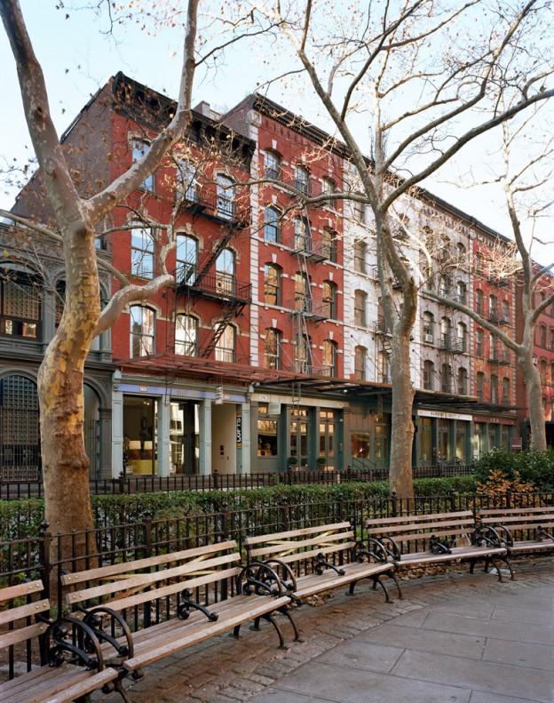
The area now known as Tribeca was originally developed in the early 19th century as a residential neighborhood close to the city’s center in Lower Manhattan. Its street grid was laid out at right angles off of Greenwich Street and on a diagonal off of Broadway, creating blocks of different lengths and irregular open spaces. The residential character of these blocks allowed for the retention of small lot sizes in future waves of development, thus creating a neighborhood with richly textured streetscapes of varying styles of architecture. After the Civil War, shipping hubs moved from the East River to the North River (later renamed the Hudson River), and South Street Seaport was traded in for steam-powered shipping on the west side via long piers. With a newly thriving industrial waterfront, the neighborhood was poised for change.
Originally referred to as the “Lower West Side”, a realtor in the 1970s, advertising real estate within the new district, referred to it as Tribeca, which stood for the Triangle Below Canal. Four historic districts were designated in 1991-92: Tribeca East, Tribeca West, Tribeca North and Tribeca South, which was extended in 2002. These are located in Tribeca’s center, while pockets around the historic districts and most of the neighborhood’s periphery remain unprotected. Community members are currently advocating for more individual landmarks and expansion of the historic district borders.
To learn more about Tribeca click here
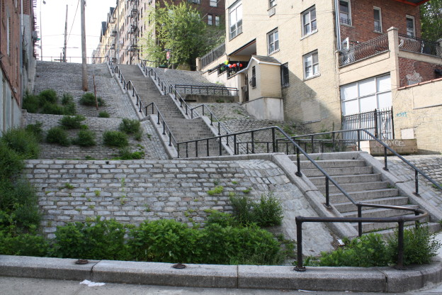
Located in Kingsbridge, Van Cortlandt Village is characterized by its hilly terrain, winding street plan and its distinctive early-20th-century housing stock, which includes freestanding houses, row houses and large apartment complexes. Most of the neighborhood’s modest two- and three-story, one- and two-family houses were designed in the neo-Tudor, neo-Georgian and neo-Federal styles, with some buildings accented by Mediterranean tiled roofs and intricate brick and stonework.
The rich mix of early-20th-century architecture and the retention of the Olmsted street plan give Van Cortlandt Village its distinctive character. In recent years the neighborhood has struggled with major development projects encroaching on the historic built environment. In 2011, the neighborhood was deemed eligible for listing on the State and National Registers of Historic Places. At the time of this publication, an official nomination is in the works.
To learn more about Van Cortlandt Village click here
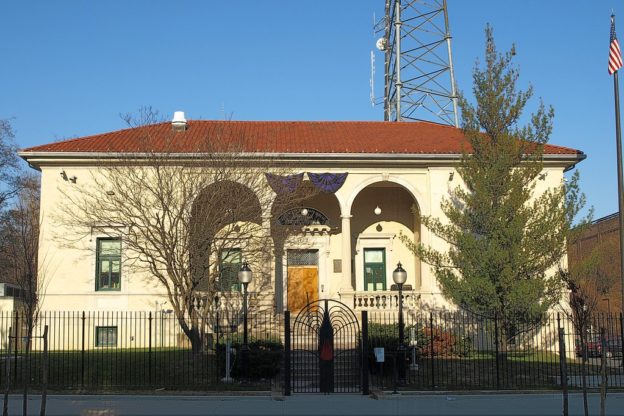
Located in the East section of The Bronx, Van Nest started developing as a family community by the 1890s. Much of its architecture is in the Queen Anne, Italianate, and Art Deco styles and includes brick construction from the 1950s, and a few tenements. Richard Vitacco, leader of the East Bronx History Forum, will work with HDC to promote the overlooked, architecturally significant buildings of the neighborhood.

Established as a Dutch farming village in 1652, Vlacke Bos, meaning “flat woodland” in Dutch, was later Anglicized to Flatbush. Around the time that it became part of the city of Brooklyn in 1894, Flatbush began its transformation into a residential suburb.Today, Victorian Flatbush is comprised of 11 neighborhoods that were all developed with the suburban country aesthetic as inspiration, which is still evident in the layout of the streetscapes with their yards, freestanding homes, and in some places planted street medians. While the houses were all constructed around the same time, their ornamental details were carefully selected to distinguish each from the other. Today this group of neighborhoods makes up one of the largest collections of Victorian-era wood-frame residential architecture in the country, though only roughly half are legally protected by the city as historic landmarks.
To learn more about Victorian Flatbush click here
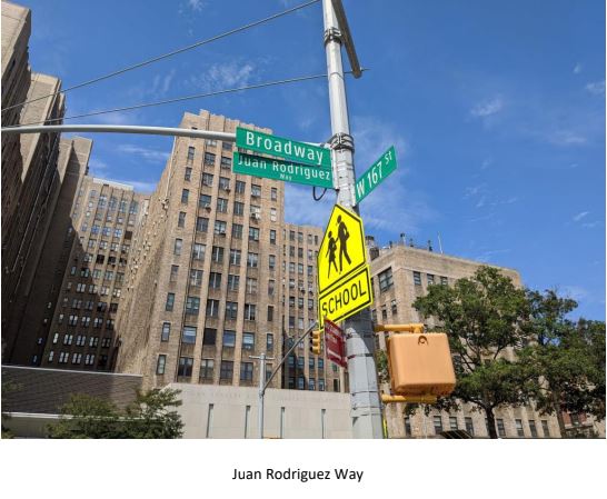
The Dominican Studies Institute of the City University of New York (CUNY DSI) came into being through the agency of the Council of Dominican Educators, community activists, and other academics from CUNY, to address the lack of reliable academic information about Dominicans available to students, scholars, and the community at large in the United States. CUNY DSI is the first and only university-based research institution in the United States focused on the study of the Dominican experience.
HDC is supporting CUNY DSI’s effort to list a section of Washington Heights on the National Register of Historic Places as the Dominican Historic District, for its historical and cultural significance.
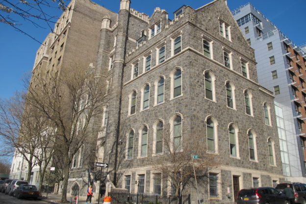
Although European settlers had begun farming the area now known as West Harlem in 1625, the community was not formally incorporated as the village of New Harlem (or “Nieuw Haarlem” in Dutch) until 1658. By the time Richard Carman began purchasing farmland in the area surrounding West 152nd Street in the 1830s, roads had been extended into the neighborhood and country estates were established as summer retreats for the city’s elite. In the 1840s, development started to encroach on this pastoral landscape as the Croton Water Aqueduct stretched through the neighborhood on its way downtown, and Trinity Church acquired a large parcel of land to construct a cemetery. After the Hudson River Railroad established a stop at the foot of West 152nd Street in 1842, the thoroughfare became the nucleus of the newly named village of Carmansville.
Carmansville featured multiple residences, several churches, a hotel and a new headquarters for the city’s 32nd Police Precinct, which was linked by telegraph to the rest of the city. The construction of an elevated railway along Eighth Avenue in 1879 further tied Carmansville to the burgeoning metropolis to the south. While the elevated railways facilitated the speculative development of blocks of brownstones for the middle class in central Harlem, the heights farther west, then called “lower Washington Heights,” saw more gradual development. When the Joseph Loth & Company Silk Ribbon Factory, one of the few industrial enterprises in the community, opened its doors at Amsterdam Avenue and West 150th Street in 1886, its immediate environs consisted of truck farms and clusters of houses.
By the time the Interborough Rapid Transit (IRT) Company inaugurated subway service along Broadway with a terminus at West 145th Street in 1904, this scene had changed dramatically to one of elegant rowhouses constructed in styles ranging from the Queen Anne to the Dutch Revival, lining the streets between Amsterdam and Broadway. Marking the urbanization of the area, one of the last undeveloped portions of Manhattan’s street grid disappeared when the stretch of West 150th Street west of Broadway was finally ceded to the city and opened as a public thoroughfare in 1906. Residential development was accompanied by improvements associated with an established urban neighborhood, including the opening of the Hamilton Grange Branch Library in 1906, the extension of Riverside Drive into Audubon Park in 1911 and the completion of the Church of the Intercession in 1915. While the turn of the century brought an influx of African-Americans into central Harlem, transforming that neighborhood into a national center of black culture, West Harlem’s black population gradually increased into the 1920s and 1930s.
In the post-World War II era, West Harlem’s buildings were plagued by poor maintenance and abandonment as middle-class residents moved to the suburbs and those who remained faced poverty and institutional neglect. Despite these challenges, West Harlem residents took steps to strengthen their community’s identity and affirm its resiliency. In the 1970s, residents organized to advocate for the construction of Riverbank State Park atop the maligned North River Water Control Plant, while Arthur Mitchell located his newly established Dance Theatre of Harlem in a renovated garage at 466 West 152nd Street. Today, local organizations continue to fight to preserve West Harlem and promote its unique identity as increased development threatens this dynamic community and its architectural beauty.

HDC is partnering with the West Village BID to create a set of storefront design guidelines to help businesses preserve historic architectural details while adapting to modern retail needs. The project will explore the feasibility of implementing a Storefront Master Plan to streamline approvals and encourage high-quality restorations that promote the rich history of the West Village’s commercial corridors.
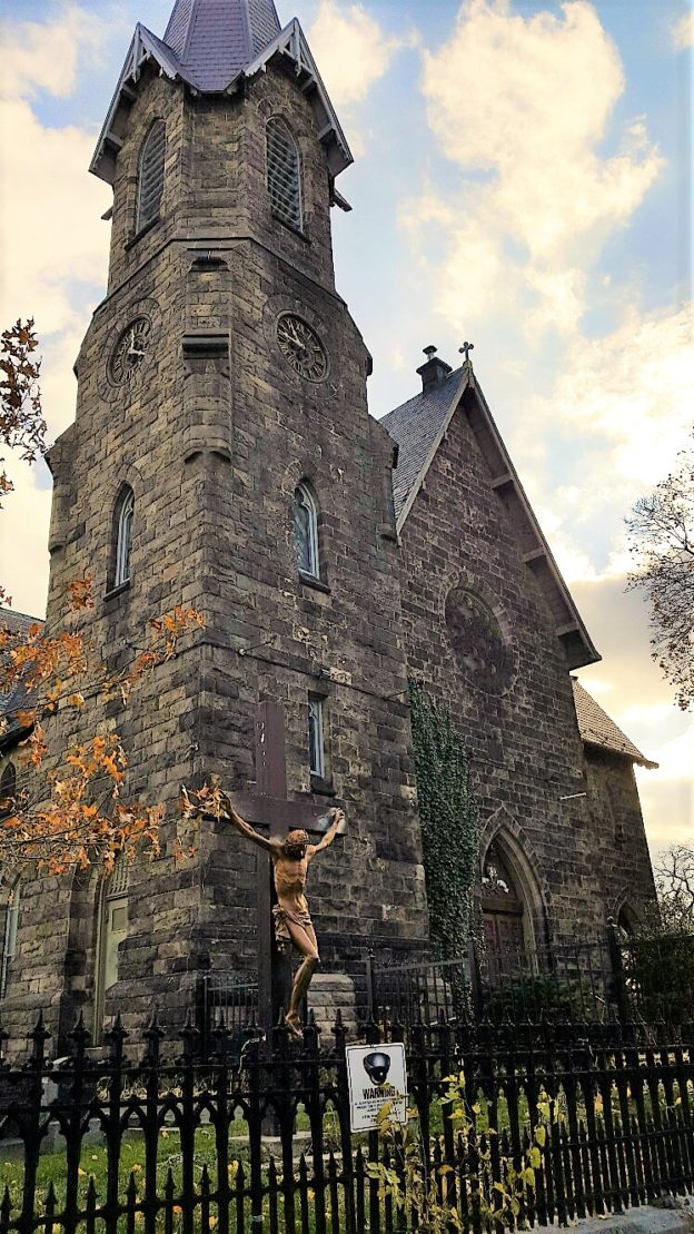
Although Westchester Square may now be subsumed within the sprawl of The Bronx’s residential and industrial neighborhoods, the community’s roots as the nucleus of a rural village can still be seen today in its layout. Westchester Square’s initial European settlement dates to the Dutch period, when the area was known as Oostdorp, or “East Village,” to denote its geographic relationship to New Amsterdam at the tip of Manhattan. By 1653, before the English formally seized the Dutch territory, settlers from the New Haven Colony had settled in New Netherland and named their community “Westchester.” In 1683, a few decades after the English takeover, the Province of New York created Westchester, one of the twelve original counties in the state, and identified the Village of Westchester as its seat. The center of regional government, Westchester Square soon became the home of the Parish of Saint Peter’s, one of the city’s oldest. Surrounding the village green, now Owen F. Dolen Park, Westchester grew into a small center of activity within the otherwise bucolic setting of The Bronx in the 18th Century.
Located near the boat landing at the head of Westchester Creek and along a long- established road, now known as Westchester Avenue, the village gained economic prominence as commercial activity grew. The geographically advantageous setting of the village took on tactical importance during the Revolutionary War. During the war, the community saw a skirmish at the bridging of the creek, rebel encampments on the village green, and the burial of soldiers in Saint Peter’s cemetery. In the following century, this district of The Bronx retained its rural character even as Westchester Square saw slow, but steady, growth. Estates and farmlands were slowly subdivided and sold off for development, such as the construction of the Van Schaick Free Reading Room in 1883, while the street grid that was platted out on maps began to take shape. This nascent residential neighborhood was characterized by relatively large single-family houses, many of which still survive today. Westchester Village served as the center of government for the Town of Westchester until 1895, when the town was annexed into New York City.
Like other communities in the expanded New York City, Westchester Square was dramatically transformed with the introduction of subway service in 1920. The Interborough Rapid Transit Company’s Pelham Line began in the South Bronx and ran above Westchester Avenue as an elevated line. Now the 6 Train, it included a stop on East Tremont Avenue which left the old village green and Saint Peter’s Church in its shadow. The accompanying speculative development turned Westchester Square into a dense neighborhood of one- and two-family homes complemented by corridors of shopping and commercial activity. The demographic character of the neighborhood changed as well, with upwardly mobile Irish and Italian immigrants following the newly constructed housing. Westchester Square still hosts an immigrant community, now largely comprised of Latin Americans and South Asians, and boasts a built environment with remarkable reminders of the community’s varying stages of development.
Woodlawn Heights is located in the northernmost section of The Bronx, bounded by the City of Yonkers to the north, Woodlawn Cemetery to the south, the Bronx River to the east and Van Cortlandt Park to the west. The area, originally part of the town of Kingsbridge, was one of the first to be annexed to the City of New York in 1874, along with West Farms and Morrisania. For most of the 19th century, the area was largely rural, dotted with farms and woodlots. As is the case for most neighborhoods in the five boroughs, development was spurred on by the availability of transportation. Today, the neighborhood’s largely middle-class population of about 8,000 includes a significant portion that are of Irish descent, including more recent Irish immigrants. In fact, Woodlawn is affectionately known as New York City’s “Little Ireland,” physical evidence of which is found in its many Irish pubs along Katonah Avenue. This family-oriented neighborhood features a charming array of detached, one- and two-family houses, some apartment buildings and hilly streets. In May 2016, Woodlawn was down-zoned to maintain orderly growth and to avoid out-of-character mid- to high-rise development, thus preserving its low-rise residential character.
To learn more about Woodlawn Heights click here
The recorded history of Yorkville begins in the 17th century when it was a tiny hamlet on the Boston Post Road, which ran northward from New York at the tip of Manhattan. It was long the province of farmers and wealthy landowners, including merchant Archibald Gracie, whose riverfront estate is now the official residence of New York’s mayor. In the 19th century, the area slowly began its transformation into the urban neighborhood we see today. Like most such transformations in New York, these changes were largely propelled by transportation improvements. In 1834, the New York & Harlem Railroad (later the New York Central) opened a station at 86th Street and Park Avenue, and in the 1850s, horsecar lines were completed along Second and Third Avenues. This opened the neighborhood to low-density residential development, and a few remnants from this era remain, including the wood-framed house at 412 East 85th Street.
After two major economic depressions (in 1857 and 1873) and the Civil War, the area was finally primed for a major wave of construction in the late 1870s with the arrival of mass transit. The Third Avenue elevated train was completed in 1877-78, and the Second Avenue elevated in 1879-80. In a relatively short period, the Upper East Side was entirely built up, and the elevated trains segregated the area along ethnic and economic lines. West of Third Avenue, wealthy homeowners established the city’s most exclusive neighborhood, while east of Third Avenue became known as Yorkville, a thriving immigrant community, which in many ways was a second-generation immigrant neighborhood—the place that recent arrivals aspired to live after filtering through the older, more congested downtown districts like the Lower East Side. Its housing stock was largely composed of tenements, but they were brand new and built after the Tenement Law of 1879 (the “Old Law”), so were subject to improvements. There were abundant employment opportunities, notably in the neighborhood’s breweries and at the Steinway piano factory in Queens, which was a short ferry ride away from the foot of East 92nd Street.
The largest and perhaps most visible immigrant group in Yorkville was the Germans. Already an established presence in New York following a wave of immigration in the 1840s, they began moving uptown from their Lower East Side settlement, Kleindeutschland (Little Germany), by the early 1880s. They brought with them many of their institutions, including churches and benevolent organizations, as well as cultural and commercial enterprises, such as beer halls and music societies. East 86th Street became the community’s main artery. Other groups had micro-neighborhoods in Yorkville, as well. Czechs began moving to the area in the 1880s and settled mostly between 71st and 75th Streets. Hungarians arrived around the turn of the century on East 79th Street, though their institutions can be found throughout the neighborhood.
Yorkville’s heyday as a distinct immigrant community was relatively short-lived. German immigration to New York peaked in 1882, and by the early 20th century, Yorkville’s Germans were already moving farther afield, using the recently built subway to access newer, more affordable neighborhoods in the outer boroughs. At the same time, anti-German sentiment during World War I led many Germans to downplay overt displays of national heritage. The Second Avenue and Third Avenue elevated trains were demolished in the 1940s and 1950s, respectively, removing one of the major boundaries between Yorkville and the rest of the Upper East Side. The neighborhood has seen its share of redevelopment since then, with large apartment buildings towering over the tenements. The recent opening of the Second Avenue subway re-established one of the area’s transit links, but may also put additional pressure on Yorkville’s surviving historic resources.
La historia de Yorkville comienza en el siglo XVII, cuando aún era una pequeña aldea en el Boston Post Road, el cual se extendía hacia el norte desde Nueva York, que en ese momento solo ocupaba la punta de Manhattan. Por mucho tiempo fue la provincia de granjeros y hacendados acaudalados, incluyendo al comerciante Archibald Gracie, cuya hacienda a la orilla del río es actualmente la residencia oficial del alcalde de Nueva York. En el siglo XIX, el área comenzó a transformarse en el barrio urbano que conocemos hoy. Como muchas transformaciones de este tipo en Nueva York, el cambio fue impulsado por las mejoras en el sistema de transporte. En 1834, el Ferrocarril de Nueva York y Harlem (posteriormente conocido como el New York Central) abrió una estación en 86th Street y Park Avenue, y en la década de 1850, una línea de tranvía impulsado por caballos fue finalizada a lo largo de Second Avenue y Third Avenue. Esto dio como resultado construcciones residenciales de baja densidad, algunos remanentes de estas construcciones aún existen, incluyendo 412 East 85th Street.
Después de dos grandes crisis económicas (en 1857 y 1873) y la Guerra Civil, el área estaba preparada para una gran ola de construcción a finales de la década de 1870 con la llegada del transporte en masa. El tren elevado de Third Avenue fue finalizado en 1877-78 y el de Second Avenue en 1879-80. En un período de tiempo relativamente corto, el Upper East Side fue completamente urbanizado, y el área fue segregada con trenes hechos para razas y clases económicas específicas. Al oeste de Third Avenue, los propietarios acaudalados establecieron el barrio más exclusivo de la ciudad, mientras que al este de Third Avenue vivía una próspera comunidad de inmigrantes, la cual ya era conocida como Yorkville en la década de 1860 y estaba compuesta en su mayoría por inmigrantes de segunda generación. Yorkville se convirtió en un barrio en el cual los inmigrantes recién llegados aspiraban a vivir después de haber pasado por distritos más congestionados del centro de la ciudad, como el Lower East Side. El conjunto de viviendas en el área estaba compuesto en su mayoría por inquilinatos, pero recién construidos y erigidos después de la Ley de Inquilinatos de 1879 (la “Old Law”), por lo cual estaban sujetos a mejoramientos. En ese tiempo, había abundantes oportunidades de empleo, especialmente en las cervecerías del barrio y en la fábrica de pianos Steinway en Queens, la cual estaba a una corta distancia en ferry desde East 92nd Street.
El más grande y visible grupo de inmigrantes en Yorkville eran los alemanes. Con una presencia ya establecida en Nueva York después de la ola de inmigración de la década de 1840, las comunidades alemanas empezaron a mudarse hacia el norte de la ciudad, dejando su asentamiento en el Lower East Side, conocido como Kleindeutchland (Pequeña Alemania). Al finalizar el siglo, Yorkville se había convertido en el principal barrio alemán de Nueva York. Los alemanes trajeron consigo sus instituciones, incluyendo iglesias y organizaciones de benevolencia, así como también emprendimientos culturales y comerciales, como cervecerías y sociedades musicales. East 86th Street se convirtió en la arteria principal de la comunidad alemana. Otros grupos también tenían micro barrios en Yorkville. Los checos empezaron a mudarse al área en la década de 1880 y se asentaron principalmente entre 71st Street y 79th Street. Los húngaros llegaron a inicios de siglo XX a East 79th Street, aunque sus instituciones se pueden encontrar en todo el barrio.
El apogeo de Yorkville como una comunidad de inmigrantes fue relativamente corto. La inmigración alemana a Nueva York alcanzó su pico en 1882 y, a comienzos del siglo XX, los alemanes en Yorkville ya habían empezado a mudarse a otros barrios más nuevos y asequibles, usando los subterráneos recientemente construidos. Al mismo tiempo, el sentimiento en contra de los alemanes estaba creciendo durante la Primera Guerra Mundial, lo cual llevó a muchos alemanes a minimizar sus sentimientos de herencia nacional. Los trenes elevados de Second Avenue y Third Avenue fueron demolidos en las décadas de 1940 y 1950 respectivamente, eliminando una de las mayores divisiones entre Yorkville y el resto del Upper East Side. El barrio ha experimentado una reurbanización desde entonces, con construcciones de apartamentos que sobrepasan a los inquilinatos. La apertura reciente del subterráneo de Second Avenue restableció una de las conexiones de tránsito del área, pero también puede ejercer presión para preservar los recursos históricos que quedan en Yorkville.