Prospect Heights Apartment House District, Brooklyn
The Prospect Heights neighborhood is located immediately north of Prospect Park, bounded by Atlantic Avenue to the north, Eastern Parkway to the south, Flatbush Av- enue to the west, and Washington Avenue to the east. The area was home to the Le-nape Indians at the time of European contact. During the 18th century, the land came into possession of a number of different owners, several of whom were slave owners. It was still predominately farm and wood lands until the middle of the nineteenth century. The two most important factors in the growth of Prospect Heights were transportation improvements –which included new links between Prospect Heights and the ferries along Brooklyn’s waterfront- and the development of Prospect Park.
The original design of Prospect Park, like the original design of Central Park, was the work of the civil engineer Egbert Ludovicus Viele. In his 1861 plan, the park extended as far south as 9th Street, and as far north as Prospect Place. It included all the land between the present Prospect Park West and Washington Avenue, bisected by Flatbush Avenue. The city acquired all the land to execute Viele’s plan, but the Civil War put the execution on hold.
In 1865, consultant Calvert Vaux proposed that additional land be purchased to the south (to 15th Street) and east (to Ocean Avenue), and that everything east of Flatbush Avenue be jettisoned. The City of Brooklyn agreed, and figured they would just sell off the extra land. Construction began on Prospect Park in 1866 and the park opened to the public in 1871, although it was not yet complete. During the 1880’s, the city sold off the land between Sterling Place and Prospect Place, which was developed with row houses that are now the Prospect Heights Historic District. In 1898, when the City of Brooklyn became the Borough of Brooklyn, Park Slope was largely urbanized. P.S. 9 and its Annex (both designated NYC Landmarks) stood at Sterling Place and Vanderbilt Avenue, the Brooklyn Museum had recently opened (only about a quarter as large as it is today), the Soldiers’ and Sailors’ Memorial Arch was in place, and Frederick MacMonnies’s bronze quadriga had just been placed atop it.
Prospect Heights north of Sterling Place (Butler Street) was an established area, but not the “East Side Park Lands.” The land between Eastern Parkway and St. John’s Place was mired in litigation over title to the land, and remained undeveloped until well after the turn of the century. There were buildings along Plaza Street to the west of the oval plaza, but no buildings on Plaza Street to the east. By 1908, the Museum had more than doubled in size, but the East Side Park Lands remained empty. Meanwhile, Bedford-Stuyvesant was intensively developed.
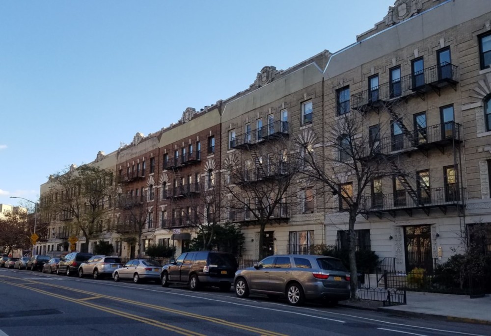
This development delay led into the apartment house era. The 1920 opening of the IRT Subway extension under Eastern Parkway spurred the construction of six-story elevator apartment houses. This typology was an attractive choice for developers, as the NYC Building Code only required the first two floors of six-story buildings to be fireproof, as opposed to all floors of seven-story buildings. In 1915-16, the Martinique building, at 163- 169 Eastern Parkway, was the first building to rise on the land. Many followed, making the East Side a rare example, especially in Brooklyn, of a central area developed with apartment houses from the start.