Cunard Building
1917-21
Benjamin Wistar Morris with Carrere & Hastings
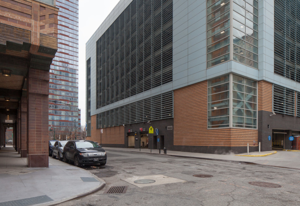
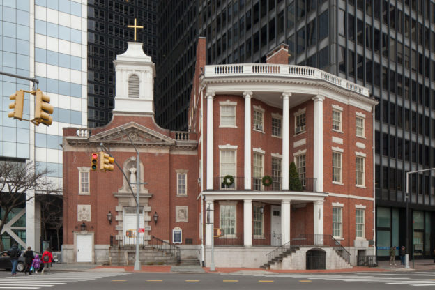
The intersection of Morris and Greenwich Streets perhaps best embodies the economic and technological forces that reshaped Little Syria, and Lower Manhattan in general, over the course of the 20th century. On the southeast corner stands the rear facade of the massive Cunard Building, one of the first major skyscrapers to be built under the 1916 zoning resolution, which established
certain limits on building bulk and massing in order to avoid the complete “canyonization” of Lower Manhattan. Across the street from the Cunard Building lies the giant trench that is the exit to the Brooklyn-Battery Tunnel, a monument to mid-century automobile-based urban planning. It is here that Greenwich Street forks off into Trinity Place, notable as the location where one of Manhattan’s earliest elevated rail lines split into two lines running northwards along Sixth and Ninth Avenues, respectively. A historic mast-arm lamppost remains at the north side of Morris Street, in the section of median that will shortly become the southern part of an expanded, redesigned Elizabeth Berger Plaza. Famed photographer Berenice Abbott photographed Morris Street at Greenwich Street in the 1930s, capturing the last remaining tenement building juxtaposed with the towering Cunard Building. The Cunard Building is a NYC Individual Landmark and listed on the State and National Register of Historic Places.
Photo courtesy of The New York Public Library.
Battery Place, Greenwich Street to Washington Street
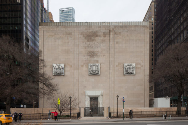
1940-50
Ole Singstad, chief engineer through 1946; Ralph Smille, chief engineer after 1946; Erling Owre, architect
The Brooklyn-Battery Tunnel, which connects Lower Manhattan with Brooklyn, was constructed over a ten-year period from 1940 to 1950—including a three-year wartime hiatus—and is the longest tunnel of its type in North America. It replaced the low-rise buildings of the former Syrian Quarter. The severe-looking Moderne style ventilation building at Battery Place was designed by Parks Department architect Aymar Embury II and completed in 1950. The facade inscription facing Battery Park commemorates the 1946 consolidation of the city’s Tunnel Authority and Triborough Bridge Authority into the Triborough Bridge and Tunnel Authority. The other architecturally notable vent building is the white octagon located off the northern tip of Governors Island, designed by the successor firm to McKim, Mead, & White. The Tunnel was renamed in 2012 in honor of former New York State Governor Hugh L. Carey. Historic photo courtesy of The Library of Congress.
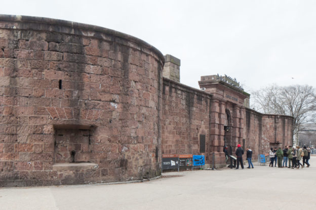
Castle Clinton: 1808-11, Lt. Col. Jonathan Williams and John McComb, Jr.
Originally sited on an island some 300 feet off the Battery, Castle Clinton was built for the War of 1812 as one of a pair of fortifications, the other being the still-surviving Castle Williams on the northern shore of Governors Island. The horseshoe-shaped brownstone monument has seen many and varied incarnations during its over 200-year history, including pleasure garden and concert hall, aquarium, ruin and finally National Monument. It also served as an immigration station, processing nearly eight million immigrants newly arrived in America — as compared to the roughly 12 million immigrants who passed through Ellis Island, its successor.
During the 1930s and 40s Castle Clinton was at the center of an epic preservation battle between legendary city Parks Commissioner Robert Moses and opponents of his plan to raze the structure for a parkway and bridge connecting Manhattan’s Battery with Brooklyn. A coalition of historic, art and landscape societies, led by the Regional Plan Association’s Robert McAneny, advocate Albert S. Bard, Manhattan Borough President Stanley Isaacs, and admiralty attorney C. C. Burlingham organized as the Central Committee of Organizations Opposing the Battery Bridge to fight Moses’ plan. Moses lost, Castle Clinton was declared a National Monument in 1946 and the Brooklyn-Battery Tunnel was built instead. Castle Clinton is a NYC Individual Landmark and listed on the State and National Register of Historic Places.
7 State Street
1793
attributed to John McComb, Jr.; extension 1806
Originally constructed in 1793 as the elegant private residence of James Watson, a merchant and the first Speaker of the New York State Assembly, the Federal style mansion at 7 State Street is a remarkable survivor from the early period when Lower Manhattan was home to the city’s wealthy and fashionable families. It is also notable for its long association with the history of Roman Catholicism in America.
Elizabeth Ann Bayley (1774-1821), a Staten Island native and religious pioneer who later became the sainted Mother Seton, briefly lived at 8 State Street before an 1803 trip to Italy that resulted in her conversion to Roman Catholicism (in an 1805 ceremony that took place nearby at St. Peter’s Roman Catholic Church on the corner of Church and Barclay streets). In 1884, 7 State Street became home to the Parish of Our Lady of the Rosary to better serve the Irish immigrants. In 1965, it was restored and protected with landmark status and, in the same year, the Classical-Revival style Our Lady of the Rosary church containing a shrine honoring Saint Elizabeth Ann Seton was constructed immediately to the left. The first American citizen to reach official sainthood, Mother Seton was canonized in 1974, on the 200th anniversary of her birth.
To the east of the building was the Leo House, a settlement house founded by the German Catholic Church in 1889 to serve German immigrants. The settlement house moved in 1926 to West 23rd Street in Chelsea. To the right of Mother Seton Shrine sits a skyscraper at 1 State Street Plaza, a building which began the wave of displacement faced by the immigrant community of the area by replacing the tenements and rowhouses that formerly occupied its space. Mother Seton Shrine is a NYC Individual Landmark and listed on the State and National Register of Historic Places.
2011
NYC DOT; AECOM, construction manager; Michael Victor Ruggiero, Landscape Architect; Ben van Berkel, UNStudio, Sculptor
Situated at the foot of Manhattan within view of New York Harbor, this plaza memorializes the early contact between the Native American inhabitants of Manhattan and its European explorers. Its centerpiece, the Plein and pin-wheel-shaped Pavillion, was donated by the Kingdom of the Netherlands to commemorate Henry Hudson’s arrival in 1609. The plaza’s namesake, Peter Minuit, was the third Director of the Dutch New Netherland colony, who in 1626 entered into an agreement with the indigenous Lenape. Though widely considered an outright purchase by subsequent colonists, this agreement was closer to a shared use contract allowing both parties equal access to live on and harvest the bounty of lower Manhattan. By the 1660s, the settlement of New Amsterdam was a thriving and diverse trading port with 18 languages spoken in the neighborhood. A bronze replica of the 1660 plan is on the north side of the plaza at State Street. Today, this plaza and transit facility is the city’s “busiest intermodal hub,” serving commuters by foot, bike, ferry, subway, and bus.
Photo by Wally Gobetz.