Archives

Hart Island Soldiers Cemetery

c. 1860

Although Hart Island is usually synonymous with “potter’s field” to most New Yorkers, City Cemetery was not the beginning of tax-funded burials. During the Civil War, both Union and Confederate soldiers encamped on Hart Island. At least three dozen units of Union Soldiers mustered in, trained or were discharged on Hart Island while a total of 3,413 Confederate POWs were incarcerated on the island in 1865. A total of 20 Union soldiers who died before June 1865 were interred in a small burial ground on the island. Burial records indicate that one Confederate soldier, A.W. Bennett of the 10th Alabama Cavalry, was interred on Hart Island before being removed to Cypress Hills National Cemetery. The other 217 Confederates who died on Hart Island while imprisoned were buried directly at Cypress Hills. However, most of the active duty military interments on Hart Island took place following the Civil War due to a cholera epidemic in July 1866. Upon acquiring Hart Island in 1868, New York City began preparations to open City Cemetery and the U.S. War Department arranged for the removal of soldiers to Cypress Hills. Unclaimed veterans who died following discharge from the army were buried by the City in a separate “soldier’s plot” on Hart Island. They were later disinterred and moved to West Farms Soldiers Cemetery in The Bronx starting in 1916; others were removed to Cypress Hills in 1941. While all of the remains were moved, an obelisk constructed in 1877 by the Army Reserves to honor soldiers and sailors, as well as fragments of cast-iron fencing, mark the location of Soldier’s Plot.

Image ©2004 Melinda Hunt courtesy The Hart Island Project

Carriage House

c. 1910

During the Civil War, ships transporting Union and Confederate troops anchored in the Long Island Sound east of Hart Island. This carriage house built in 1910 likely replace an earlier structure at this location, close to the beach, where supplies came ashore. Later, docks were built on the western shore, closer to the city. A building similar in scale and location appears in an 1865 engraving published in the Illustrated London Times. This building was subsequently used as a morgue to hold disinterred bodies awaiting pick-up by a funeral director or the Medical Examiner.

Image ©1999 Melinda Hunt courtesy The Hart Island Project

Ball Field

1960 – c. 1992

On May 26, 1960, roughly 600 grandstand seats from Ebbets Field (home of the Brooklyn Dodgers), which had been demolished a few months before, were dedicated for use at the workhouse prison ball field on Hart Island. The ball field was named Kratter Field after its donor Marvin Kratter, the developer who acquired Ebbets Field and donated the seats. The workhouse “All Stars” played against an Army unit stationed at the Nike missile battery on Hart Island. On opening day, The New York Times reported: “A standing-room crowd of 1340 – all but fifty-three of the prisoners on the island – was present.” Unfortunately, the ball field and the seats are no longer extant. Many of the seats were stolen over the years, but in the early 1990s, the DOC removed the rest and the ball field was mowed. The photo above was taken before the seats were removed.

©1991 Joel Sternfeld courtesy The Hart Island Project

Gazebo

2006

Arriving on Hart Island, visitors are directed by Correction officers to a wooden gazebo enclosed by a white picket fence. This is as far as the vast majority of visitors – the general public – can go on the island. In 2006, the DOC erected this shelter for the Interfaith Friends of Potter’s Field, a prayer group organized by the nonprofit Picture the Homeless. DOC agreed that the group could assemble at the gazebo on a bi-monthly basis, but access to gravesites was still prohibited. In 2013, a group of eight women, working with the Hart Island Project, organized and petitioned New York City to visit the mass graves of their infants buried on Hart Island. On March 14, 2014, Elaine Joseph was the first woman to be permitted to walk to an infant burial site. In December 2014, the New York Civil Liberties Union filed a federal class action lawsuit demanding gravesite access for relatives of the buried. Those who are not relatives are only permitted to visit the gazebo, which is open to the public on the third Thursday of each month.

Image ©2017 Alon Sicherman l-vision courtesy The Hart Island Project

Hart Island Natural Ecology

Hart Island is a saltwater, non-barrier island whose 131 acres include areas of woodland, scrub, vineland and closed forest. A saltmarsh occurs on its west side. Visitors arriving by boat at either the coal dock or the ferry dock will notice a small lagoon that is part of an expanding wetland area being naturally reclaimed. Formerly known as Spectacle Island, there were two land masses joined with a bridge of land in the middle similar in appearance to eyeglasses. Landfill added in the 1880s has been washing this fill away, recreating a lagoon. In addition to the saltmarsh, Hart Island has several wildlife habitats consisting of abandoned buildings, high bluffs, successional forests and a riprap shoreline. It is home to 28 species of wildlife and 65 plant species. The buildings and roads are deteriorating and earlier landscaped areas are succeeding to meadow. Institutional structures are being removed to provide new burial space, a process that is disruptive to the natural ecology due to the industrial scale of the graves that stay open for long periods. Erosion is a problem in areas close to the burials along the shoreline. Mitigation is expected to begin in 2019 with funding from the Federal Emergency Management Agency (FEMA).

Image ©2004 Melinda Hunt courtesy The Hart Island Project

J. L. Mott Iron Works

2403 Third Avenue
(sections c. 1860s; main building: Babcock & McAvoy, 1882; expanded c. 1890s)

Jordan L. Mott, inventor de la primera cocina a carbón, estableció su primer tienda de trabajos de herrería en Lower Manhattan en 1828. Después de haber comprado una gran extensión de tierra en El Bronx en 1841 para crear Mott Haven, trasladó su fábrica al Río Harlem, entre el puente de la Tercera Avenida y la recién inaugurada vía férrea del tranvía de Harlem y Nueva York. Los primeros edificios eran de armazón de madera y se incendiaron por lo menos dos veces. Mott los continuó reconstruyendo y las partes más antiguas del complejo, los cobertizos gemelos con hastiales en la esquina noroeste, seguramente datan de la década de 1860. El edificio más grande de cinco plantas, hecho de ladrillo, fue construido un par de décadas después, al comienzo del auge del transporte del barrio. La estrecha estructura tiene una fachada decorada con enladrillado que dice “The J. L. Mott Iron Works” en la fachada que da al río. A medida que creció, la compañía extendió su línea de productos, ofreciendo una amplia gama de productos para el hogar, incluyendo fregaderos y bañeras, así como también trabajos decorativos, como fuentes y cercas. Varios desagües y tapas de alcantarillas en el barrio, aún tienen la fundición del estampado de J. L. Mott Iron Works. En 1902 la compañía anunció que se trasladaría a Trenton, Nueva Jersey. Mott Haven, ahora el barrio densamente poblado soñado por Jordan Mott, aparentemente ya no tiene más espacio para la expansión de estos trabajos. Hoy en día, estos edificios albergan a una variedad de arrendatarios comerciales.

Mott Haven, El Bronx – En Español

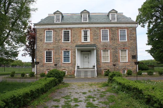
El Bronx fue nombrado en honor a Jonas Bronck, un inmigrante europeo nórdico, quien llegó a la colonia de Nueva Holanda en 1639. Bronck y su esposa Teuntje Joriaens crearon una granja en lo que ahora se conoce como Mott Haven, en la intersección del Río Harlem y Bronx Kill, con vistas a la isla Randall. En 1670, gran parte del área fue adquirida por la familia Morris, quienes construyeron una casa de campo llamada Morissania. La familia mantuvo su propiedad, y el área estuvo escasamente poblada hasta inicios del siglo XIX. La llegada del ferrocarril de Nueva York y Harlem, anunciada en 1840, convenció a la familia Morris de aceptar proyectos suburbanos en su hacienda.

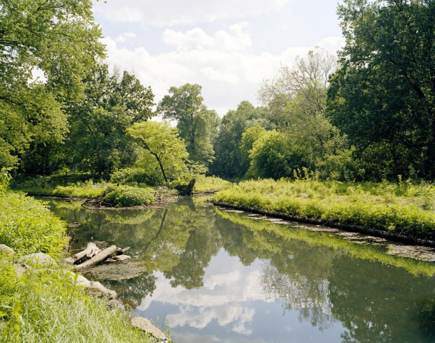
Jordan L. Mott, homónimo del barrio Mott Haven, compró unas grandes extensiones de tierra de la familia Morris en 1841 y 1848. Con la intención de crear una “zona céntrica del Condado de Westchester” (de la cual Mott Haven todavía era parte) Morris dispuso calles y lotes para construcciones, y empezó a promocionar este lugar como Mott Haven. De acuerdo con sus planes, la parte sur tendría uso industrial, con su propia carpintería metálica, y comunicado con un canal de 3000 pies, construido específicamente para este fin. La parte norte fue reservada específicamente para edificios residenciales prolijos, protegidos por cláusulas que restringían elementos “dañinos para la salud o nocivos u ofensivos para el barrio”. Otros constructores pronto siguieron los pasos de Mott en el sur de El Bronx, comprando grandes extensiones de tierra de la familia Morris, y diseñando sus propios suburbios, como Wilton (subdividido en 1857) y Nueva York del Norte (1860), ambos parte de Mott Haven en la actualidad. La familia Morris también formó parte del auge de las construcciones, y fueron quienes planearon el barrio industrial Port Morris.
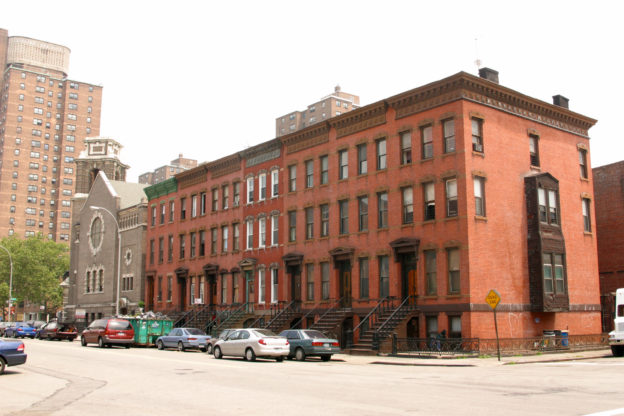
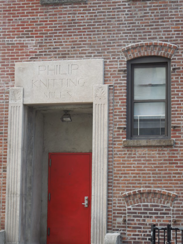
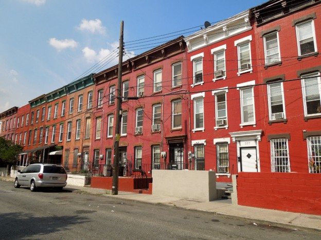
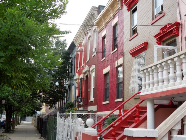
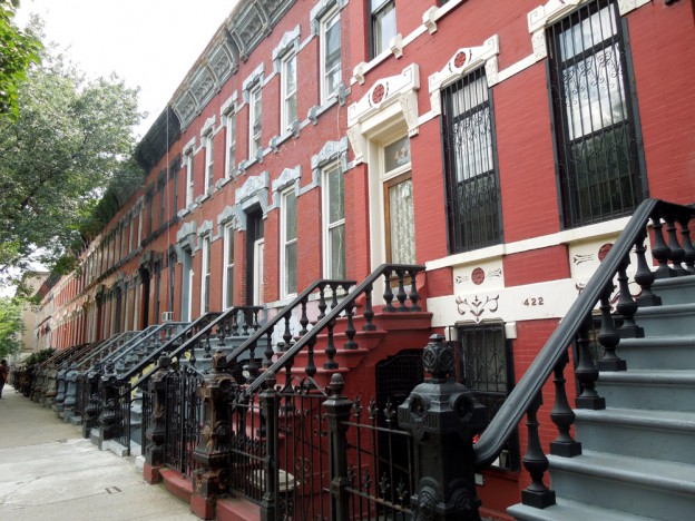
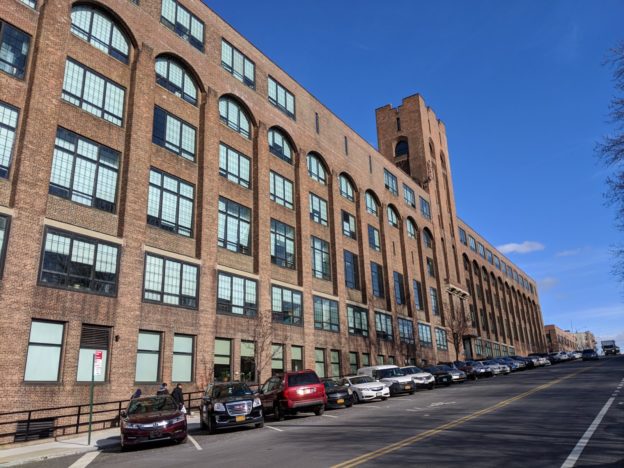
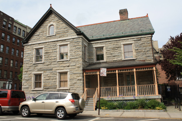
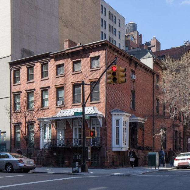
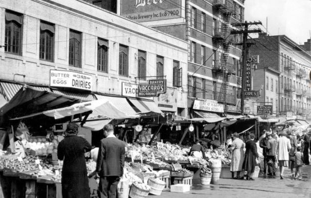
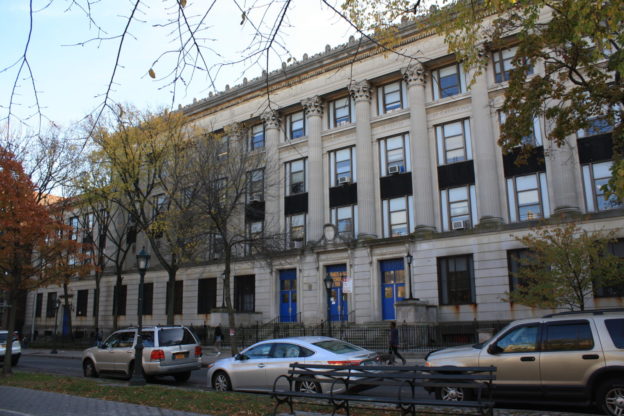
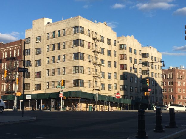
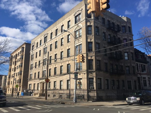
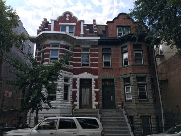
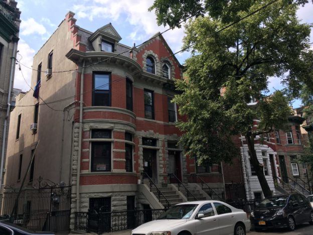
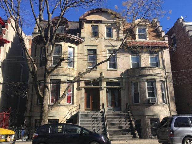
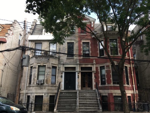
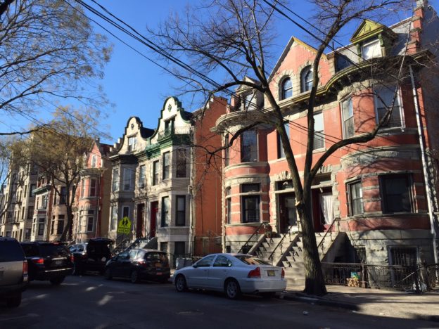
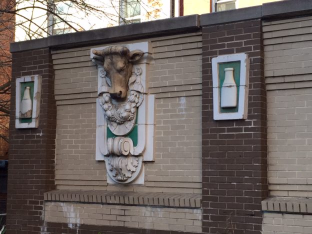
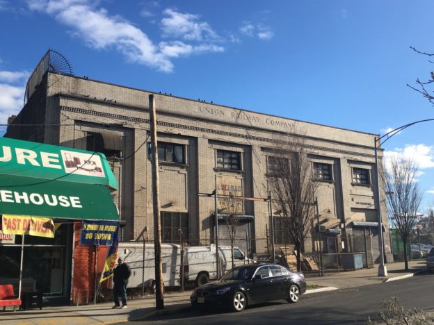
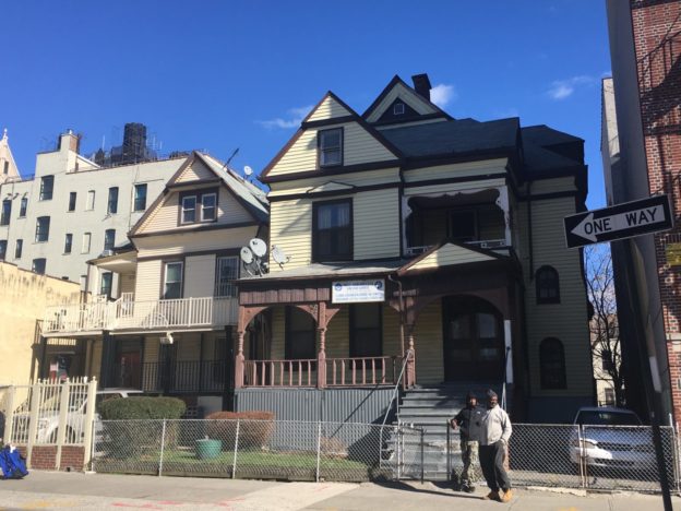
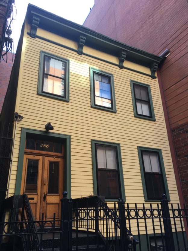
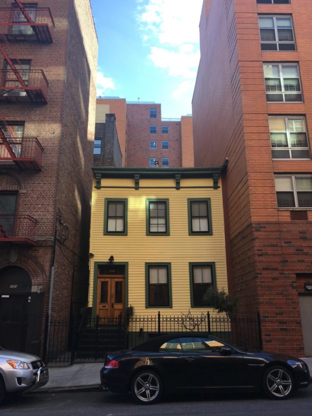
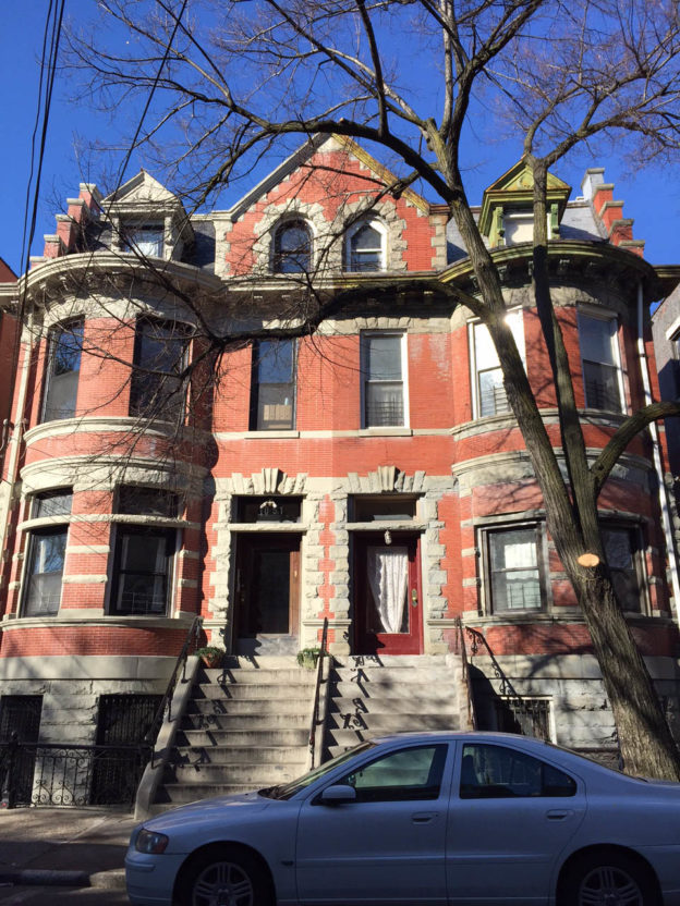
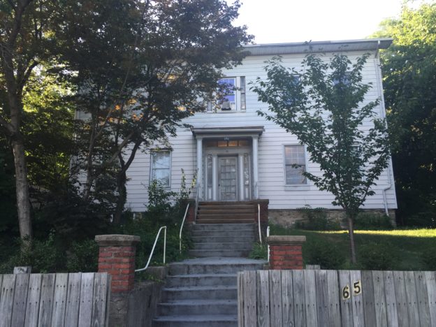
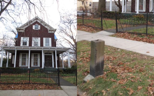
El desarrollo de estas extensiones de tierra fue sostenido, aunque no tan rápido como a los promotores les habría gustado. Mott Haven propiamente dicho, el cual se extendía entre la Tercera Avenida y el Río Harlem, era el más poblado, con una concentración de casas modestas con armazón de madera, mayormente construidas para los trabajadores locales de las fábricas. Para la década del 1860, el área incluso se jactaba de algunas casas en hilera hechas de ladrillo, algunas de las cuales aún subsisten. Gran parte del área, sin embargo, permaneció en manos de inversionistas esperando que se incrementara el valor de la zona. El pánico de 1873 retrasó este proceso por varios años, aunque en 1874, el sur de El Bronx se anexó a la ciudad de Nueva York, asegurando su eventual desarrollo como un barrio urbano. La llegada del transporte público (apertura de la estación de la calle 138 de la Compañía Suburbana de Tránsito en 1887, posteriormente parte del tren elevado de la Tercera Avenida de la Interborough Rapid Transit) le dio un último empuje al crecimiento de la zona. En una década o dos, la mayoría de las calles de Mott Haven estaban construidas con una amplia variedad de edificios, desde cómodas casas en hilera para una sola familia, hasta edificios con múltiples apartamentos y edificios residenciales. La industria también floreció. La empresa de herrería de Jordan Mott, en la actualidad controlada por sus descendientes, continuó expandiéndose. Otras manufacturas llegaron al barrio, incluyendo un número notable de productores de pianos. De hecho, a inicios del siglo XX, El Bronx tenía 63 fábricas de pianos, 43 de ellas en Mott Haven, las cuales producían más de 100.000 instrumentos al año.

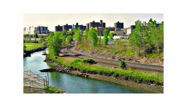
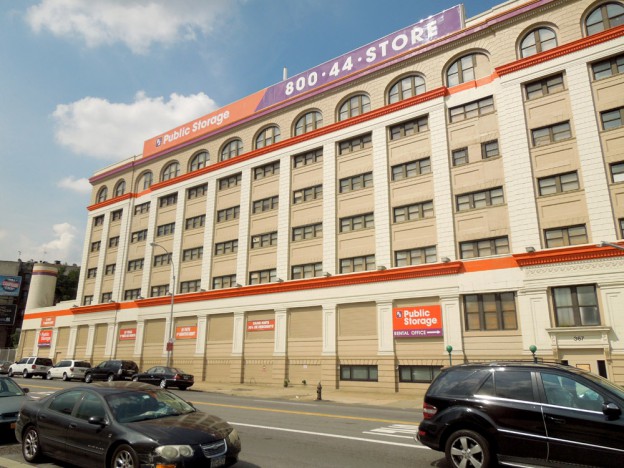
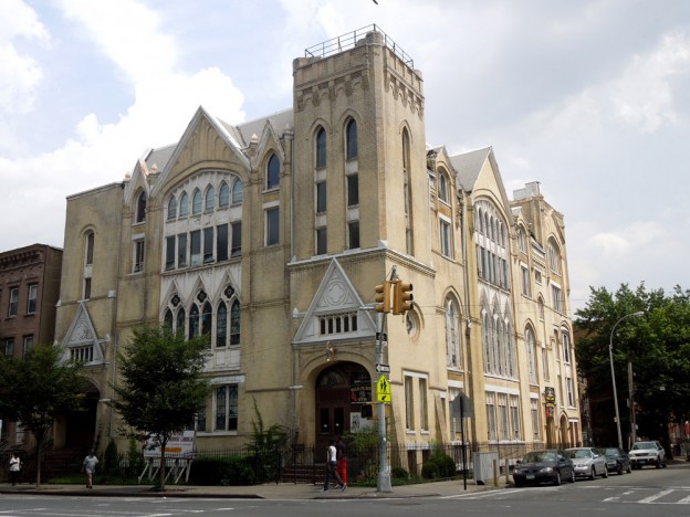
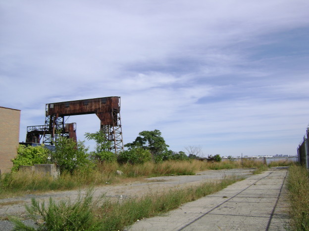
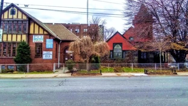
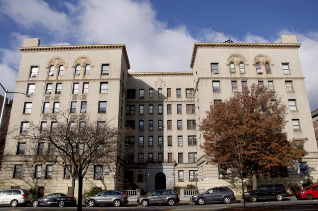
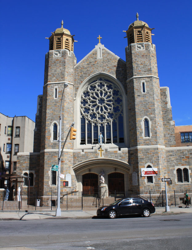
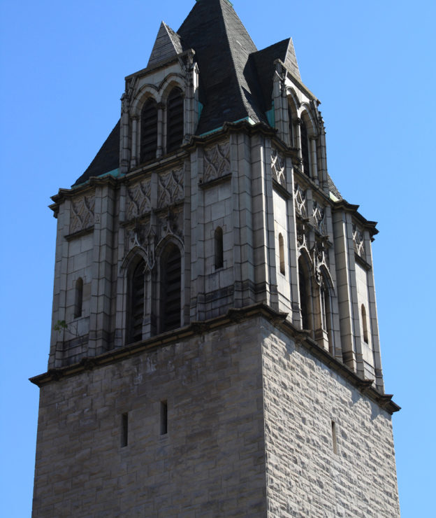
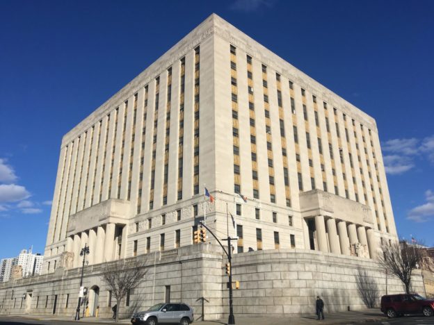
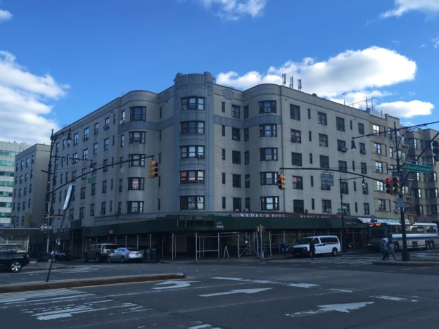
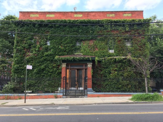
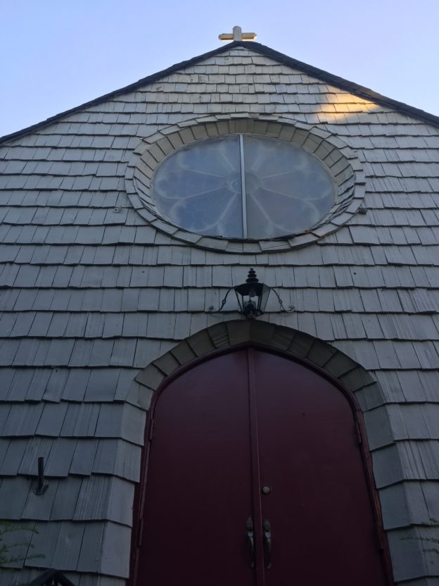
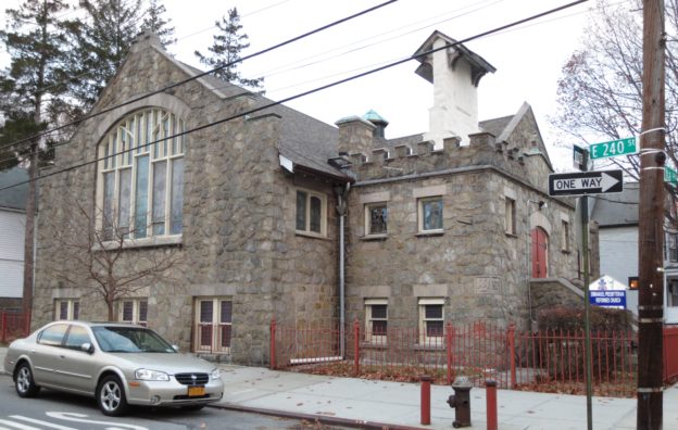
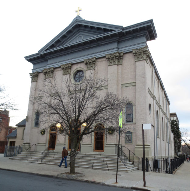
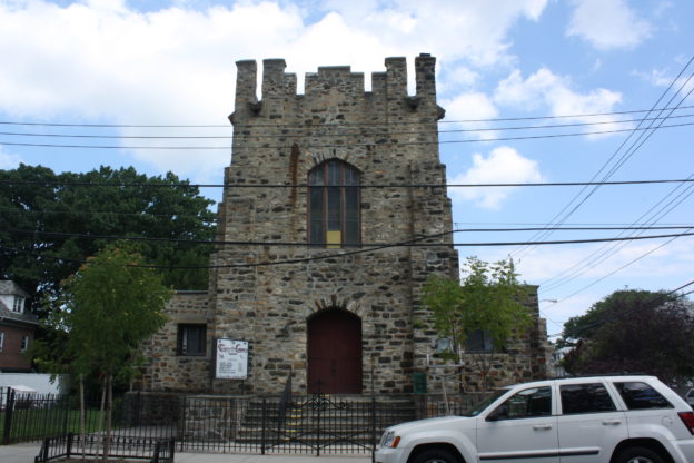
El origen industrial de Mott Haven provocó que el barrio fuese particularmente afectado por la desindustrialización de la ciudad de Nueva York a mediados del siglo XX. A pesar de que el sur de El Bronx se convirtió en un símbolo de decadencia urbana y desinversión en la década de 1970, también permaneció siendo un barrio vibrante de inmigrantes con nuevas instituciones, como el Teatro de Puerto Rico (sitio 11b en la guía), que se mudaron a varios de los edificios históricos que subsistieron. La rica historia y distinción arquitectónica de Mott Haven ha sido reconocida por la Comisión de Preservación de Emblemas de la Ciudad de Nueva York, a través de la designación de tres distritos históricos (incluyendo el primero en El Bronx) y varios emblemas individuales.

PUENTES TRANSBORDADORES DE 134TH STREET

106 Avenida Locust,1948

Los puentes transbordadores de la calle 134th, también llamados gantries (grúas) están situados en la ribera del East River en la avenida Locust entre las calles East 134th y East 135th. Con aproximadamente cuatro pisos de altura, esto puentes son un recuerdo de la rica herencia náutica de la ciudad de Nueva York. Antes de la construcción de estos puentes a comienzos de siglo XX, la gente y las mercancίas se transportaban a través de los transbordadores que operaban en los muelles de la ribera. El muelle de la calle 134th fue establecido en 1903 por la compañía College Point Ferry Company, la cual había estado operando transbordadores a lo largo del East River desde varios puntos de embarque desde 1886. Para capitalizar la inclusión de Port Morris en una red de comunidades servidas por el transbordador, en 1905 se construyeron en las proximidades un mercado, restaurantes hoteles y establos.

Con el progreso de la infraestructura de avenidas, el subterráneo y el ferrocarril, la demanda por el transbordador disminuyó y muchas empresas que estaban en este negocio quebraron. La compañía New York and College Point Ferry Company quebrό en 1918, pero no exclusivamente por la obsolescencia de su negocio, sino también debido a que el fundador de la compañía, George Ehret, Sr., apoyó financieramente a las causas alemanas, y se encontraba en Alemania al comienzo de la Primera Guerra Mundial. Como consecuencia de su decisiόn de permanecer en Alemania, el Gobierno de Estados Unidos lo consideró un extranjero enemigo e incautó todos sus bienes, incluyendo su empresa de transbordador. Desde ese momento, el gobierno de la ciudad controlό las operaciones del transbordador desde el lugar de transportación hasta instituciones de la ciudad situadas en Rikers, Welfare y las islas North Brothers. En 1948, North Brother se convirtió en el hogar del Alojamientos de Emergencia Riverside para veteranos de la Segunda Guerra Mundial y sus familias. Para adaptarse a este nuevo tráfico en la isla, la ciudad remodeló el centro transbordador en la calle 134th, y construyό los puentes transbordadores ese mismo año. Los puentes transbordadores funcionaron como pasarelas para transportar pasajeros y vehículos y alivianar el impacto de los botes que entraban al muelle. En 1966, el transbordador dejó de funcionar y el Departamento de Policía empezό a usar el sitio como un puerto deportivo. Se construyó un edificio de ladrillo de un piso de altura como sede de la unidad portuaria. En la actualidad, Port Morris y los puentes transbordadores de la calle 134th aún le pertenecen a la ciudad, pero han permanecido sin uso desde la década de 1990.

En 2006, la ciudad reveló la propuesta del proyecto South Bronx Greenway, el cual incluye un nuevo servicio de transbordador que conecta sitios populares a lo largo de la ribera, incluyendo una parada en los puentes transbordadores llamada East River Landing. En 2013, se construyó un corredor de un cuarto de milla desde la calle East 132nd hasta la Isla Randall llamado Randall’s Island Connector. El camino se extiende por debajo de los arcos del puente ferroviario y está provisto de iluminación, plantaciones y un puente peatonal sobre el agua. También se incluyó una pista para bicicletas en el proyecto, además de plantaciones a lo largo de la avenida Locust. Además de estas mejoras, la asociación Friends of Brook Park está luchando por la creaciόn de un espacio verde público cerca a los puentes transbordadores.

ZONAS INDUSTRIALES EN EL LITORAL

Adyacente a la zona de los puentes transbordadores se encuentran dos plantas de energía de gas metano de General Electric y un depósito de combustible . Los preservacioncitas locales temen que la planta se expanda hasta los puentes transbordadores y bloquee los puntos de acceso al río, los cuales incluyen Park Avenue y su amplio espacio verde, y la avenida Lincoln, espacio usado por los residentes para pescar y navegar en sus botes. Por más de dos décadas, la comunidad del sur de El Bronx ha estado luchando por una justicia ambiental y tuvo éxito en una campaña que logró el cierre del último incinerador de desechos médicos. La lucha continúa para cerrar cuatro centrales eléctricas en la ribera.Una de las luchas más recientes de la comunidad fue tratar de impedir que la empresa de camiones para venta de comida Fresh Direct recibiera $130 millones en subsidios públicos para ocupar la última franja de tierra pública en el litoral en Harlem River Yards, propiedad del Departamento de Transporte del Estado de Nueva York, situado al oeste de la autopista Bruckner. Varias acciones, protestas, sesiones con la comunidad y divulgación puerta a puerta han generado el apoyo de cientos de organizaciones y políticos locales, y derivó en una demanda presentada por la organización New York Lawyers for the Public Interest.

ENTRADA NORTE DEL PUENTE HELL GATE

Ca. 1917

Extendiéndose desde el norte de la calle East 132nd por debajo de la carretera del puente se encuentran arcos de concreto que sostienen el puente Hell Gate a medida que avanza hacia la Isla Randall. El histórico puente ferroviario es uno de los emblemas de ingeniería más notables de este barrio.

FÁBRICAS DE WILLOW AVENUE

Willow Avenue, East 132nd hasta East 138th
Ca. 1880 – 1910

Estas cautivadoras seis cuadras incluyen varios edificios de fábricas históricas. La fábrica Philip Knitting Mills en la esquina sureste de Willow y la calle East 136th fue construida en 1884 y posee enladrillado decorativo en la cornisa y en los dinteles de las ventanas. La entrada en la calle East 136th fue posteriormente decorada con detalles de caliza art deco. También se destacan las dos fábricas en el lado oeste entre las calles East 135th y East 136th. En la calle East 136th hay una fábrica que fue construida en 1907 cuya fachada del lado sur está adornada con las persianas de madera originales, que pueden ser vistas desde el callejón de la avenida Willow. Hacia el sur está la compañía Marcus Brush, la cual tiene enladrillado decorativo en su cornisa y letreros pintados en la avenida Willow.

COMPAÑÍA WARD BREAD

367 Southern Boulevard
Arquitecto desconocido, ca. 1900

La compañía Ward Bread, fundada por el inmigrante irlandés Hugh Ward en 1849 en el Lower East Side, fue una compañía grande con fábricas en todo el país, incluyendo una en Brooklyn y esta en El Bronx. El edificio de seis pisos con terracota acristalada tenía una chimenea con el nombre de la compañía pintado. La chimenea fue truncada y el nombre de la compañía fue cubierto con pintura. A principios del siglo XX, la empresa revolucionó el proceso de panificación con la adopción de nuevas tecnologías para hornear pan en una línea de producción mecanizada. En la década de 1920, el nieto de Hugh, William, intentó monopolizar el mercado de panificación de Estados Unidos, usando tácticas de negocio sucias. Para remediar la mala prensa y la deteriorada reputación, la empresa asumió el nombre de una de las empresas que había adquirido: Wonder Bakeries, creadores del pan Wonder Bread.

CASAS EN HILERA DE CONCONCORD AVENUE

321–355 Concord Avenue
Ca. 1886–1921

Estas elegantes casas en hilera fueron hechas en ladrillo con ornamentos en piedra rojiza y la mayoría aún tiene sus históricas cornisas con ménsulas. Una de las características más evidentes de esta hilera es la paleta de color uniforme. Casi todas las casas de esta hilera poseen el original ladrillo rojizo o han sido pintadas en rojo.

PARQUE ST. MARY’S

Este parque debe su nombre a una iglesia que en algún momento estuvo situada en la calle East 142nd y la avenida Alexander. En la parte norte del parque se encuentra la colina de Jane, nombrada en honor a Adrian Janes, socio de Janes, Kirtland & Company Iron Works, cuya compañía se encontraba en el noroeste del parque. Esta compañía moldeó la forja del puente Bow en Central Park, y también moldeó y erigió el domo del Capitolio de Washington, D.C. en 1863.

404–450 East 142nd Street

William O’Gorman
1897

Estas 24 casas con estilo neogriego en el lado sur de la calle East 142nd fueron diseñadas por el mismo arquitecto responsable por varias casas en el Distrito Histórico Mott Haven East. Fueron construidas en ladrillo con ornamentos de piedra y cornisas con ménsulas. En años recientes, algunas de estas casas han vuelto a ser revestidas o pintadas en una gama de colores intensos.

IGLESIA UNIDA METODISTA

Originalmente la Iglesia Episcopal Metodista de la Avenida Willis
330 Willis Avenue
George W. Kramer, 1900

Esta iglesia neogótica de ladrillo beige se caracteriza por sus ventanas de madera pintadas de blanco, sus frontones y sus molduras. Sus coloridos vitrales son un elemento particularmente bello en este edificio esquinero.

DISTRITO HISTÓRICO MOTT HAVEN EAST

William O’ Gorman & William
Hornum, 1877 – 1900
Distrito Histórico de la Ciudad de Nueva York.

Este distrito histórico, situado en las calles East 139th y East 140th entre las avenidas Willis y Brook, es una de las urbanizaciones de casas en hilera más antigua de El Bronx, en donde la tipología de casas en hilera no es tan común en comparación con otras partes de la ciudad. Las casas fueron diseñadas por dos arquitectos que, en ocasiones, trabajaron juntos. Las casas al norte de la calle East 140th forman una extravagante hilera con una mezcla de estilos que incluyen frontones holandeses y flamencos.

PARQUE BROOK

El Parque Brook debe su nombre al Aserradero Brook que en algún momento funcionó allí. Friends of Brook Park es una organización fundada en 1999 para educar al público sobre los recursos ambientales. La organización realiza sesiones de limpieza de la costa, recorridos en bote en los canales y clases de cultivo. También son defensores de la justicia ambiental, del acceso al litoral y del desarrollo de espacios verdes.

IGLESIA Y CEMENTERIO ST. ANN’S

295 St. Ann’s Avenue
Arquitecto desconocido, 1840 – 41
Emblema Individual de la Ciudad de Nueva York

Erigida por Gouverneur Morris Jr. como un monumento para su familia en su hacienda rural, es la iglesia existente más antigua de El Bronx. El edificio posee una base simple de piedra fieldstone, y una torre de madera pintada de verde en estilo neogriego, con un campanario octagonal, un chapitel bajo y una cruz simple. En la cripta y el cementerio de la iglesia yacen ilustres miembros de la familia Morris, incluyendo a Gouverneur Morris, Sr., al juez Lewis Morris, al primer
3 — Historic Districts Council — Port Morris & The 134th Street Ferry Bridges
Gobernador de Nueva Jersey y al alcalde general Lewis Morris, miembro del Congreso Continental y firmante de la Declaración de Independencia.

DESARENADOR DE EL BRONX

158 Bruckner Boulevard
McKim, Mead & White, 1936-37
Emblema Individual de la Ciudad de Nueva York

El desarenador de El Bronx fue construido como una planta de tratamiento de aguas residuales para Wards Island Sewage Treatment Work, la primera gran iniciativa de la ciudad de Nueva York para aliviar el problema de aguas contaminadas. Fue una de las instalaciones más grandes y modernas del mundo de este tipo y era capaz de tratar un quinto de las aguas residuales de la ciudad. Diseñada con el estilo neoclásico de McKim, Mead & White, la arquitectura de este edificio recuerda otras obras civiles contiguas. Su fachada simétrica está centrada en una larga ventana arqueada y flanqueada por cuatro pilastras rústicas, e hiladas que se alternan entre ladrillo romano y piedra caliza. Otros ornamentos incluyen moldes de caliza y una clave foliada en la parte superior del arco.

Port Morris, El Bronx

Port Morris y los puentes transbordadores de la calle 134

La sección Port Morris de El Bronx fue alguna vez parte de Morrisania, que fue establecido como un puerto marítimo en 1842 por Gouverneur Morris Jr., hijo del padre fundador de Estados Unidos, Gouverneur Morris. En la década de 1850, la ribera de esta área se desarrolló como un centro industrial con arrendatarios que incluían fábrica de muebles, de pianos y de labrado de piedras. Al final del siglo XIX, Port Morris era la capital de fabricación de pianos en Estados Unidos. Estos emprendimientos aprovecharon el bajo costo de la tierra en esta área, y el acceso que ofrecía a distintos mercados y a materia prima a través del ferrocarril. En la zona continental de la ribera industrial, los constructores erigieron edificios de apartamentos y manzanas comerciales para satisfacer las necesidades de los empleados de las fábricas. Hoy en día, el barrio mantiene su trazado. La autopista Bruckner constituye el límite entre la ribera y las zonas continentales, lo cual ofrece a los peatones un claro sentido del carácter de esta delimitación.
En 1906, se construyeron los depósitos de ferrocarriles de Nueva York, New Haven y Hartford en Bronx Kills. Con las mejoras en el transporte, Port Morris consolidó su estatus de centro industrial. En 1916, la ciudad de Nueva York aprobó la primera ley de zonificación, la cual, además de otros aspectos, reguló el uso de la tierra por primera vez. Port Morris, Mott Haven y West Farms fueron zonificados casi exclusivamente para ser áreas industriales, mientras que el resto de El Bronx fue zonificado como residencial para ser un suburbio de Manhattan. Port Morris experimentó un decaimiento de prosperidad Val comienzo de la década de 1940. Los incendios provocados destruyeron muchos edificios de la zona en la década de 1970, pero para finales del siglo XX, la industria empezó a reavivarse. En 2006, la ciudad designó esta área como una Zona Industrial de Negocios, con incentivos para los negocios que los estimulaba a quedarse en esta zona.
A comienzos del siglo XX, Port Morris era parte de una red de distritos industriales en el sur de El Bronx, el norte de Queens y el norte de Manhattan, todos localizados en la ribera. Debido a que todavía no había puentes que conectaran estas zonas de la ciudad, los transbordadores eran el principal medio de transporte para atravesar el río. Las empresas que conformaban esta red le pertenecían en su mayoría a inmigrantes alemanes, los cuales incluían a George Ehret, el millonario que fundó Hell Gate Brewery, una de las cerveceras más grandes del país en ese tiempo, situada en la calle 92nd y 2nd Avenue en Manhattan. El servicio de transbordador de Ehret transportaba pasajeros y productos entre las fábricas de El Bronx, el mercado en Harlem, la cervecería en la calle 92nd, el barrio residencial mayormente alemán de Yorkville en Manhattan, el barrio industrial mayormente alemán de College Point en el norte de Queens, y el enclave recreacional alemán de North Beach, también en el norte de Queens.
Una de las terminales del transbordador a lo largo de esta red se encontraba en la calle East 134th en El Bronx, para lo cual se construyó un par de puentes transbordadores o gantries (grúas) en 1948. Los puentes transbordadores fueron descontinuados en la década de 1960 y dejados a la merced del deterioro. Sus siluetas rústicas adornan la ribera y se han convertido en objeto de vigorosas campañas de preservación lideradas por Friends of Brook Park, un grupo local de educación y defensa que aboga por convertir este lugar en un parque muy necesario. Los puentes transbordadores son la parada final de este tour autoguiado en Port Morris.

Bedford Park, the Bronx

In the 1850s, the neighborhood now known as Bedford Park was part of the property owned by financier and noted sportsman Leonard Jerome, Winston Churchill’s grandfather. He leased a section of it for use as a race track and, to ensure accessibility and promote development, lobbied for a paved boulevard and began selling off his other Bronx properties. By the 1870s, streets were laid out and blocks were subdivided into house lots, but construction didn’t take off until the early 1880s. Early developments were primarily free-standing wood-frame homes, soon followed by religious architecture and infrastructure. Some of the oldest surviving examples of these buildings include houses at Bainbridge Avenue & E 201st Street, the Bedford Park Congregational Church, the Convent of Mount St. Ursula and the former Beford Park Railroad Station .

By the early-20th century, transportation improvements such as the extension of elevated lines to nearby Fordham Road, and construction of the Mosholu Parkway, had expanded the boundaries of the neighborhood and increased the population drastically. This fueled residential development and also prompted the construction of new facilities for city services, like the NY Fire Department and the NYPD . Several prestigious educational institutions were also created, with buildings located in an area referred to as the Educational Mile. These include DeWitt Clinton and the Bronx High School of Science, along with Lehman College.

However, the most significant project in the neighborhood’s development was the construction of the Jerome Park Reservoir, transforming the former racetrack at Jerome Park into a fresh-water reservoir for the New Croton Aqueduct. Completed in 1906, it became a valuable asset for the rapidly growing City of New York and provided residents with recreational open space. The project also shaped demographics, as the Italian and Irish immigrants who worked on it relocated to the area and built neighborhood staples like the St. Philip Neri Roman Catholic Church.

Bedford Park continued to grow throughout the 20th century, especially after WWI. During this time, it began to shift from a quiet suburb into a more densely populated urban area. Within 20 years of the completion of the Grand Concourse, apartment buildings featuring the then fashionable architectural styles lined the boulevard and the surrounding areas, replacing single-family houses. This type of development would continue throughout the 1950s, but the neighborhood never lost its bucolic character and ethnic diversity.

Today, Bedford Park is facing significant development pressures, with many of the early free-standing houses already lost to out-of-scale development. Community groups and organizations are working to raise awareness on the area’s history and significance, in order to protect its character and the neighborhood from.

Kingsbridge, the Bronx

Kingsbridge, the Bronx

This northwestern Bronx community is home to architectural gems from multiple eras and in various styles, from the imposing Kingsbridge Armory to 19th century farmhouses to stunning 1930’s Art-Deco apartment buildings. The Northwest Bronx Community & Clergy Coalition has been working since 1974 with residents and small businesses in the Bronx to prevent displacement, foster equitable economic development, protect housing and maintain strong and stable communities. The NWBCCC is now seeking to identify historic resources in order to better protect and stabilize community character and foster pride in the area’s architecture and history.

Hunts Point, the Bronx

Hunts Point, the Bronx

Much more than massive wholesale markets, this south Bronx neighborhood possesses historic and cultural richness that Dondi Mckellar of Bronx Community Board 2 is working to celebrate and preserve. The 1912 Feldco Building was a center for generations of popular music styles from jazz to salsa to hip-hop, and the area is home to a burial ground for enslaved Africans, vibrant local businesses, architectural gems, and a rich musical and artistic heritage. The group is working to ensure that both long-time residents and newcomers are aware of the neighborhood’s cultural wealth, and that new development is respectful of the area’s architecture and scale.

Casa Latina

151 East 116th Street
Henry Devoe
1870

Desde 1948, Casa Latina ha vendido partituras e instrumentos a clientes de toda la ciudad. Además de ser la tienda de música más antigua en East Harlem, tiene la distinción de ser la primera tienda de música en español del país. Su fundador, Bartolo Alvarez, fue un músico y ejecutivo de discográfica puertorriqueño. El negocio se mudó a este lugar en 1962, y su colorida fachada ha sido un ícono del barrio y un importante punto de encuentro desde entonces. El edificio donde se encuentra la tienda fue construido en 1870 como parte de una hilera de casas brownstone y ha sido alterado en gran medida a través de los años.

BOSQUE DEL RÍO BRONX ; RÍO BRONX Y BRONX RIVER PARKWAY

1925

Antes del asentamiento europeo, esta área estaba cubierta por árboles de madera dura antiguos. A pesar de que los árboles de este bosque tienen alrededor de 100 años, este bosque recuerda esta magnífica riqueza histórica. El Puente Burke es un agradable lugar para apreciar el bosque y el Río Bronx. Originalmente llamado “Aquehung” o “Río de Peñascos Altos” por los indios Mohegan, el río de 23 millas se origina en un arroyo afluente en el condado de Westchester y desemboca en el Río Este. En 1693, el pionero sueco Jonas Bronck
(1600-1643) compró 500 acres de los Mohegan, incluyendo una larga porción del río, que eventualmente se lo denominó “Bronck’s River”. De este nombre deriva el nombre del río y el municipio. Bronck y otros colonos emplearon su energía para crear molinos, tres de los cuales aún se pueden encontrar aguas abajo. El río solía ser muy limpio antes de la construcción del Ferrocarril Central de Nueva York en la década de 1840, el cual creó un corredor industrial contaminando el río dramáticamente. La creación de El Bronx Park en 1888 ayudó en los esfuerzos para proteger el río. En 1925, la Bronx Park Avenue de 15.5 millas fue finalizada como una zona placentera y de recreación, con parques que van hasta Kenisco Dam.

JARDÍN BOTÁNICO DE NUEVA YORK ; Edificio del Museo

Establecido en 1895
1896–1901
Fuente de la Vida: Charles E. Tefft, 1903–05
Callejón del Árbol Tulipán: Nathaniel Lord Britton, 1903–11
Emblema Nacional Histórico
Registro Nacional de Lugares Históricos — Propiedad

El Jardín botánico de Nueva York, un jardín público e institución de investigación reconocida internacionalmente, está adentro de El Bronx Park en un área que previamente le perteneció a Pierre Lorillard, un magnate de la industria del tabaco. En 1891, la ciudad asignó 250 acres para el jardín botánico público, hecho por el cual el Club Botánico Torrey había abogado por algún tiempo. Este club lideró una campaña de recaudación de fondos para el proyecto y esta estructura público-privada aún existe en la actualidad. Nathaniel Lord Britton y su esposa Elizabeth Gertrude Britton, botánicos prominentes, trabajaron con el Club en esta iniciativa, y en 1896, Mr. Britton se convirtió en el primer director de la institución.

COMISARÍA DE POLICÍA NÚMERO 52

3016 Webster Avenue
Stoughton & Stoughton, 1904–06
Registro Nacional de Lugares Históricos — Propiedad
Emblema Independiente de la Ciudad de Nueva York

Cuando la parte este de El Bronx se anexó a la ciudad en 1898, su población creció rápidamente y esta área necesitaba tener protección policial, lo cual llevó a la construcción de la comisaría policial número 52. Este chalet del neorrenacimiento italiano con ladrillos rojizos, posee una torre cuadrada con aleros salientes y relojes de terracota azules y blancos en tres de sus lados, protegidos por techos inclinados con ménsulas de madera como soportes.

Esta estación de policía fue designada emblema independiente de la Ciudad de Nueva York en 1974 y fue incluida en el Registro Estatal y Nacional de Sitios Históricos en 1982.

MOSHOLU PARKWAY

1888; Ampliada 1935-37

En la década de 1860, Frederick Law Olmsted diseñó un sistema de caminos para conectar los parques de la ciudad. Estas carreteras fueron creadas para posibilitar diferentes tipos de tráfico y permitir una eficiencia óptima. Separadas por un paisaje placentero, la carretera central era para tráfico privado mientras que las carreteras paralelas a los lados eran para tráfico local y comercial. En las intersecciones había puentes y túneles para evitar que el flujo vehicular se rompiera. Moshulu Parkway fue adquirida en 1888, y originalmente conectaba los parques Bronx y Van Cortlandt. En 1935-37, las tres millas de esta carretera fueron extendidas para conectar Henry Hudson Parkway al noroeste (las dos se convirtieron en Saw Mill River Parkway en el norte), y Bronx River Avenue hacia el este. Moshulo es la palabra algonquina para “piedras suaves” y se refiere a Tibbett’s Brook, que va desde Yonkers a través del Parque Van Courtlandt.

WILLIAMSBRIDGE OVAL y ANTIGUAMENTE LA CASA DEL CUIDADOR DEL EMBALSE WILLIAMSBRIDGE

4300 Reservoir Oval West
Geroge Birdsall, ingeniero jefe, Departamento de Trabajos Públicos de la Ciudad de Nueva York
1889-90
Registro Nacional de Lugares Históricos — Propiedad
Emblema Independiente de la Ciudad de Nueva York

El embalse Williamsbridge fue creado para llevar agua fresca al oeste de El Bronx, a través de una tubería que provenía de lagos al norte de White Plains. Debido a la construcción contigua del Acueducto New Croton, únicamente funcionó hasta 1919 y fue transferido al Departamento de Parques en 1934. Digno de mención es el edificio de recreación, construido en 1937. La cabaña atravesando la calle fue construida para el supervisor del embalse. Está hecha de un sillar de pared de roca con cimientos de granito y guarnición, y posee una cubierta de gablete empizarrada, alcantarilla de cobre, y un porche ornamentado. La casa se mantuvo desocupada por muchos años hasta que fue comprada en 1946 para ser una residencia privada. En 1999, la Moshul Preservation Corporation (Corporación de Preservación Moshul) la convirtió en su sede de oficinas.

CASA VALENTINE–VARIAN

3266 Bainbridge Avenue
1758
Registro Nacional de Lugares Históricos — Propiedad
Emblema Independiente de la Ciudad de Nueva York

Esta casa, la segunda más antigua de El Bronx, fue construida por el agricultor y herrero Isaac Valentine, usando piedra nativa de los 260 acres de la propiedad. Durante la Guerra de la Revolución, fue ocupada por los ingleses, por los soldados Hessianos y por las tropas patriotas, siendo lugar de varias contiendas. La casa sobrevivió al conflicto, pero su dueño pasó por momentos difíciles y vendió la casa a Isaac Varian en 1792. Con la creciente urbanización del área, la propiedad disminuyó su extensión y se vendió lo que quedó a un constructor en 1904. William F. Beller compró la casa en 1905 y la mantuvo por 60 años. En 1965, su hijo, William C. Beller, donó la casa a The Bronx County Historical Society (Sociedad Histórica del Condado de El Bronx), la cual administra como el Museo de Historia de El Bronx.

La casa Valentine-Varian fue designada emblema independiente de la Ciudad de Nueva York en 1978.

MANSIÓN VAN CORTLANDT Estatua de la entrada

1748
William Clark Noble
1902
Emblema Nacional Histórico
Registro Nacional de Lugares Históricos — Propiedad
Emblema Independiente de la Ciudad de Nueva York
Emblema Interior de la Ciudad de Nueva York

Esta mansión de piedras fieldstone y ladrillo con estilo gregoriano es la casa más antigua de El Bronx. Fue construida para el hijo de Jacobus Van Cortland, Frederick. Desafortunadamente, Frederick murió antes de que fuera terminada y fue el primero en ser enterrado en la parcela de sepultura familiar en Vault Hill, al norte de la casa. Durante la ocupación inglesa de Nueva York en 1776, August Van Cortland, quien era el secretario municipal, escondió los registros municipales en la bóveda de la casa. George Washington usó esta casa para sus maniobras militares, y como cuartel temporario antes de su marcha triunfante en Manhattan. Desde 1897, la construcción ha funcionado como una casa museo (el primero de la ciudad), exhibiendo su colección de muebles de los siglos XVIII y XIX, y sus artes decorativas. El terreno también incluye una estatua de bronce del alcalde general Josiah Porter  y una ventana del almacén de azúcar Rhinelander.  El almacén de azúcar fue uno de varios depósitos del siglo XVIII en donde se almacenaban azúcar y melaza que se importaban desde el Caribe antes de que fueran enviadas a las refinerías inglesas. Durante la Guerra de la Revolución, los ingleses usaron los almacenes de azúcar como prisiones, aunque no se sabe si Rhinelander fue uno de ellos.

La Mansión Van Cortland fue designada emblema independiente la Ciudad de Nueva York en 1966, y emblema interior en 1975. Fue añadida en el Registro Estatal y Nacional de Sitios Históricos en 1967, y fue nombrada Emblema Nacional Histórico en 1976.

PARQUE VAN CORTLANDT

1889

Este parque es parte de una larga parcela que fue adquirida por la Dutch West India Company (Compañía Holandesa de las Indias Occidentales) de la tribu Wiechquaskeck en 1639. Le perteneció a Adrian Van der Donck, primer abogado de Nueva Amsterdam, y después fue comprado por Frederick Philipse, el hombre más rico de Nueva York. Jacobus Van Cortlandt, quien era el yerno de Philipse y el alcalde de Nueva York en 1710-11 y 17219-20, compró parte de la hacienda (el actual parque) en 1699. En ese entonces, se construyó una represa en Tibett Brook para que le diera energía a dos molinos, creando el lago Van Cortlandt, el cual aún existe. La familia Van Cortlandt operó los molinos y una plantación de cereales allí. En 1778, soldados ingleses mataron a 37 patriotas indios Stockbridge en una emboscada en el lado noroeste de la propiedad. El “Indian Field” (Campo Indio) marca el lugar de su entierro. Después de 140 años, la familia Van Cortlandt vendió la propiedad a la ciudad en 1889. Para transformar este terreno en un parque, la ciudad lo llenó de pantanos, le plantó árboles y le añadió instalaciones de recreación, incluido el primer campo de golf municipal en 1895.

PARQUE CROTONA y Centro de Recreación Crotona

1888
Herbert Magoon, Aymar Embury II, y otros 1934-36
Emblema Independiente de la Ciudad de Nueva York
Emblema Interior de la Ciudad de Nueva York

Este parque era originalmente parte de los aproximadamente 2.000 acres de la hacienda Morris, la cual data del año 1679. En 1848, el gobernador Morris II (1813-1888) subastó la mayoría de su propiedad para beneficiarse de la suburbanización de esta área. Esta parcela de 127,5 acres fue vendida a la familia Bathgate, quien fue su dueña hasta 1888, cuando fue adquirida por la ciudad. Debido a planes de incluir diversas instalaciones atléticas, el parque fue nombrado en honor a Crotona, la antigua ciudad griega que fue hogar de varios campeones olímpicos. El Indian Lake es uno de los lugares más pintorescos, la familia Bathgate permitió que el público lo usara para recreación antes de que el parque fuera público. Se instalaron paredes y caminos de concreto alrededor del lago en 1914. El garaje para barcos fue construido en 1940 por el inspector de parques, Rober Mosses, después de que el puesto de comidas que solía estar en este lugar se quemó. Atravesando el lago, hay un puente y anfiteatro de piedra que fueron inaugurados en 2009. El Centro de Recreación Crotona, con el baño público y una piscina en el lado oeste del parque, fue construido con estilo art deco por la Works Progress Administration (Administración de Trabajos en Progreso). Tiene una monumental entrada arqueada de ladrillo con dos torres cuadradas que en su parte alta poseen claraboyas con bloques de vidrio, y un patio interior al aire libre.

El Parque Crotona y el área de juegos fueron designados emblemas independientes e interiores de la Ciudad de Nueva York en 2007.

CROTONA PARKWAY MALLS, 1910 IGLESIA CATÓLICA ROMANA SANTO TOMÁS DE AQUINO

1900 Crotona Parkway
Ca. 1925

Crotona Parkway Malls, entre Crotona Avenue y Southern Boulevard, le confiere una atmósfera placentera a la avenida. La ciudad adquirió la tierra para Crotona Avenue en 1888 con el fin de conectar el parque Crotona y el parque Bronx. Southern Boulevard data de 1870, cuando era una carretera desde East 133rd Street y la Tercera Avenida hasta la actual Kazimiroff Boulevard. El obelisco rosado de granito en East Tremont Avenue es un monumento a las 87 personas que perdieron su vida en un incendio que destruyó el Happy Land Social Club al otro lado de la calle el 20 de marzo de 1990. En Fairmount Place está la Iglesia Católica Romana Santo Tomás de Aquino, cuyo edificio neogótico le da elegancia a este tramo de la avenida.

MONUMENTO BECK DE LA IGLESIA PRESBITERIANA

980 East 180th Street
1905

La congregación de esta iglesia data de 1815, cuando algunos de los aproximadamente 300 habitantes de West Farm Village fundaron la Primera Iglesia Presbiteriana. Este es el segundo edificio de la iglesia y fue fundado por el fideicomisario Charles Bathgate Beck en honor a su madre. Este edificio neogótico de piedra tiene grietas de aspilleras rectangulares que evocan un castillo medieval. Su larga e imponente torre cubierta de terracota posee un techo con buhardilla, con ventanas estilo claraboya y una veleta ornamentada.

CEMENTERIO DE SOLDADOS DE WEST FARMS

East 180th Street y Bryant Avenue
Ca. 1815
Emblema Independiente de la Ciudad de Nueva York

Camine de vuelta hacia Boston Road y voltee a la derecha en East 180th Street. Una cuadra abajo, a la derecha, hay un cementerio con aproximadamente 200 años de antigüedad, es el cementerio público de veteranos más antiguo en El Bronx. Esta parcela de aproximadamente 2/3 de acre contiene 40 tumbas de soldados que pelearon en cuatro guerras de Estados Unidos: la Guerra de 1812, la Guerra Civil, la Guerra Hispano-Estadounidense, y la Primera Guerra Mundial. Fue fundado por John Butler para ser un cementerio privado. La perteneció a la familia Butler hasta que la ciudad tomó posesión en 1954. La estatua de bronce de un soldado del Ejército de la Unión fue erigida en 1909. La parcela fue nombrada en honor a su locación que solía ser West Farm Village, establecida en 1663.

El cementerio fue designado emblema independiente de la Ciudad de Nueva York en 1967.

ZOOLÓGICO DE EL BRONX

1899

En 1884, la Universidad Fordham vendió una gran parcela de su campus a la ciudad para que se usara como zoológico y jardín, el cual eventualmente sería el Bronx Park. Esta propiedad le había pertenecido originalmente a la hacienda Lorillard, cuyo molino de tabaco sigue existiendo en el Jardín Botánico de Nueva York. En 1888, la ciudad asignó 250 acres a la Sociedad Zoológica de Nueva York, y en 1891 otras 250 acres le fueron aginadas a la Sociedad Botánica de Nueva York. Es el el zoológico más grande de los cinco zoológicos de la ciudad, y está dividido en una sección norte y otra sur. La parte norte se caracteriza por su diseño formal con Astor Court en el centro, rodeada de edificios con estilo Beaux Arts, algunos de los cuales han sido designados emblemas de la ciudad. El paisaje en el sur es más naturalista, con construcciones cuyos estilos van desde el modernismo hasta el brutalismo. Esta entrada es la Puerta de Asia, la cual conduce a un bosque que rodea el Bronx River, con un despliegue de vida salvaje asiática.

ANTIGUA REPRESA DEL MOLINO DELANCEY

En el Interior de River Park en East 108th Street y Boston Road

River Park está en la punta sur de El Bronx Park y posee esta bella cascada de 13 pies de altura. Las cascadas fueron inicialmente modificadas por William Richardson justo después de 1680 para ser una represa que diese energía a los molinos a lo largo del río. Posteriormente, los molinos le pertenecieron y fueron operados por la familia DeLancey, hugonotes (protestantes franceses) que llegaron a Nueva York en 1686. James DeLancey (1746-1804), era famosamente conocido como el “criminal de El Bronx”, por su leal posición durante la Guerra de la Revolución, durante la cual lideró el “Westchester Chasseurs”, un grupo de tropas tory. Después de la guerra, sus tierras fueron confiscadas y se mudó a Nueva Escocia, en donde se convirtió en un político prominente.

ANTIGUO EDIFICIO DE LA ADMINISTRACIÓN DEL FERROCARRIL DE NUEVA YORK, WESTCHESTER Y BOSTON

East 180th Street en Morris Park Avenue
Fellheimer & Long con Allen H. Stem
1912
Registro Nacional de Lugares Históricos — Propiedad
Emblema Independiente de la Ciudad de Nueva York

Situado en la punta sur de El Bronx Park (Parque de El Bronx), esta construcción con estilo italiano renacentista fue originalmente la oficina administrativa del sistema de ferrocarriles de Nueva York, Westchester y Boston. Después de que el sistema dejó de funcionar en 1937, la ciudad anexó la parte de la línea férrea de El Bronx al sistema del subterráneo. Desde entonces, esta construcción ha sido la estación de East 180th Street para las líneas 2 y 5 del subterráneo. Se destaca el reloj ornamentado en la esquina de la fachada, el cual muestra la cabeza de Mercurio con alas, Dios romano de los viajes. El arquitecto Allen H. Stem trabajó simultáneamente con Charles Reed para diseñar la estación Grand Central, cuyo estilo Beaux Arts es un contraste con esta villa italiana, de la misma manera que el ambiente urbano de midtown Manhattan con el escenario bucólico de El Bronx en ese entonces. En 2011, la ciudad llevó a cabo una gran restauración del edificio.

Historic Bronx Parks, The Bronx- En Español

Cuando la parte oeste del Bronx se anexó a la ciudad de Nueva York en 1874, fue solo cuestión de tiempo hasta que esta área rural experimentase una urbanización expansiva y una explosión de población. John Murray (1835-1915), considerado como el “padre del sistema de parques de El Bronx,” fue un reportero y editor de periódicos que pensó que este futuro crecimiento sería una amenaza para el bienestar de los residentes y el desarrollo inteligente de la ciudad.

Los esfuerzos de Murray culminaron en 1884 con la Ley de Nuevos Parques, y la compra por parte de la ciudad en 1888-90 de tierras para los parques Claremont, Crotona, Van Cortland, Bronx, St Mary’s, y Pelham Bay, así como también con la creación de las carreteras Moshulu, Bronx, Pelham, y Crotona, las cuales conectan los parques entre sí. En 1931, 18 años después de que Mullay muriera, se le dedicó en su honor el Mullay Park en el sur del Bronx.

Cultural Landmarks, Citywide

New York City is known for many things: Art Deco skyscrapers, picturesque parks, the world’s greatest theater district, venerable museums and educational institutions, not to mention bagels and pizza! But above all of these, New York is most important as home to some of the world’s most fascinating and significant people and as the site of impactful and significant happenings throughout history. The city’s cultural influence is, perhaps, its greatest contribution to the world, and its built environment stands as a grand scavenger hunt of clues waiting to be uncovered. Lucky for us, the city’s Landmarks Law, passed in 1965, provides the legal framework for protecting the physical reminders of the city’s cultural wealth. In fact, one of the stated purposes of the Landmarks Law is to “safeguard the city’s historic, aesthetic and cultural heritage.”

In the first 50 years that landmarks were designated by the City, much emphasis was placed on the historic and aesthetic. In recent years, though, more consideration has been made for the importance of sites associated with people or historical events, rather than just for their architectural or historical value. In 2015, the NYC Landmarks Preservation Commission (LPC) designated the Stonewall Inn as an Individual Landmark solely for its association with the Stonewall Uprising of 1969. In 2018, the Commission designated the Central Harlem—West 130th-132nd Streets Historic District, describing it as “not only representative of Central Harlem’s residential architecture, but the rich social, cultural, and political life of its African American population in the 20th century.” Also, in recent years, Greenwich Village’s Caffe Cino and Julius’ Bar were listed on the National Register of Historic Places as significant and influential sites connected to the Lesbian Gay Bisexual Transgender (LGBTQ) community, The New York Times profiled a historian giving tours of Muslim sites of significance in Harlem, and the City is commemorating some of our most storied and accomplished female citizens with the installation of statues in all five boroughs. Indeed, grassroots preservation activism around the city is also swelling around sites of cultural significance: Tin Pan Alley and Little Syria in Manhattan, Walt Whitman’s house in Brooklyn, Arthur Avenue in The Bronx and a recently-rediscovered African burial ground in Queens, to name a few.

In response to this movement of interest in cultural landmarks, the Historic Districts Council undertook an initiative to highlight such places as one of its Six to Celebrate in 2018. The culmination of that effort was a conference in October 2018 entitled “Beyond Bricks and Mortar: Rethinking Sites of Cultural History.” The conference convened preservationists, historians, artists, planners, place-makers and more to work together to clarify what cultural significance is and how it can work, how to document and create compelling narratives around cultural sites, and how to identify the specific challenges of cultural sites from a preservationist perspective.

This brochure provides just a sample of some of the city’s cultural landmarks, organized thematically and representing all five boroughs. The list includes some sites that are legally protected — in some cases by more than one government body — and some that are unfortunately in danger of being lost. Preserving culturally significant sites that may not possess overtly aesthetic value often requires a particularly active and engaged form of advocacy to achieve protection from the wrecking ball. But, as long as there are interesting people making their mark on New York City and crucial events taking place here, that effort will never be in vain, since those stories are the lifeblood of this vibrant place.

Westchester Square, The Bronx

Although Westchester Square may now be subsumed within the sprawl of The Bronx’s residential and industrial neighborhoods, the community’s roots as the nucleus of a rural village can still be seen today in its layout. Westchester Square’s initial European settlement dates to the Dutch period, when the area was known as Oostdorp, or “East Village,” to denote its geographic relationship to New Amsterdam at the tip of Manhattan. By 1653, before the English formally seized the Dutch territory, settlers from the New Haven Colony had settled in New Netherland and named their community “Westchester.” In 1683, a few decades after the English takeover, the Province of New York created Westchester, one of the twelve original counties in the state, and identified the Village of Westchester as its seat. The center of regional government, Westchester Square soon became the home of the Parish of Saint Peter’s, one of the city’s oldest. Surrounding the village green, now Owen F. Dolen Park, Westchester grew into a small center of activity within the otherwise bucolic setting of The Bronx in the 18th Century.

Located near the boat landing at the head of Westchester Creek and along a long- established road, now known as Westchester Avenue, the village gained economic prominence as commercial activity grew. The geographically advantageous setting of the village took on tactical importance during the Revolutionary War. During the war, the community saw a skirmish at the bridging of the creek, rebel encampments on the village green, and the burial of soldiers in Saint Peter’s cemetery. In the following century, this district of The Bronx retained its rural character even as Westchester Square saw slow, but steady, growth. Estates and farmlands were slowly subdivided and sold off for development, such as the construction of the Van Schaick Free Reading Room in 1883, while the street grid that was platted out on maps began to take shape. This nascent residential neighborhood was characterized by relatively large single-family houses, many of which still survive today. Westchester Village served as the center of government for the Town of Westchester until 1895, when the town was annexed into New York City.

Like other communities in the expanded New York City, Westchester Square was dramatically transformed with the introduction of subway service in 1920. The Interborough Rapid Transit Company’s Pelham Line began in the South Bronx and ran above Westchester Avenue as an elevated line. Now the 6 Train, it included a stop on East Tremont Avenue which left the old village green and Saint Peter’s Church in its shadow. The accompanying speculative development turned Westchester Square into a dense neighborhood of one- and two-family homes complemented by corridors of shopping and commercial activity. The demographic character of the neighborhood changed as well, with upwardly mobile Irish and Italian immigrants following the newly constructed housing. Westchester Square still hosts an immigrant community, now largely comprised of Latin Americans and South Asians, and boasts a built environment with remarkable reminders of the community’s varying stages of development.

Arthur Avenue, The Bronx

Belmont was originally part of the Town of West Farms (incorporated 1846), which, with the Towns of Kingsbridge and Morrisania, was annexed by New York City in 1874. From 1901 to 1973 Belmont was served by the Third Avenue Elevated, which had stops at 180th Street, 183rd Street and Fordham Road.

Today, the easiest way to get to Belmont from Manhattan is by Metro-North to Fordham. A short walk east along Fordham Road, with Fordham University’s beautiful campus on one’s left, takes one to Arthur Avenue, the main commercial artery of Belmont, renowned as The Bronx’s “Little Italy,” though the neighborhood also contains sizable representations of Albanians and Mexicans. Notable residents have included the esteemed novelist Don DeLillo (b. 1936), who was born and grew up near Arthur Avenue (and who attended Fordham University) and was the recipient of the National Book Award in 1985 for his novel White Noise. DeLillo’s novel Underworld (1997) is partly set in the neighborhood.

Perhaps the most famous of Belmont’s native sons is Dion Francis DiMucci (b. 1939), who grew up at 749 East 183rd Street, at Prospect Avenue. A member of the Rock and Roll Hall of Fame, Dion (he has always been known by the single name) was one of the most popular recording artists in the world in the late 1950s and 1960s, and has been counted a principal influence by Paul Simon, Bruce Springsteen and Lou Reed. Dion got his musical start by singing a cappella on Belmont street corners. With three other neighborhood boys, he formed Dion and the Belmonts in 1957. Belmont is also notable as the setting of the Academy Award-winning film Marty (1955). Locals like to point out that actor Joe Pesci was “discovered” by Robert DeNiro while tending bar at Amici’s, an Arthur Avenue restaurant. Another important cultural touchstone for the neighborhood is the off-Broadway play, film, and Broadway musical A Bronx Tale by Chazz Palminteri.

Fordham University, on the northern border of Belmont, originated as St. John’s College in 1841. The campus was built on the Rose Hill manor farm of Robert Watts. Renamed as Fordham University in 1907, it was the first Roman Catholic college in the northeastern United States. Among Fordham’s countless notable alumni are Congress Member Geraldine Ferraro, Governor Andrew Cuomo, CIA director William Casey, Attorney General John Mitchell, football coach Vince Lombardi, baseball announcer Vin Scully, novelist Don DeLillo, and actor Denzel Washington.

Belmont was once part of the landholdings of the Lorillard family. The Lorillard tobacco firm was founded in 1760 and moved to this part of The Bronx in 1792. In 1870, the family moved their manufacturing operations from The Bronx to Jersey City, and in 1888, the city acquired the eastern section of the Lorillard lands for incorporation into Bronx Park. The western section—today’s Belmont—was subdivided for development. Many Italian immigrants were attracted to the area by jobs in the construction of the New York Botanical Garden (opened 1891), the Bronx Zoo (opened 1899) and the Jerome Park Reservoir (opened 1906). There is a persistent myth that Arthur Avenue was named by one of the Lorillards in honor of President Chester A. Arthur. However, the name “Arthur Street” appears on the New York City Department of Public Parks topographical map of the Bronx in 1873. That is eight years before Arthur became president, making it unlikely that the avenue was named for him.

To learn more about the area, visit www.BronxLittleItaly.com.

St. Francis De Sales School for the Deaf

260 Eastern Parkway
Robert J. Reilly
1925

The construction of this large school was inspired by Crown Heights South’s inexpensive land, nearby public transportation and a growing Catholic population, while the building’s Beaux-Arts design was inspired by that of the Brooklyn Museum across the street. Its most striking feature is an impressive colonnade running almost the entire length of the building. Originally constructed as the Bishop McDonnell Memorial High School for Girls, its students were known as “Memorialites” and were all awarded tuition-free scholarships until the 1960s. In another design nod to the museum, whose façade is engraved with the names of historic figures known for their contributions to the arts, philosophy, science and literature, the school features the names of female saints engraved above the third-floor windows. The high school closed in 1973, and was repurposed as a school for the deaf. The building’s architect, Robert J. Reilly, trained at Columbia University and worked extensively with the Catholic diocese of New York. Reilly was also a protégé of Ernest Flagg, known as much for his mastery of Beaux-Arts design as for his advocacy of urban reform and the social responsibility of architecture.

Eastern Parkway

Frederick Law Olmsted and Calvert Vaux
1870-74
NYC Scenic Landmark, National Register of Historic Places

Eastern Parkway, the world’s first six-lane parkway and one of only 10 scenic landmarks in New York City, was built between 1870 and 1874. The parkway, a term that Olmsted himself coined, was modeled on Parisian boulevards, and designed for “promenading” and leisurely carriage rides and strolls. Its broad green medians with rows of trees are flanked on either side by service roads originally meant for carriages. Though it was narrowed over the years, the parkway retains this layout today. Eastern Parkway was designed to extend the picturesque character of Prospect Park, also by Olmsted and Vaux, eastward into the neighborhoods of Brooklyn. It runs between Grand Army Plaza and Ralph Avenue, which was, at the time, Brooklyn’s eastern border. Olmsted & Vaux envisioned mansions and townhouses lining both sides of the parkway, a goal never realized in great numbers. Instead, Eastern Parkway is lined with middle-class apartment buildings, rowhouses and fine civic buildings such as museums, houses of worship, theaters and libraries. Today, this “shaded green ribbon,” as Olmsted called it, forms the boundary between Crown Heights North and Crown Heights South.

730 & 740 Grand Concourse

Jacob M. Felson
1939
Grand Concourse Historic District, National Register Historic District

Completed in 1939, this pair of six-story Art Deco apartment houses was designed and built by Jacob Felson. Felson was a Russian-born immigrant noted for his movie theaters and apartment houses, which can be found elsewhere on the Grand Concourse, as well as in the Upper West Side, Upper East Side and Riverside-West End Historic Districts in Manhattan. Felson used decorative brickwork to create the buildings’ most significant architectural features, including vertical elements on the central bay, dark brick bands between window openings and rounded corner bricks on the outer bays. The cast stone surrounding the recessed entryways and the rounded metalwork of the fire escapes further contribute to the buildings’ Art Deco aesthetic.

Thomas Garden Apartments

840 Grand Concourse
Andrew Thomas
1926-7
Grand Concourse Historic District, National Register Historic District

With its expansive courtyard filled with vegetation and landscaping, the red brick Thomas Garden Apartments stand out from the dense urban fabric that characterizes most of the Grand Concourse. Named after its architect, Andrew Thomas, this complex was financed by John D. Rockefeller, Jr., as a non-profit cooperative. Thomas is often associated with the garden apartment typology, which is typically characterized by groups of low-rise buildings arranged around an interior courtyard and located on relatively large building lots. Besides its notable layout, this Renaissance Revival style building features terra cotta detailing at the roofline and round-arched entry surrounds framed by stepped hood molding.

Bronx County Courthouse

851 Grand Concourse
Joseph H. Freedlander & Max L. Hausle
1931-1933
Grand Concourse Historic District, NYC Individual Landmark, National Register Historic District

Prominently overlooking Joyce Kilmer and Franz Sigel parks, this nine-story limestone building was designed in the neo-Classical style befitting a civic building situated on a prominent thoroughfare. The courthouse’s solid square massing is juxtaposed with sculptural details and ornamental reliefs. Among these is a frieze that encircles the entire building, depicting the “universal working man” engaged in such activities as agriculture, industry, the arts and war. Like other public buildings constructed during the Great Depression, the project was intended to provide needed work for architects, artists and construction workers. While the courthouse is the only project on which architects Joseph Freedlander and Max Hausle collaborated, Freedlander designed other recognizable New York City buildings, including the Museum of the City of New York and the nearby Andrew Freedman Home.

888 Grand Concourse

Emery Roth & Sons
1937
Grand Concourse Historic District, National Register Historic District

The only building designed by Emery Roth in the historic district, 888 Grand Concourse takes on a distinct streamlined appearance with its three curved bays, which stretch up six stories. The building’s entrance, located beneath the central bay at the corner of East 161st Street, features a concave vestibule decorated with beige and gold mosaic tiles and a terrazzo floor. This central bay is further accentuated by cast stone window surrounds that run the full height of the building and terminate in a stylized Art Deco crown. Emery Roth, one of New York City’s most renowned architects, was responsible for other landmark apartment buildings, including the San Remo and Eldorado on Central Park West in Manhattan.

1000 Grand Concourse

Sugarman & Berger
1935
Grand Concourse Historic District, National Register Historic District

When it was completed in 1935, 1000 Grand Concourse was the first apartment building over six stories tall to be erected along the prestigious thoroughfare. The ten-story Art Deco building is faced with beige brick and features a cast stone entrance surround. However, the building’s most noticeable feature is the raised and contrasting brickwork along the spandrels and roofline that add variety to a relatively unadorned façade. The apartment house was designed by Sugarman & Berger, whose work can also be found in Greenwich Village and on the Upper West and Upper East Sides of Manhattan.

Executive Towers

1020 Grand Concourse
Philip Birnbaum
1961-1963
Grand Concourse Historic District, National Register Historic District

Designed in the Modern style by Philip Birnbaum, this 23-story cooperative apartment complex contains 453 units. Faced primarily in white brick, the Executive Towers features a slightly concave elevation with curved balconies, punctured by narrow light wells running up the height of the building. Projecting outward from the building, the entrance pavilion’s jagged, sawtooth roof, supported by green and white marble columns, contrasts sharply with the gentle curves of the tower. The complex was completed in 1963, just as the middle class began its rapid exodus from the Grand Concourse. Boasting features like central air conditioning, it was touted in real estate brochures as “the first luxury skyscraper in the Bronx.” Despite the development’s aspirations, the Executive Towers could not compete with the suburbs and larger complexes like Co-op City, which contained 15,000 apartments in a self-contained community in the northeast Bronx.

Andrew Freedman Home

1125 Grand Concourse
Joseph H. Freedlander & Harry Allan Jacobs
1922-24; wings by David Levy, 1928-31
Grand Concourse Historic District, NYC Individual Landmark, National Register Historic District

Sitting prominently on the Grand Concourse, the four-story Andrew Freedman home was designed by Joseph Freedlander and Harry Jacobs in the tradition of the Italian Renaissance palazzo. This monumental building is defined by its symmetrical massing and architectural details, including a balustraded terrace and beautiful ironwork. After his death in 1915, Andrew Freedman, who was involved with the construction of New York City’s first subway and had close ties to Tammany Hall, left his fortune for the establishment of a home for the “care and maintenance of aged and indigent persons of both sexes…who have been in good circumstances but by reason of adverse fortune, have become poor and dependent.” This home for the once-wealthy was expanded between 1928 and 1931 and remained in its original use until 1983. Purchased by the Mid-Bronx Senior Citizens Council, the rechristened Andrew Freedman Complex now serves as a lodging facility, cultural center and event space.


1150 Grand Concourse

Horace Ginsbern & Marvin Fine
1936-7
Grand Concourse Historic District, National Register Historic District

With its curved corners, Art Moderne flourishes and geometric cast stone entryway, 1150 Grand Concourse is arguably one of the most striking examples of Art Deco architecture in the neighborhood. The six-story building incorporates six light courts, which not only provide tenants with fresh air, but also lend the façade a streamlined flare. The vibrant tinted mosaic tile mural of tropical fish at the building’s entrance lends 1150 Grand Concourse the nickname, the “Fish Building.” Notably, the building’s architects, Ginsbern & Fine, along with Ginsbern’s son Frederick, were also responsible for the designs of the Chock Full O’ Nuts restaurant chain in New York City.

1212 Grand Concourse

Horace Ginsbern
1936-37
Grand Concourse Historic District, National Register Historic District

Occupying the corner of East 167th Street, this six-story brick apartment building designed by Horace Ginsbern embodies many characteristic elements of the Art Deco style. While the majority of the building faces East 167th Street, its entrance opens onto the Grand Concourse, and is topped by a vertical band of raised bricks that stretch up to the roofline and culminate in a terra cotta crown. In addition to the geometric patterns found in the brickwork throughout the façade, the building boasts an eye-catching iron fire escape with curved railings and chevron details. This building’s location at the intersection is accentuated by its wrap-around corner window openings that punctuate the monotone masonry exterior.

Grand Concourse Historic District

The Grand Concourse Historic District encompasses 61 apartment houses that were built between 1917 and 1959 along the Grand Concourse, the major north-south artery of the West Bronx that was conceived in 1891 as a means of linking the park system of Manhattan with the rural Bronx. The development of apartment buildings along the Grand Concourse was precipitated by the completion of the Jerome Avenue subway, which made it possible for residents to commute to Manhattan, as well as the introduction of real estate tax exemptions. About half of the district’s apartment buildings were constructed following these two major developments, from 1922 to 1931, and were mostly designed in revival styles popular in Manhattan at the time, including Renaissance and Colonial Revival. The 1933 opening of the IND subway along the Grand Concourse sparked the Grand Concourse’s next building boom, which lasted until about 1945 and produced most of the remaining buildings in the district. Many of these were undertaken in the Art Deco and Moderne styles for which the district is famous. Charles Kreymborg & Son and Jacob M. Felson were the architects responsible for the greatest number of buildings found within the historic district, though it also features buildings by other illustrious architects of the day, including the prolific apartment building designer, Emery Roth. Despite a period of decline and deterioration lasting from the 1950s to the 1980s, the architectural character of the Grand Concourse survived and now serves as the backdrop to a diverse working class community with a large immigrant population.

Fulton, 371 East 165th Street / 360 East 166th Street / 380 East 166th Street

Neville & Bagge, 1909
Neville & Bagge, 1910
Clay Avenue Historic District

The three apartment buildings found within the historic district were all designed in the neo-Renaissance style by Neville & Bagge, a prolific architectural firm in New York from the 1890s to the 1920s. While most well-known for its apartment buildings on Manhattan’s Upper West Side, Neville & Bagge designed rowhouses, individual residences and commercial lofts, in addition to hundreds of neo-Renaissance style apartment buildings. These brick buildings, trimmed with stone and terra cotta, face the side streets, centering on an entrance with a low stoop and limestone enframement featuring Doric pilasters. On the Clay Avenue side, each building has a pair of three-sided bays flanking a central bay that reflects, at a larger scale, the massing of the two-family houses on the street. These four- and five-story buildings are typical “new law” tenements, built in compliance with the standards outlined in the Tenement House Act of 1901. Catering to working-class households, all apartments in “new law” tenements met minimum size standards for rooms, boasted kitchens and bathrooms, and were guaranteed adequate access to light and air via light courts at the side and rear of the buildings. A look at the residents of 360 East 166th Street in 1910 sheds light on the buildings’ original social makeup. Eighteen households, averaging two to three people, lived in the building in 1910. A range of nationalities was represented, including American, Italian and German, and occupations such as bookkeeper, grocer, architect, photo engraver, asphalt company laborer and court clerk.

1055 and 1057 Clay Avenue

Warren C. Dickerson
1901-02
Clay Avenue Historic District

These houses each feature three-sided, angled bays clad in rough-hewn stone at the basement and first story, and boast windows with leaded-glass transoms. A pair of tall stoops with historic wrought iron railings lead up to entrances framed in the same rough-hewn stone. The ensemble is topped by a galvanized iron cornice and a pair of curving Flemish-inspired gables. No. 1055 retains an original galvanized iron decorative urn in its gable. In 1905, the two apartments of No. 1055 were home to the families of Frederick Krauth, a clothing cutter, and John Elstner, a German immigrant. No. 1057, on the other hand, was home to a real estate agent, a police sergeant and their families.

1051 and 1053 Clay Avenue

Warren C. Dickerson
1901-02
Clay Avenue Historic District

The façade of this pair of red brick, three-story rowhouses is enlivened by the rock-faced stone at the buildings’ bases, around the entrances, in the second-story window lintels and on the beltcourses. Stone stoops with historic wrought-iron railings lead up to the entrances, which each feature a wood and glass door set below a transom. With two-story rounded bays flanking either side, the façade culminates in a central gable with a set of two round-arch windows. Ornamented dormers, which rise above a bracketed cornice, are found on either side of the gable. In 1905, four households occupied the two buildings, including that of Helen Seamen, a dressmaker who lived at No. 1053 with her five children and a niece.

1054 and 1056 Clay Avenue

Warren C. Dickerson
1901-02
Clay Avenue Historic District

Although Nos. 1054 and 1056 share similar asymmetrical massing with their southern neighbors, this pair of houses stands out with its rounded bays and gable topped with a segmental-arched pediment. Tall stone stoops, as seen throughout the district, lead to doorways flanked by dwarf pilasters with foliate corbels and caps. No. 1054 retains all of its original leaded-glass transoms in the second story windows. Both the gable and the dormers feature galvanized iron pediments, while only No. 1056 features its original bracketed cornice. The areaway features its historic wrought-iron railings and cast-iron newels. In 1903, Henry Stiehl, a baking supply dealer, purchased No. 1054 and moved in with his wife, two sons and a servant. A year later, Martha Tezlaff, a German immigrant, bought No. 1056, and 1910 census data indicates that she lived here with her daughter, son-in-law and servant.

1050 and 1052 Clay Avenue

Warren C. Dickerson
1901-02
Clay Avenue Historic District

While this pair of houses may be asymmetrical in its massing, Nos. 1050 and 1052 share common characteristics such as keyed limestone transom bars and dwarf pilasters flanking the doors. Non-historic iron railings guide visitors up the tall pair of stone stoops to the entryways. The façade, faced in Roman brick (red brick for No. 1050 and beige brick for No. 1052), is enlivened with window openings featuring keyed enframements and drip lintels. The shared gable that rises from the center of the pair features a galvanized iron pediment. Dormers with pediments supported by Ionic pilasters are found on either side of the gable. In 1905, No. 1050 was home to John E. Hubbard, a carpet salesmen, and Thomas Ahearn, a fireman, as well as their families. Their neighbors at No. 1052 included Henry Cabaud and his mother, daughter and Irish-born aunt.

381 East 165th Street

Charles S. Clark
1906
Clay Avenue Historic District

This two-story, red brick building at the corner of East 165th Street and Clay Avenue is the only single-family house in the historic district. Francis Keil commissioned Charles Clark, a Bronx-based architect, to design this grand neo-Renaissance style house to serve as his home. Keil, one of the original homeowners on Clay Avenue, was a Czech-born hardware manufacturer with a factory located nearby. The building’s façade is almost completely covered in ivy, which is only interrupted by an entrance porch of brick piers that supports a sloping roof and frames a pair of wood and glass doors. The house is crowned by a bracketed cornice and a brick parapet with inset panels, the latter of which can also be seen above the ivy-covered façade.

Clay Avenue Historic District

New York City Historic District, National Register Historic District

The Clay Avenue Historic District encompasses one block from East 165th and East 166th Streets, and is made up of charming, low-rise and mostly intact buildings that date from the early 20th century. In 1900, seeing a chance to earn a profit through speculative development, Ernest Wenigmann began amassing property on Clay Avenue in The Bronx, in some instances directly purchasing it from descendants of the Morris family that held title to the land since 1670. Intending to construct 28 houses on the block, Wenigmann commissioned Warren C. Dickerson, a reputable architect who designed many high quality rowhouses in The Bronx at the turn-of-the-century. Dickerson employed a transitional style, combining Renaissance-inspired massing and detailing with popular Romanesque Revival motifs, such as rock-faced stonework. Although all of the houses are faced with beige or red brick, Dickerson counterbalanced variations in ornamentation with the repetition of building forms to create a dynamic streetscape. Other details emerge upon further inspection: for instance, all of the houses on the west side of the street have single wooden doors, while the east side homes feature wood and glass double doors.

Dickerson, who was also responsible for a majority of the buildings in the Longwood and Morris High School Historic Districts, designed each detached pair to house four families, though each resembles a pair of single-family homes. At the turn of the 20th century, these two-family houses had become popular in Brooklyn and The Bronx, and were viewed as “the best possible investment for the young married man.” The aspirational middle-class homeowner could fit their family into one apartment while renting out the adjacent unit for additional income, all while maintaining the appearance of occupying an entire single-family home. On Clay Avenue, Ernest Wenigmann began selling his houses in 1902, and three years later the street was almost entirely occupied. The 1905 New York State census indicates that Clay Avenue was a predominantly middle-class street of owners and renters, with all residents identifying as white and most listed as American-born.

Sheffield Farms Company (Milk) Bottling Plant

1075 Webster Avenue
Frank Rooke
1914; annex: 1923

When the Sheffield Farms Milk Plant was completed in 1914, it was one of the most expensive and elaborate milk plants in the country, boasting one of the highest processing capacities in the dairy industry. Sheffield Farms, one of the largest and most innovative dairy companies of its time, hired Frank Rooke to design a series of four large-scale milk plants in The Bronx, Brooklyn and Manhattan (one of which survives as Columbia University’s Prentis Hall). Sheffield Farms was among the first to implement large-scale pasteurization, and pioneered the production of certified milk and introduced the world’s first paper-packaged milk container in 1930. The original building, designed in a modern French Renaissance style, was sold by the successor of Sheffield Farms in 1971 and demolished in 1991, leaving only the two-story ice and storage building standing. In homage to the site’s history, three glazed terra-cotta cow heads and milk bottles were salvaged from the plant and installed on a wall in the garden of the adjacent Webster House apartment building.

Union Railway Company

1068 Brook Avenue
Axel S. Hedman
1908

This utilitarian building was constructed in 1908 to serve as “Sub Station No. 2” for the Union Railway Company, which operated a streetcar network stretching from the Westchester County line to a southern terminus in Harlem. Until the last route was discontinued in 1948, streetcars played an important role in The Bronx’s rapid transit network by providing both local service across the borough and shuttling commuters to elevated railway and subway stops. Raised brickwork and geometric patterning constitute the primary form of architectural ornamentation found on this two-story building, but the Union Railway Company name emblazoned at the cornice line is the structure’s most noticeable feature.

Second Battery Armory

1122 Franklin Avenue
Charles C. Haight, 1906-1911
addition by Benjamin W. Levitan, 1926-1928

Situated at the top of a steep slope overlooking the western Bronx, the Second Battery Armory consists of a large drill shed and administrative building topped with a six-story corner tower. Designed by Charles Haight, who was awarded the commission after winning a design competition, the asymmetrical red brick building is similar to other New York armories in its use of Gothic details like slit windows and crenellated parapets. In 1928, Benjamin Levitan designed a one-story addition for the building’s Franklin Avenue façade, expertly replicating original design elements while providing additional storage space. The first permanent armory built in The Bronx, the Second Battery Armory was located in the burgeoning Morrisania neighborhood, which was also home to the borough’s first high school (Morris High School, 1904). The Second Battery, whose successors occupied the armory until 1988, has a history dating back to 1833 that includes action in the Civil and Spanish-American wars, as well as in numerous New York City strikes and riots.

1074 Cauldwell Avenue / 1076 Cauldwell Avenue

F.T. Camp, 1887
Charles C. Churchill, 1892

This pair of two-and-one-half-story, wood-frame buildings is representative of a period in which larger single-family homes were the predominant housing stock in this section of The Bronx. Characteristic of the Queen Anne style, these houses are asymmetrically massed and feature a variety of ornamentation. No. 1076, built in 1892, retains less of its original detailing than its southern neighbor. No. 1074, on the other hand, boasts an arched porch with turned posts on its first story and a smaller second-story porch framed by a whimsical bargeboard. This ornamentation is complemented by gables intersecting at different levels to create an irregular roofline.

386 East 162nd Street

Architect & date unknown

Wedged between the masses of two apartment buildings, the two-story, wood-framed house at 386 East 162nd Street survives as a symbol of an earlier period in The Bronx’s development. This vernacular building is relatively unadorned except for its three Italianate cornice brackets. The Morrisania section of The Bronx dates back to 1850, when country estates were subdivided and developed with single-family houses that could be sold to professionals commuting into Manhattan on the New York & Harlem Railroad. The introduction of industry and manufacturing to the area and the coming of the elevated railway along Third Avenue in 1887 encouraged denser development so that by the turn of the 20th century, the neighborhood was a mix of tenements, single-family dwellings and old village housing.

386 East 162nd Street

386 East 162nd Street
Architect & date unknown

Wedged between the masses of two apartment buildings, the two-story, wood-framed house at 386 East 162nd Street survives as a symbol of an earlier period in The Bronx’s development. This vernacular building is relatively unadorned except for its three Italianate cornice brackets. The Morrisania section of The Bronx dates back to 1850, when country estates were subdivided and developed with single-family houses that could be sold to professionals commuting into Manhattan on the New York & Harlem Railroad. The introduction of industry and manufacturing to the area and the coming of the elevated railway along Third Avenue in 1887 encouraged denser development so that by the turn of the 20th century, the neighborhood was a mix of tenements, single-family dwellings and old village housing.

Clay Avenue, The Bronx

While just nine blocks apart from one another, Clay Avenue and the Grand Concourse appear to be worlds apart in terms of architecture and urban form. However, both the small-scale street of two-family houses and the wide thoroughfare lined with Art Deco apartment buildings help to tell the story of the development of this section of The Bronx. Both are located in what was historically the village of Morrisania, named for the English brothers Colonel Lewis Morris and Captain Richard Morris who purchased the land in 1670.

In 1900, Ernest Wenigmann began amassing property on Clay Avenue with the intention of constructing 28 houses. Wenigmann commissioned architect Warren C. Dickerson, who had a reputation for designing many fine rowhouses across the borough. For the Clay Avenue development, Dickerson employed elements of the Renaissance Revival and Romanesque Revival styles, and while the houses are all different in their ornamentation, they are linked by the use of beige or red brick, as well as their similar massing and repetitive trends found on either side of the street. The houses were designed in pairs, with each house meant to house two families, but Dickerson subtly designed the houses so that each would give the appearance of a single-family dwelling. Thus, the aspirational middle-class homeowner could fit their family into one apartment while renting out the adjacent unit for additional income, all the while residing in what appeared to be a single-family home. The 28 houses on Clay Avenue were all constructed between 1901 and 1902, when Ernest Wenigmann began selling the properties. Within three years, the street was almost entirely occupied, illustrating the success of Wenigmann’s venture and Dickerson’s designs. Clay Avenue remains a beloved architectural ensemble and tight-knit community.

In 1909, seven years after Wenigmann completed construction of the houses on Clay Avenue, the Grand Concourse was opened to traffic and became a crucial link between Manhattan and the still rural sections of The Bronx. The completion of the Jerome Avenue subway in 1918 and the introduction of real estate tax exemptions precipitated a wave of development that swept the Grand Concourse from 1922 to 1931. This period saw the construction of over half of the district’s buildings, primarily five- and six-story apartment houses situated on large lots and enlivened by decorative elements that evoked faraway places. The 1933 opening of the IND subway along the Grand Concourse sparked a second building boom from 1935 to 1945 that produced many now iconic Art Deco and Moderne style buildings. These structures feature terra cotta, mosaic tile, cast stone and beige brick in their designs. Although these buildings were executed in a range of architectural styles, many of them are representative of the garden apartment typology. This housing form, which developed in the late 1910s and 1920s, was principally characterized by medium-rise structures arranged around large courtyards.

The neighborhoods surrounding Clay Avenue and the Grand Concourse shared in the precipitous population loss and economic decline that plagued much of The Bronx in the post-World War II era. Nevertheless, the community emerged from the turmoil to become the stable, dynamic and diverse area that it is today. The significance and integrity of this neighborhood’s built fabric prompted the Landmarks Preservation Commission to designate two historic districts here: Clay Avenue (1994) and the Grand Concourse (2011).


Public School 19, Judith K. Weiss School

4318 Katonah Avenue
1924

Woodlawn Heights’ local Public School 19, serving students from kindergarten through eighth grade, spans Katonah Avenue between East 237th and East 238th Streets. The imposing brick structure features Classically-inspired details, including a monumental entrance with engaged columns topped with an ornamental shield, window lintels with urn and garland motifs, and a dentilled cornice above the second story. Perhaps the most prominent feature on the building is its multi-light windows with green frames, which appear to be relatively new. The green color scheme is quite striking, and may have been chosen to reflect and honor Woodlawn Heights’ Irish-American and Irish heritage.

St. Stephen’s Episcopal Church

439 East 238th Street
1901

Originally established as the “Chapel of Advent” in 1897, this small parish’s first services were held in a rented storefront chapel on Webster Avenue and East 234th Street. Renamed in honor of its first vicar, Reverend Stephen Van Rensselaer, St. Stephen’s Episcopal Church purchased its present site in 1899 and the cornerstone was laid the following year. The white clapboard building resembles a countryside church, set back from Vireo Avenue by a green lawn with mature trees. Reportedly, a botanist from the New York Botanical Garden discovered a new species of English Ivy on the grounds of the church in 1981, and named it “238th Street” Ivy or “Hedera helix 238th Street.” Inside the church, there is a marble altar and a three-paneled painting by the Reverend John Walsted, an Episcopal priest and accomplished iconographer whose works also hang in the Church of the Transfiguration and the Cathedral of St. John the Divine. The rectory, which was remodeled in 1947, is adjacent to a Victorian style parish house, where the church operates a thrift shop.

Woodlawn Heights Presbyterian Church

4371 Martha Avenue
1914

In the spring of 1911, a group of Presbyterian residents of the neighborhood began holding services in private homes. The first official services open to the public were held in Hopewell Hall on East 240th Street in May of that year, presided over by Reverend Stevenson. In January 1913, the church was formally organized by the Presbytery of New York and a lot was purchased that year on the northwest corner of East 240th Street and Martha Avenue. The cornerstone was laid on September 28, 1913, and on May 10, 1914, the church was dedicated and the keys were presented to the first Pastor, Reverend W. F. Daun. The design of Woodlawn Heights Presbyterian was influenced by the Gothic Revival style, and features two large, ornate stained glass windows, one on the main façade facing Martha Avenue and the other on the side façade facing East 240th Street. Above the bright red double-door entrance are a crenelated parapet and a modest bell steeple. Unfortunately, the bell was subsequently removed and the steeple filled in with stucco.

St. Barnabas Church

409 East 241st Street
Starrett & Van Vleck
1911

Established and dedicated on the day of the feast of St. Barnabas in 1910 by Archbishop John Farley, this Catholic parish flourished from its approximately 360 original members to a congregation boasting almost 15,000. Its founder and pastor Reverend Michael A. Reilly fostered the church from its beginnings as a small storefront mission at the intersection of Webster Avenue and East 240th Street to the completion of this grand, Italianate style church and rectory. Over the next 15 years, the church also established an elementary school, high school and rectory, and later, a new high school building and a chapel. The architects of the church were Starrett & Van Vleck, a firm famous for its Art Deco department store buildings and whose portfolio includes several iconic landmarks, such as Saks Fifth Avenue, the American Stock Exchange Building, the Everett Building at Union Square North and Garfinckel’s Department Store in Washington, DC. St. Barnabas Church is monumental in scale and features a triangular pediment, circular rose window and massive Corinthian pilasters. Its cream-colored brick façades are punctuated by stained glass windows.

Trinity Community Church

4390 Katonah Avenue
1913

The Trinity Community Church has an imposing presence facing Katonah Avenue. Its exterior, evoking a quaint country church, is clad in fieldstone and features a deeply crenellated parapet at its tower. The structure was built for the Methodist Episcopal Church of Woodlawn Heights, which later became St. Luke’s United Methodist Church. Established in 1875, the congregation’s first church was located on East 237th Street between Katonah and Kepler Avenues, on land donated by Edwin K. Willard. The parish commissioned this structure, completed in 1913, but eventually outgrew it, moving four blocks north to another site. The historic bell perched on the church’s front steps is older than the church, as evidenced by its inscription: “Clinton H. Meneely Bell Company, Troy, N.Y. A.D. 1892.

Tunnel Workers Memorial

Katonah Avenue and East 242nd Street
2000

This memorial is dedicated to the 23 men who lost their lives between 1970 and 2000 during construction of City Water Tunnel No. 3, a massive project that is still being built in stages. Tunnels No. 1 and No. 2 were completed in 1917 and 1936, respectively, to bring fresh water to the city from upstate New York. The construction of Tunnel No. 3 is a long-term endeavor to enhance and improve the water delivery system to the five boroughs. The Manhattan and Bronx legs of the tunnel have already been completed, while the Brooklyn and Queens legs, which will also supply water to Staten Island, have been completed but await activation (expected in 2020). The Department of Environmental Protection and the Local 147 sandhog union worked together to build this memorial, which consists of 23 manhole covers embedded in the pavement, a drinking fountain, trees, plants and a flag pole whose base is made of gray stones from the tunnel. Each manhole cover is engraved with the name of the person and the year of his death. The memorial’s location was selected due to its proximity to the underground chamber that directs flows from upstate water supply systems to all of the boroughs.

John Muir Trail Entrance

Broadway and Mosholu Avenue or Van Cortlandt Park East & Oneida Avenue
1997

The John Muir Trail is a 1.5-mile trek that passes through the Northeast Forest, the Croton Wood, the old Croton Aqueduct and the Northwest Forest.  It is the only trail in Van Cortlandt Park that runs east-west, from Van Cortlandt Park East to Broadway, connecting Woodlawn Heights to Riverdale. The trail, established in 1997, was named for Scottish-American naturalist, author, early advocate for wilderness conservation in the United States and founder of the Sierra Club, John Muir (1838-1914).

World War I Memorial

Rita Ley Triangle/Oneida Triangle
East 238th Street and Oneida Avenue
dedicated in 1925

This 13-foot stone monument, topped with a sphere and an eagle sculpture, honors the residents of Woodlawn Heights who served and sacrificed their lives in World War I. The Oneida Triangle is an appropriate place for a war memorial given that it was the site of a small battle during the Revolutionary War, when Oneida Avenue was known as DeVoe’s Lane (it became Oneida Avenue in 1896). Oneida was also the name of a Civil War ship (USS Oneida) built at the New York Navy Yard in 1861 and commissioned in 1862. The Triangle, which was provided by the New York City Departments of Parks and Transportation for use as a memorial site, is also occupied by Norway and Sycamore maples, London plane trees and shrubs.

Van Cortlandt Park – Indian Field

East 233rd Street between Jerome Avenue and Van Cortlandt Park East

Indian Field is dedicated to Chief Daniel Nimham, the last sachem of the Wappinger people, who, along with a number of other Wappinger that included his son, Captain Abraham Nimham, was ambushed by the British near this spot in 1778. The battle was fought on land owned by the DeVoe family, who were responsible for the burial and placement of a stone cairn on the Chief’s grave. In 1906, the Bronx Chapter for the Daughters of the American Revolution also honored their sacrifice with a stone cairn and plaque, known today as the Chief Nimham Memorial, which is located at Van Cortlandt Park East and East 238th Street.

Van Cortlandt Park – Van Cortlandt Mansion

enter at Broadway and West 246th Street
1748
NHL, NR-P, NYC IL, NYC INL

This fieldstone and brick Georgian style manor is The Bronx’s oldest house, built for Jacobus Van Cortlandt’s son, Frederick. Unfortunately, he died before it was completed and was the first to be buried in the family burial plot on Vault Hill, north of the house. Frederick left the estate to his son, James Van Cortlandt. Most notably, George Washington used the house for military maneuvers and as a temporary headquarters before his triumphant march into Manhattan during the Revolutionary War. The mansion has operated as a house museum—the first in the city—since 1897, when the National Society of Colonial Dames in the State of New York was granted custody to manage the site and exhibit its collection of 18th- and 19th-century furniture and decorative arts. The grounds also include a 1902 bronze statue of Major General Josiah Porter by William Clark Noble. The Van Cortlandt Mansion is a National Historic Landmark, NYC Individual Landmark and a NYC Interior Landmark.

Van Cortlandt Park

1888

Van Cortlandt Park is situated in the northernmost part of the city between Yonkers and Kingsbridge. At 1,146 acres, it is the third largest public park in New York City. The current park is part of a large parcel acquired by the Dutch West India Company from the Wiechquaskeck Lenape nation in 1639. It was purchased in 1646 by Adrian Van der Donck, New Amsterdam’s first lawyer, who then sold it in 1670 to Frederick Philipse, New York’s wealthiest man. Philipse’s son-in-law, Jacobus Van Cortlandt, mayor of New York City in 1710–11 and 1719–20, purchased a part of the estate—the present park—in 1699. At that time, Tibett’s Brook was dammed to power two mills, forming the Van Cortlandt Lake, which still exists. The Van Cortlandts operated the mills and a grain plantation here to process wheat into flour, transporting these goods down the Harlem and Hudson Rivers with their own fleet of boats. Jacobus Van Cortlandt’s son, Frederick, established the Van Cortlandt Mansion in 1748, although he did not survive to see its completion. Vault Hill, a square, stone-walled structure that served as the family’s burial ground, was also constructed around this time atop Fordham Gneiss. It was here that Augustus Van Cortlandt, who was serving as City Clerk, hid the municipal records during the British occupation of New York in 1776. After 140 years, the Van Cortlandts sold the property to the City in 1888. To transform it into a park, the City filled in swamps, planted trees and added recreational facilities, including the country’s first municipal golf course in 1895. The City named the park after its former occupants in 1913.

65 East 233rd Street

c. 1850

This two-story structure is believed to be the oldest house in Woodlawn. It belonged to the Valentine family, who owned much of the land that became Woodlawn Cemetery. The house was once located in the present-day Van Cortlandt Park, but was moved to its current location after the city acquired the land for the park in 1888. The house features an elaborate entrance with a multi-light transom and sidelights, pilasters and a columned entrance porch. Multi-light sidelights mimicking those found around the doorway are echoed on either side of the window above the entrance on the second floor. Perched on an incline, several sets of stairs lead to the entrance, lending the symmetrical ensemble a sense of grandeur when viewed from the street.

Carriage House

340 East 234th Street
c. 1878

This charming building with remarkably intact historic details is believed to have originally been used as a carriage house. It features a multi-gable roof covered with slate tiles, a full-width front porch supported by Tuscan columns and brick cladding in a stretcher bond pattern. Bracketed cornices are found above the porch and along the roofline. The stately double-door entrance is topped with a fan window and a white surround. The windows on the front façade are furnished with fixed louver shutters, but the two ground-level, full-height windows are especially picturesque. The property has retained its original wrought iron fence enclosing the front yard and, at the curb, hitching posts, originally used to tie up horses and horse-drawn carriages, are an extant reminder of this house’s long history.

Orio J. Palmer Way

East 234th Street between Webster and Vireo Avenues

These two blocks of East 234th Street are named in honor of FDNY Battalion Chief Orio J. Palmer, who perished in the South Tower of the World Trade Center when it collapsed as a result of the attacks on September 11, 2001. Palmer managed to ascend to the South Tower’s 78th floor, the location of the plane’s impact, and his radio communications from those moments have provided ongoing analysis on the part of emergency personnel regarding how events unfolded that day. A Woodlawn native and graduate of The Bronx’s Cardinal Spellman High School, Palmer was hailed as a hero for rushing to the aid of those who were injured and trapped in the South Tower, providing comfort to the injured and guiding evacuees in the stairwells.

Peters Place

between Webster Avenue and Vireo Avenue

Peters Place, located just across from Woodlawn Cemetery, is named for Reverend Absalom Peters, a theologian and poet considered to be the “Father of Woodlawn Cemetery.” Peters was responsible for championing and campaigning for a non-sectarian, rural cemetery in The Bronx, which, he was determined would become the country’s most beautiful cemetery. Peters appealed to individuals with a sense of civic pride to support the endeavor, and assembled a committee of eight prominent New York City residents to be its first trustees. Born in 1793 in New Hampshire, he attended Dartmouth College and Princeton Theological Seminary. Peters Place is a subtle reminder of Peters’ crucial role in the establishment and development of the cemetery, which ultimately had an immense impact on The Bronx.

Muskrat Cove

located between Bronx River Parkway and the Metro-North Railroad and East 233rd and East 234th Streets
c. 2001

Named for the muskrat that lives in the surrounding forested stream banks, Muskrat Cove is located just outside of the Metro-North Station parking area, and can be accessed by a paved path beyond an opening in the guardrail at the park entry. Local residents have beautified this site, cleaning up the path and planting a garden. Green Ash trees lining the pathway honor the victims of the attacks on September 11, 2001. Muskrat Cove is part of the Bronx River Greenway, a 23-mile, recreational, multi-use path that connects Bronx River communities. The path extends from the Bronx River Parkway to beneath the multi-arch Nereid Avenue Bridge.

Woodlawn Cemetery- Admiral David Glasgow Farragut Gravesite

Aurora Hill Plot
Casoni and Isola
1872
NHL, NR-P

This exquisite white marble pillar is dedicated to Admiral Farragut, a Civil War hero loyal to the Union and the first officer to hold the ranks of rear admiral, vice admiral and admiral in the United States Navy. Farragut was widely praised for his victories in the Battle of New Orleans and the Battle of Mobile Bay. After the Civil War, Farragut lived in New York City until his death in 1870 at the age of 69, and was interred at Woodlawn Cemetery. Situated on Woodlawn’s first circular mound, a gift from the cemetery, Farragut was the first person to be buried in the Aurora Hill Plot. The monument, which set an architectural standard in its day, is shaped into a broken ship’s mast and is draped with an American flag, a symbol of a life gone too soon. At the base, it is decorated with military emblems and other insignia of naval warfare: three shields, a sword, compass, sextant, block and tackle, and an anchor and rope. The pedestal bears the inscriptions for Farragut, his wife, son and daughter-in-law. The monument was manufactured by Casoni and Isola, a New York City-based firm that owned a shop on Broadway, as well as extensive marble quarries in Carrara, Italy. The firm also fabricated the Seventh Regiment Memorial in Central Park. The Admiral David Glasgow Farragut Gravesite is a National Historic Landmark and is listed on the National Register of Historic Places.

Woodlawn Cemetery- Lehman Mausoleum

Walnut Plot
William H. Deacy
1938

This large, austere, Classical Revival style monument, set in a large lot, was designed by William H. Deacy for Philip Lehman and family in 1938, nine years before Lehman himself passed away in 1947. The simple and monolithic mausoleum is made of limestone, with a stepped roof and a recessed, bronze double door entrance. The austere and dignified design was meant to reflect Lehman’s illustrious career as a banker and financier. Philip Lehman was senior partner of Lehman Brothers, director of the F. W. Woolworth Company and a noted art collector. His son, Robert Lehman, who died in 1969, is also entombed here. Deacy worked as chief designer for Presbrey-Leland, which manufactured a great number of mausoleums and monuments in Woodlawn Cemetery. It was conveniently located just across the street from the cemetery’s main entrance.

Woodlawn Cemetery- Huntington Mausoleum

Magnolia Plot
Robert Caterson
1891

Designed and manufactured by Robert Caterson, whose monument firm was located close to Woodlawn Cemetery, the mausoleum of Collis P.  and Elizabeth Huntington is located on a hill adjacent to the main entrance to the cemetery. This enormous granite and marble Classical Revival style temple cost $250,000 and took five years to build. Its massive bronze door depicting a standing woman draped in a heavy robe was sculpted by Herbert Adams and added in 1932. The mausoleum has six Tuscan columns along each of the side façades and Tuscan columns framing the entrance. Collis P. Huntington was one of the Big Four who were responsible for developing the transcontinental railroad system in the United States. Befitting a railroad magnate, its grand double-flight staircase was inspired by one in New York’s Pennsylvania Station.

Woodlawn Cemetery

517 East 233rd Street
Founded 1863
NHL, NR-P

Woodlawn Cemetery is considered to be one of the most beautiful cemeteries in the United States. Roughly bounded by East 211th Street to the south, East 233rd Street to the north, Webster Avenue to the east and Jerome Avenue to the west, the cemetery encompasses 400 acres. Founded in 1863, its location was considered remote enough for a burial site, but still accessible via the New York and Harlem railroad from Manhattan. The development of the cemetery in this relatively rural area followed the New York Legislature’s 1847 Rural Cemeteries Act, which authorized commercial burial grounds and encouraged the establishment of such resting places outside of the growing city, as well as an 1852 law prohibiting burials within the city limits by the Common Council of New York City. Woodlawn Cemetery was designated a National Historic Landmark in 2011, and bears the distinction of containing the largest architecturally significant collection of historic private mausoleums (1,271) of any cemetery in the country.

Continuing Reading

Woodlawn Station, IRT Jerome Avenue Subway Line

Bainbridge Avenue & Jerome Avenue
Squire J. Vickers
1917
NR-P

Woodlawn Station is the northern terminus and last stop on the Jerome Avenue Subway line. Squire Vickers, along with his design and chief engineers, J. Cooperstock and Alfred Craven, respectively, designed the steel framed station. With two tracks and side- and island-platforms, this elevated station is architecturally significant for its Arts and Crafts design and use of ornamental concrete. Most elevated stations typically have rough, bush-hammered concrete surfaces, but the Woodlawn Station has a smooth and streamlined finish throughout. Cornell University-educated Vickers worked for 36 years as chief architect for the New York City Subway, and often utilized simple but colorful tiles in his work. Vickers painted as a hobby, employing dynamic colors and fantastical imagery. The high level of craftsmanship and material quality of these inlaid tiles are exceptional and indicative of his careful attention to detail. The Woodlawn IRT station is listed on the National Register of Historic Places.

Hart Island, The Bronx

municipal cemetery in the United States. It was part of the property purchased by the English physician Thomas Pell from Native Americans in 1654. On May 16, 1868, the Department of Charities and Correction (later the Department of Correction or “DOC,” which split off from the Department of Public Charities in 1895), purchased Hart Island from the family of Edward Hunter to become a new municipal burial facility called City Cemetery. Public burials began in April 1869. Since then, well over a million people have been buried in communal graves with weekly interments still managed by the DOC. The burials expanded across the entire island starting in 1985. Over its 150-year municipal history, it has also been home to a number of health and penal institutions. The island is historically significant as a cultural site tied to a Civil War-era burial system still in use today.

During the Civil War, in April 1864, the federal government leased Hart Island as a training camp for the 31st regiment of the United States Colored Troops. For four months in 1865, Hart Island was host to a prisoner-of-war camp for 3,413 captured Confederate soldiers. Hart Island was also leased to the federal government for training and defense purposes during World War II and the Cold War. Following the Civil War, personnel from the U.S. Sanitary Commission were stationed at Bellevue Hospital and helped to establish a morgue for examining and identifying the dead. In 1866, the City Council passed new sanitary codes prohibiting new burial grounds from opening in New York City. The Potter’s Field then in use on Wards Island (established in the 1840s) closed, and City Cemetery on Hart Island (then part of Westchester County) opened in 1869.

In 1872, a highly efficient grid system of burials began on Hart Island that is largely unchanged today. Trenches were laid out in three layers of 50 graves. In 1931, this system changed to sections of two across and three deep with 50 bodies per section. Each pine box is listed as a grave and recorded in ledger books. Consequently, the City’s mortuary service, still operated by the Office of the Chief Medical Examiner at Bellevue Hospital, can readily disinter a body for further examination or return it to families claiming the deceased at a later date. In 1931, the City also began recycling graves, which is legal after a body has decomposed to skeletal remains. Due to these practices, City Cemetery is large enough to accommodate New York City’s burial needs indefinitely, making it an important municipal resource.

In 2013, the New York City Council passed legislation requiring the DOC to post its database of burials online and to list its visitation policy. In 2013, a group of eight women working with a charity, The Hart Island Project (HIP), petitioned the City to visit the graves of their infants buried on Hart Island. In 2015, the New York Civil Liberties Union filed a class action lawsuit establishing rights for families to visit graves on Hart Island. Families are now able to visit once a month by appointment. HIP was founded in 1991 to provide public access to information about burials and, in 2014, launched The Traveling Cloud Museum, an online database with an interactive map for locating burial sites and collecting stories of the recently buried. These resources are intended to reconnect Hart Island with communities across the globe.

Historic Bronx Parks, The Bronx

When the western Bronx was annexed by New York City in 1874, it was only a matter of time until this rural area would experience widespread urban expansion and a surge in population. John Mullaly (1835–1915), regarded as the “father of the Bronx Park system,” was a newspaper reporter and editor who looked upon this future growth with concern for the well-being of city residents and for the intelligent development of the city itself. Mullaly’s effort culminated in the 1884 New Parks Act and the City’s 1888-90 purchase of 4000 acres for Claremont, Crotona, Van Cortlandt, Bronx, St. Mary’s, and Pelham Bay Parks, as well as the Mosholu, Bronx, Pelham, and Crotona Parkways that connect the parks to one another. In 1932, 18 years after his death, Mullaly Park in the south Bronx was dedicated in his honor.

To read more click here

Historic Public Libraries, New York City

The New York Public Library (NYPL) was formed in 1895 with the consolidation of three private corporations: the Astor Library (founded by John Jacob Astor in 1849), the Lenox Library (founded by James Lenox in 1870) and The Tilden Trust (a fund established in 1886 by Samuel J. Tilden). The NYFCL also joined this consolidation in 1901 in order to benefit from Carnegie’s gift of $5.2 million for 67 library branches to be built between 1901 and 1929 (56 are still standing). Carnegie’s only stipulation was that the city acquire the sites and establish building maintenance plans. To design the buildings, the NYPL organized a committee of architects: Charles F. McKim, Walter Cook and John M. Carrère. In order to stylistically link the branches and save money, the committee decided on a uniform scale, interior layout, character and materials palette for the buildings.

To read more about New York City’s Historic Public Libraries click here

Landmarks Under Consideration, New York City

In November 2014, the New York City Landmarks Preservation Commission (LPC) announced a plan to clear 95 properties that had been on its calendar for five years or more, but not yet designated as landmarks. The wholesale removal of these properties without considering each one’s merits would have represented a severe blow to the properties and to the city’s landmarks process in general, sending a message that would jeopardize any future effort to designate them.

The Historic Districts Council acted strongly in opposition to this action, and advocated for a more considered, fair and transparent approach. As part of this effort, HDC worked with Manhattan Borough President Gale Brewer and a coalition of other preservation organizations to submit an alternative plan for the LPC’s consideration. The plan eventually formed the basis for the LPC’s initiative, entitled “Backlog95,” calling for a series of public discussions to evaluate the properties in geographical groupings.

To learn more about the Landmarks Under Consideration click here

Mott Haven, The Bronx

The Bronx is named after Jonas Bronck, a Nordic European settler who arrived in the colony of New Netherlands in 1639. Bronck and his Dutch wife, Teuntje Joriaens, established their farmstead in what is now Mott Haven at the confluence of the Harlem River and Bronx Kill overlooking Randall’s Island. In 1670 much of the area was acquired by the Morris family, who established a large manor called Morissania. The family retained ownership—and the area remained sparsely populated—through the early 19th century. It was the arrival of the New York and Harlem Railroad line, announced in 1840, that finally persuaded the Morrises to embrace suburban development on their estate.

Jordan L. Mott, the neighborhood’s namesake, purchased sizable tracts from the Morris family in 1841 and 1848. Hoping to create a “downtown of Westchester County” (of which this area was then still a part), he laid out streets and building lots and began marketing the new hamlet called Mott Haven. According to Mott’s plan, the southern portion was devoted to industrial uses, including his own iron works, all served by a purpose-built, 3,000-foot canal. The northern section was reserved for tidy residential buildings, protected by restrictive covenants from anything “pernicious to health or noxious or offensive to the neighborhood.” Other developers soon followed Mott to the South Bronx, purchasing large tracts from the Morris family and laying out their own suburbs such as Wilton (subdivided 1857) and North New York (1860)—now both part of the neighborhood of Mott Haven. The Morris family itself entered the development fray, planning the industrial neighborhood of Port Morris.

Development of these tracts was steady, if not as rapid as their promoters may have wanted. Mott Haven proper—which consisted of the area between Third Avenue and the Harlem River—was the most populous, containing a concentration of modest, mostly wood-framed, houses built for local factory workers. By the 1860s the area even boasted a few brick rowhouses, some of which still survive. Much of the area, however, remained in the hands of real estate investors waiting for the area to gain in value. The Panic of 1873 delayed this by several years, although around the same time, in 1874, the South Bronx was annexed into New York City, likely ensuring its eventual development as an urban neighborhood. The arrival of mass transit (the 1887 opening of the Suburban Rapid Transit Company’s 138th Street Station, later part of the IRT Third Avenue Elevated) provided the ultimate spark for the area’s growth. Within a decade or two, most of Mott Haven’s streets were completely built up with a diverse range of buildings, from comfortable single-family rowhouses, to larger multi-family tenements and apartment buildings. Industry also blossomed. Mott’s iron works, now controlled by his descendants, continued to expand. Other manufacturers moved into the area including a remarkable number of piano manufacturers. In fact, by the early 20th century the Bronx had (by one count) 63 piano factories—43 of them in Mott Haven—producing more than 100,000 instruments a year.

Mott Haven’s dense industrial base meant the neighborhood was particularly hard hit by the deindustrialization of New York City in the mid 20th century. Though the South Bronx became a symbol of urban decay and disinvestment by the 1970s, it also remained a vibrant immigrant neighborhood with new institutions, such as the Teatro de Puerto Rico (site 11b), moving into the many surviving historic buildings. The rich history and architectural distinction of Mott Haven has been recognized by the New York City Landmarks Preservation Commission through the designation of three historic districts (including the first in the Bronx) and several individual landmarks.

Port Morris & The 134th Street Ferry Bridges, The Bronx

The Port Morris section of The Bronx was once part of Morrisania, which was established as a seaport in 1842 by Gouverneur Morris, Jr., son of United States founding father Gouverneur Morris. In the 1850s, the area’s waterfront developed as an industrial center with tenants such as stone works and furniture and piano factories. Around the turn of the 20th century, Port Morris was part of a network of industrial waterfront districts in the southern Bronx, northern Queens and northern Manhattan. As there were not yet bridges connecting these parts of the city, ferries were the primary means of crossing the waterways.

One of the ferry depots along this network was at East 134th Street in The Bronx, for which a pair of large ferry bridges or “gantries” was constructed in 1948. The ferry bridges were discontinued in the 1960s and have been left to deteriorate. Inland of the industrial waterfront, developers constructed apartment buildings and commercial blocks to serve factory employees. Today the neighborhood has retained this layout.

To learn more about Port Morris and the 134th Street Ferry Bridges click here

Van Cortlandt Village, The Bronx

Located in Kingsbridge, Van Cortlandt Village is characterized by its hilly terrain, winding street plan and its distinctive early-20th-century housing stock, which includes freestanding houses, row houses and large apartment complexes. Most of the neighborhood’s modest two- and three-story, one- and two-family houses were designed in the neo-Tudor, neo-Georgian and neo-Federal styles, with some buildings accented by Mediterranean tiled roofs and intricate brick and stonework.

The rich mix of early-20th-century architecture and the retention of the Olmsted street plan give Van Cortlandt Village its distinctive character. In recent years the neighborhood has struggled with major development projects encroaching on the historic built environment. In 2011, the neighborhood was deemed eligible for listing on the State and National Registers of Historic Places. At the time of this publication, an official nomination is in the works.

To learn more about Van Cortlandt Village click here