3330 GILES PLACE, Dwight James Baum, 1922;
3332 GILES PLACE, Charles A. Newburgh, 1922;
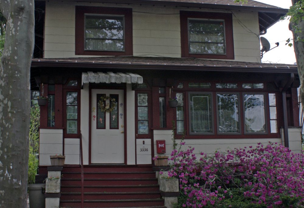
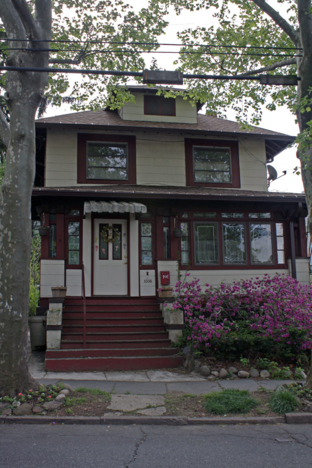
3336 GILES PLACE, ca. 1922;
3338, 3340, 3344 GILES PLACE, James Wells, 1923|
Along Giles Place, south of the Cannon Place intersection, stands a series of cottage houses constructed in the early 1920s. No. 3330 was built for P. Robert O’Connor, the brother-in-law of Bronx Congressman Charles A. Buckley. No. 3336 is believed to be a Sears Roebuck catalog house, though this is not confirmed. Nos. 3338 and 3340, which are identical in form but not materials, have symmetrical façade layouts with central gabled entry porches. No. 3344 (not pictured) is most distinctive in its architectural details. Designed by the same architect as Nos. 3338 and 3340, the house is made of brick with a Mediterranean tiled roof and features an enclosed porch with a fenced balcony above and arched windows on both levels.
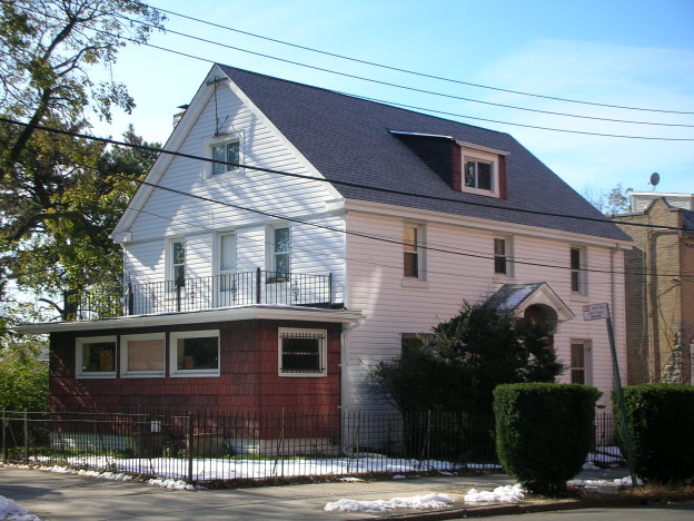
Captain Lawrence V. Meehan, 1921|
This modest freestanding house was designed and built by Captain Lawrence V. Meehan, who, as superintendent of construction, repair and supplies of the Armory Board, oversaw the construction of the Kingsbridge Armory, which was the largest in the world at the time of its construction. Captain Meehan’s house has undergone some changes, including the replacement of its shingles with vinyl siding and the redesign of its Cannon Place façade.
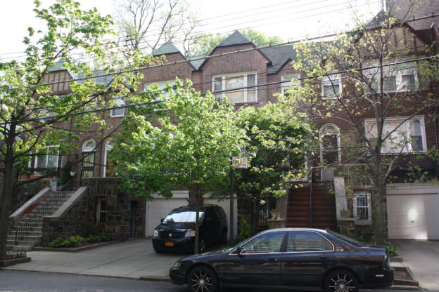
Solomon Pomeranz, 1932|
This row of five attached houses was designed in the neo-Tudor style and features brick and stucco façades with stone accents, half timbering on the upper levels, and gabled entryways.
Manough Exerjian
1925|
Built in 1925, one year before the construction of Shalom Aleichem Houses, this row of four attached houses was among the neighborhood’s first neo-Tudor architecture. The houses were designed by Manough Exerjian, a Turkish architect who immigrated to the United States in 1914 and based his practice in Great Neck, Long Island.
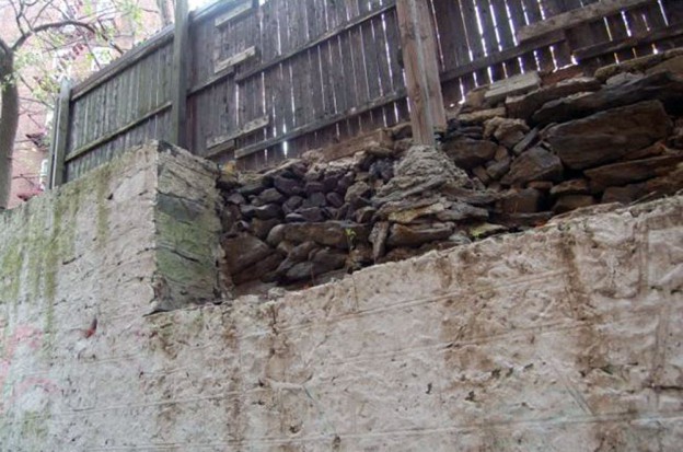
Ca. 1776|
Fort Independence was constructed under orders by General George Washington and under the direction of Colonel Rufus Putnam in 1776 to protect the American army and defend the line of the Harlem River. The fort was surrounded by an entrenchment that was 10 feet wide and three and a-half feet deep, and commanded far-reaching views of the whole area. Led by Sir Henry Clinton, British troops destroyed the fort in 1779. This stone wall is believed to be the only extant physical trace of Fort Independence. The fort once stood between Giles Place and Cannon Place to the south of West 238th Street, making these stones the remnants of the fort’s western wall.
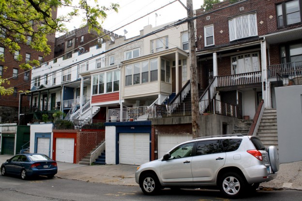
Matthew W. Del Gaudio, 1915–16|
This row of eight houses is the earliest extant housing in the neighborhood. The row is broken up into two groups of four houses. The first group, Nos. 3480 to 3486, was constructed in 1915 of red brick, and the second group, Nos. 3488 to 3494, was constructed in 1916 of beige brick. Both are adorned with diamond-shaped brickwork and simple wooden porches on their front façades. They were designed by Cooper Union graduate and Bronx-based architect Matthew W. Del Gaudio, who served as the president of several prominent New York architecture societies. This row pays particular attention to the hilly terrain of the neighborhood, as each house is raised above a garage on the street level, affording views to the west.